Property Record
651 Schiller St, Sun Prairie, WI 53590
NEARBY LISTINGS FOR SALE OR LEASE
-
-
View all Sun Prairie listings for sale on LoopNet.com
Property Detail
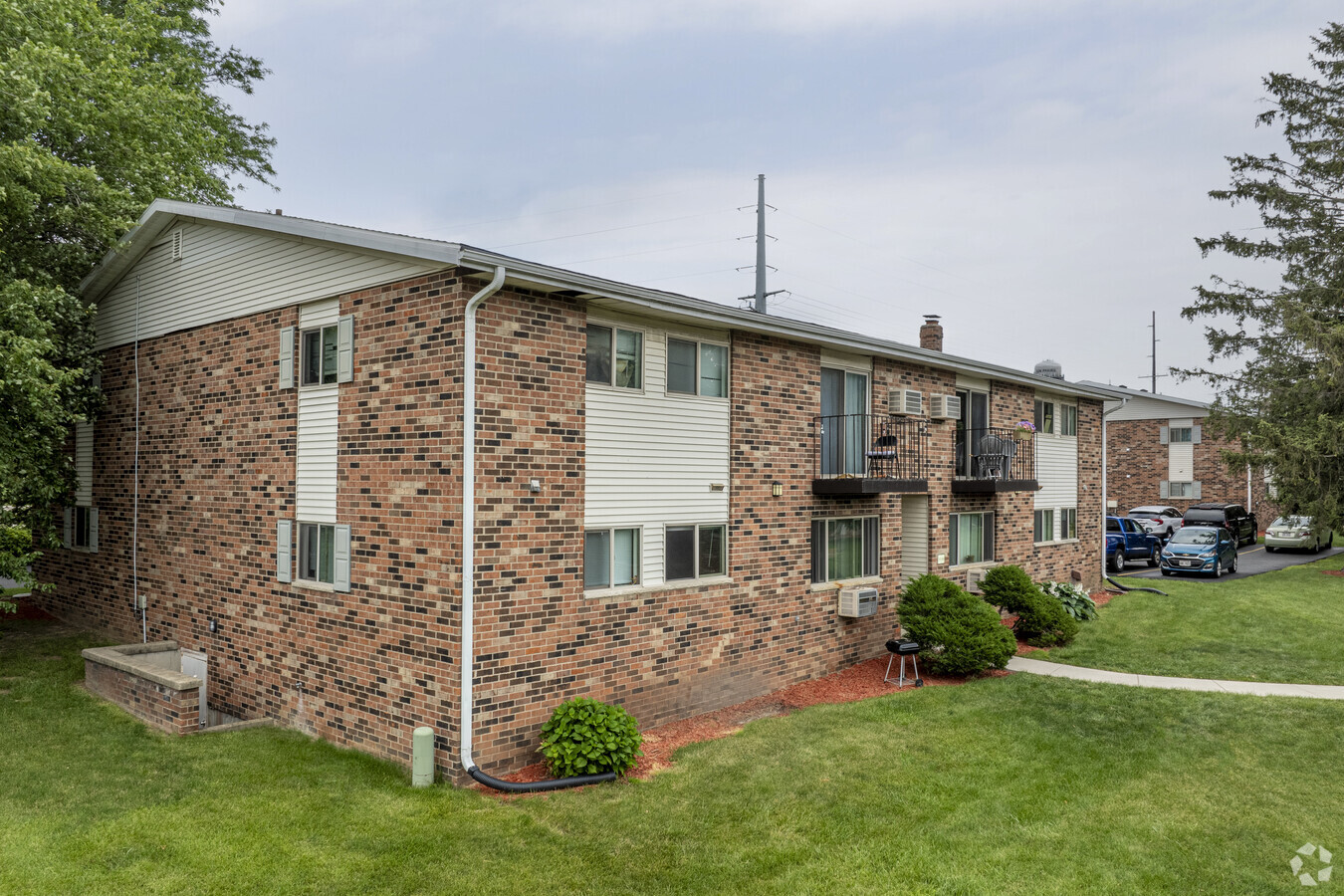
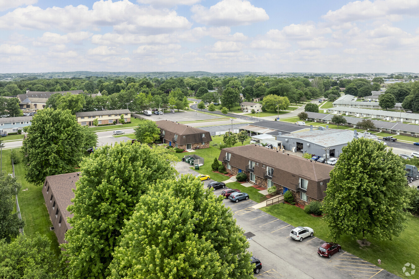
651 Schiller St
Madison, WI
Sunfield West Condo Unit 2
0811-061-9530-9
SUNFIELD WEST CONDOMINIUM PHASE I UNIT 6
Commercialnec
Dane
X
Wisconsin
55025C0280H
53
2023
3 AC
2023
Village View Heights
011506
Milwaukee/Madison
5,694 SF
DEMOGRAPHICS near 651 Schiller St
1 Mile
3 Mile
5 Mile
2024 Total Population
13,442
41,197
53,036
2029 Population
13,977
42,794
55,164
Pop Growth 2024-2029
+ 3.98%
+ 3.88%
+ 4.01%
Average Age
38
38
38
2024 Total Households
5,328
16,258
21,373
HH Growth 2024-2029
+ 4.11%
+ 4.04%
+ 4.20%
Median Household Inc
$66,153
$88,080
$89,183
Avg Household Size
2.40
2.50
2.40
2024 Avg HH Vehicles
2.00
2.00
2.00
Median Home Value
$280,765
$320,065
$320,287
Median Year Built
1988
1995
1996
Nearby Places
- Restaurants
- Banks
- Shops
- Fitness
- Groceries
PUBLIC TRANSPORTATION
AIRPORT
Dane County Regional/Truax Field
DRIVE
WALK
Distance
Dane County Regional/Truax Field
17 min
10.1 mi
Freight Ports
Port Milwaukee
DRIVE
WALK
Distance
Port Milwaukee
91 min
76.0 mi
Nearby Properties
Address
Land Use
TOTAL SIZE
Lot Size
Zoning
Address
Land Use
TOTAL SIZE
Lot Size
Zoning
8.49 AC
SFR
Address
Land Use
TOTAL SIZE
Lot Size
Zoning
58,272 SF
136.54 AC
SO
Address
Land Use
TOTAL SIZE
Lot Size
Zoning
Address
Land Use
TOTAL SIZE
Lot Size
Zoning
8.56 AC
Address
Land Use
TOTAL SIZE
Lot Size
Zoning
26.32 AC
Address
Land Use
TOTAL SIZE
Lot Size
Zoning
4.64 AC
Address
Land Use
TOTAL SIZE
Lot Size
Zoning
31,986 SF
5 AC
PD
Address
Land Use
TOTAL SIZE
Lot Size
Zoning
46,902 SF
5.28 AC
PD
Address
Land Use
TOTAL SIZE
Lot Size
Zoning
222,532 SF
18.02 AC
PD
Address
Land Use
TOTAL SIZE
Lot Size
Zoning
Address
Land Use
TOTAL SIZE
Lot Size
Zoning
72,072 SF
11.78 AC
Address
Land Use
TOTAL SIZE
Lot Size
Zoning
147,310 SF
14.68 AC
SC
Address
Land Use
TOTAL SIZE
Lot Size
Zoning
70,080 SF
3.21 AC
Address
Land Use
TOTAL SIZE
Lot Size
Zoning
26,854 SF
8.25 AC
UR12
Address
Land Use
TOTAL SIZE
Lot Size
Zoning
12.16 AC
Address
Land Use
TOTAL SIZE
Lot Size
Zoning
Address
Land Use
TOTAL SIZE
Lot Size
Zoning
152,636 SF
13.28 AC
Address
Land Use
TOTAL SIZE
Lot Size
Zoning
430,172 SF
18.33 AC
SI
Address
Land Use
TOTAL SIZE
Lot Size
Zoning
Address
Land Use
TOTAL SIZE
Lot Size
Zoning
15.38 AC
Address
Land Use
TOTAL SIZE
Lot Size
Zoning
133,853 SF
12.95 AC
PD
Address
Land Use
TOTAL SIZE
Lot Size
Zoning
84,541 SF
10.54 AC
PD
Address
Land Use
TOTAL SIZE
Lot Size
Zoning
22,866 SF
5.39 AC
PD
Address
Land Use
TOTAL SIZE
Lot Size
Zoning
16,464 SF
7.36 AC
UR12
Address
Land Use
TOTAL SIZE
Lot Size
Zoning
15,288 SF
14.55 AC
UR12
Address
Land Use
TOTAL SIZE
Lot Size
Zoning
55,581 SF
3.35 AC
PD
Address
Land Use
TOTAL SIZE
Lot Size
Zoning
155,550 SF
21.13 AC
SI
Address
Land Use
TOTAL SIZE
Lot Size
Zoning
24.49 AC
Address
Land Use
TOTAL SIZE
Lot Size
Zoning
15.24 AC
ABA
Address
Land Use
TOTAL SIZE
Lot Size
Zoning
20,560 SF
6.63 AC
UR12
The World's #1 Commercial Real Estate Marketplace
Connect with us
© 2025 CoStar Group
The information above has been obtained from sources believed reliable. While we do not doubt its accuracy we have not verified it and make no guarantee, warranty or representation about it. It is your responsibility to independently confirm its accuracy and completeness. Any projections, opinions, assumptions, or estimates used are for example only and do not represent the current or future performance of the property. The value of this transaction to you depends on tax and other factors which should be evaluated by your tax, financial, and legal advisors. You and your advisors should conduct a careful, independent investigation of the property to determine to your satisfaction the suitability of the property for your needs.