Property Record
651 W Mills St, Columbus, NC 28722
NEARBY LISTINGS FOR SALE OR LEASE
Property Detail
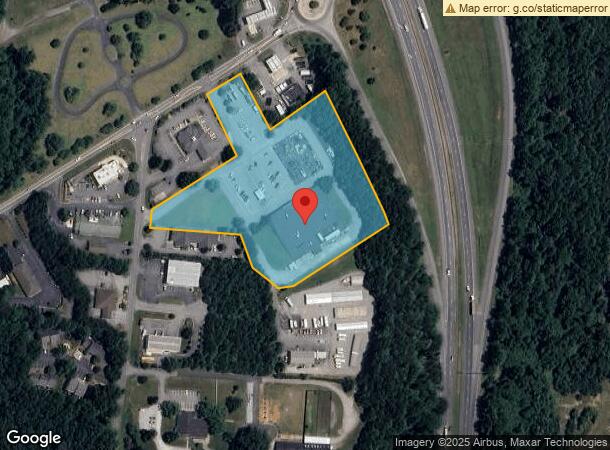
651 W Mills St
P60-113
Columbus Res Area 56
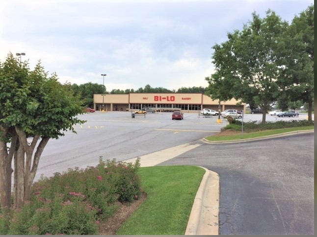
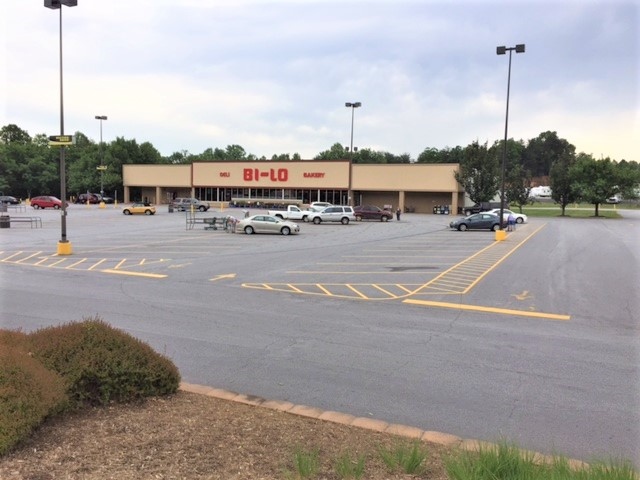
Storebuilding
TRACTOR SUPPLY, 0C56 COLUMBUS RES AREA 56
X
Polk
45083C0005D
North Carolina
2024
6.10 AC
2024
North Carolina West/Cherokee Area
920301
Other Market Areas
30,144 SF
DEMOGRAPHICS near 651 W Mills St
1 Mile
3 Mile
5 Mile
2024 Total Population
1,882
6,380
13,271
2029 Population
2,046
6,952
14,583
Pop Growth 2024-2029
+ 8.71%
+ 8.97%
+ 9.89%
Average Age
52
52
50
2024 Total Households
834
2,871
5,982
HH Growth 2024-2029
+ 8.75%
+ 9.09%
+ 9.95%
Median Household Inc
$51,568
$52,550
$56,208
Avg Household Size
2.10
2.10
2.10
2024 Avg HH Vehicles
2.00
2.00
2.00
Median Home Value
$210,800
$246,308
$265,953
Median Year Built
1986
1982
1980
Nearby Places
- Restaurants
- Banks
- Shops
- Fitness
- Groceries
PUBLIC TRANSPORTATION
AIRPORT
Asheville Regional
DRIVE
WALK
Distance
Asheville Regional
34 min
27.1 mi
Greenville Spartanburg International
DRIVE
WALK
Distance
Greenville Spartanburg International
47 min
37.2 mi
Freight Ports
North Charleston Terminal
DRIVE
WALK
Distance
North Charleston Terminal
242 min
218.0 mi
SALE & LEASE HISTORY
LISTING DATE
SALE/LEASE

Jun 12, 2017
For Sale
Nearby Properties
Address
Land Use
TOTAL SIZE
Lot Size
Zoning
Address
Land Use
TOTAL SIZE
Lot Size
Zoning
68,155 SF
63.56 AC
MX
Address
Land Use
TOTAL SIZE
Lot Size
Zoning
63.34 AC
MX
Address
Land Use
TOTAL SIZE
Lot Size
Zoning
92,600 SF
15.84 AC
MX
Address
Land Use
TOTAL SIZE
Lot Size
Zoning
92,600 SF
15.84 AC
MX
Address
Land Use
TOTAL SIZE
Lot Size
Zoning
11.67 AC
Address
Land Use
TOTAL SIZE
Lot Size
Zoning
1,481.45 AC
OPEN
Address
Land Use
TOTAL SIZE
Lot Size
Zoning
16,744 SF
7.58 AC
M
Address
Land Use
TOTAL SIZE
Lot Size
Zoning
13 AC
M
Address
Land Use
TOTAL SIZE
Lot Size
Zoning
11,382 SF
5.75 AC
M
Address
Land Use
TOTAL SIZE
Lot Size
Zoning
14,926 SF
4.48 AC
M
Address
Land Use
TOTAL SIZE
Lot Size
Zoning
15,450 SF
3 AC
M
Address
Land Use
TOTAL SIZE
Lot Size
Zoning
7,204 SF
5.25 AC
M
Address
Land Use
TOTAL SIZE
Lot Size
Zoning
2,796 SF
7.95 AC
M
Address
Land Use
TOTAL SIZE
Lot Size
Zoning
6,735 SF
8.20 AC
M
Address
Land Use
TOTAL SIZE
Lot Size
Zoning
600 AC
Address
Land Use
TOTAL SIZE
Lot Size
Zoning
6.73 AC
Address
Land Use
TOTAL SIZE
Lot Size
Zoning
2,966 SF
11.53 AC
MX
Address
Land Use
TOTAL SIZE
Lot Size
Zoning
36,300 SF
6.62 AC
M
Address
Land Use
TOTAL SIZE
Lot Size
Zoning
5,442 SF
1.66 AC
M
Address
Land Use
TOTAL SIZE
Lot Size
Zoning
14,016 SF
3.88 AC
M
Address
Land Use
TOTAL SIZE
Lot Size
Zoning
3.24 AC
M
Address
Land Use
TOTAL SIZE
Lot Size
Zoning
12.90 AC
Address
Land Use
TOTAL SIZE
Lot Size
Zoning
11,925 SF
1.93 AC
M
Address
Land Use
TOTAL SIZE
Lot Size
Zoning
10,125 SF
2.07 AC
M
Address
Land Use
TOTAL SIZE
Lot Size
Zoning
1,232 SF
2.01 AC
M
Address
Land Use
TOTAL SIZE
Lot Size
Zoning
6,443 SF
0.72 AC
M
Address
Land Use
TOTAL SIZE
Lot Size
Zoning
9,076 SF
1.50 AC
M
Address
Land Use
TOTAL SIZE
Lot Size
Zoning
4,368 SF
3.71 AC
M
Address
Land Use
TOTAL SIZE
Lot Size
Zoning
7,316 SF
3.01 AC
M
Address
Land Use
TOTAL SIZE
Lot Size
Zoning
28.12 AC
M
The World's #1 Commercial Real Estate Marketplace
Connect with us
© 2025 CoStar Group
The information above has been obtained from sources believed reliable. While we do not doubt its accuracy we have not verified it and make no guarantee, warranty or representation about it. It is your responsibility to independently confirm its accuracy and completeness. Any projections, opinions, assumptions, or estimates used are for example only and do not represent the current or future performance of the property. The value of this transaction to you depends on tax and other factors which should be evaluated by your tax, financial, and legal advisors. You and your advisors should conduct a careful, independent investigation of the property to determine to your satisfaction the suitability of the property for your needs.