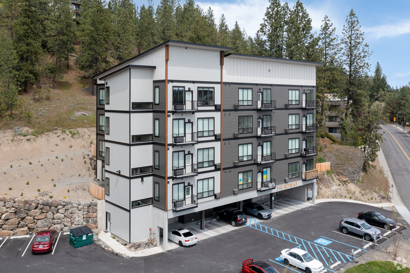
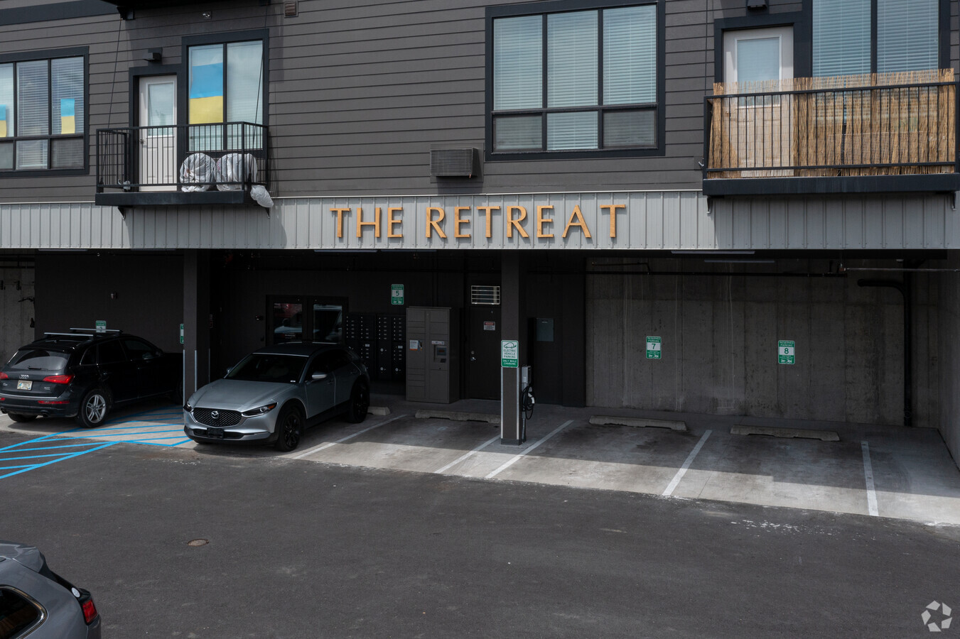
Property Record
6515 N Austin Rd, Spokane, WA 99208

NEARBY LISTINGS FOR SALE OR LEASE
Property Detail
6515 N Austin Rd
Spokane-Spokane Valley, WA
Northridge Add
26254.2006
NORTHRIDGE ADD L6 B2
Apartment
Spokane
X
Washington
53063C0529D
6
2024
1.13 AC
2024
Five Mile Prairie
000800
Spokane
19,764 SF
DEMOGRAPHICS near 6515 N Austin Rd
1 Mile
3 Mile
5 Mile
2024 Total Population
14,903
114,383
199,472
2029 Population
15,785
121,358
211,997
Pop Growth 2024-2029
+ 5.92%
+ 6.10%
+ 6.28%
Average Age
39
39
39
2024 Total Households
5,920
45,501
81,032
HH Growth 2024-2029
+ 6.03%
+ 6.25%
+ 6.59%
Median Household Inc
$67,884
$61,576
$56,631
Avg Household Size
2.50
2.40
2.30
2024 Avg HH Vehicles
2.00
2.00
2.00
Median Home Value
$294,303
$288,601
$295,934
Median Year Built
1956
1961
1965
Nearby Places
- Restaurants
- Banks
- Shops
- Fitness
- Groceries
PUBLIC TRANSPORTATION
COMMUTER RAIL
Spokane (Empire Builder - Amtrak)
DRIVE
WALK
Distance
Spokane (Empire Builder - Amtrak)
14 min
5.3 mi
AIRPORT
Spokane International
DRIVE
WALK
Distance
Spokane International
20 min
9.9 mi
Freight Ports
Port of Everett
DRIVE
WALK
Distance
Port of Everett
348 min
305.5 mi
Nearby Properties
Address
Land Use
TOTAL SIZE
Lot Size
Zoning
Address
Land Use
TOTAL SIZE
Lot Size
Zoning
523,081 SF
92.96 AC
LDR
Address
Land Use
TOTAL SIZE
Lot Size
Zoning
531,295 SF
17.11 AC
CC2
Address
Land Use
TOTAL SIZE
Lot Size
Zoning
171,479 SF
67.30 AC
RSF
Address
Land Use
TOTAL SIZE
Lot Size
Zoning
386,885 SF
22.81 AC
RSF
Address
Land Use
TOTAL SIZE
Lot Size
Zoning
278,777 SF
5.47 AC
HDR
Address
Land Use
TOTAL SIZE
Lot Size
Zoning
188,040 SF
68.10 AC
UR
Address
Land Use
TOTAL SIZE
Lot Size
Zoning
139,485 SF
16.74 AC
RSF
Address
Land Use
TOTAL SIZE
Lot Size
Zoning
317,476 SF
31.10 AC
GC
Address
Land Use
TOTAL SIZE
Lot Size
Zoning
1,065,742 SF
23.80 AC
GC
Address
Land Use
TOTAL SIZE
Lot Size
Zoning
228,981 SF
5.32 AC
RHD
Address
Land Use
TOTAL SIZE
Lot Size
Zoning
56,600 SF
4.98 AC
GC
Address
Land Use
TOTAL SIZE
Lot Size
Zoning
159,508 SF
18.52 AC
RSF
Address
Land Use
TOTAL SIZE
Lot Size
Zoning
241,400 SF
11.57 AC
RMF
Address
Land Use
TOTAL SIZE
Lot Size
Zoning
155,976 SF
6.60 AC
RMF
Address
Land Use
TOTAL SIZE
Lot Size
Zoning
64,602 SF
8.75 AC
RMF
Address
Land Use
TOTAL SIZE
Lot Size
Zoning
82,688 SF
10.31 AC
RMF
Address
Land Use
TOTAL SIZE
Lot Size
Zoning
73,593 SF
7.24 AC
RMF
Address
Land Use
TOTAL SIZE
Lot Size
Zoning
55,050 SF
5.48 AC
RMF
Address
Land Use
TOTAL SIZE
Lot Size
Zoning
76,559 SF
7.11 AC
LDR
Address
Land Use
TOTAL SIZE
Lot Size
Zoning
77,804 SF
12.84 AC
RMF
Address
Land Use
TOTAL SIZE
Lot Size
Zoning
76,224 SF
12.67 AC
RMF
Address
Land Use
TOTAL SIZE
Lot Size
Zoning
150,061 SF
5.01 AC
GC
Address
Land Use
TOTAL SIZE
Lot Size
Zoning
76,224 SF
13.94 AC
RMF
Address
Land Use
TOTAL SIZE
Lot Size
Zoning
110,836 SF
14.85 AC
RMF
Address
Land Use
TOTAL SIZE
Lot Size
Zoning
99,984 SF
4.45 AC
O
Address
Land Use
TOTAL SIZE
Lot Size
Zoning
107,246 SF
6.63 AC
GC
Address
Land Use
TOTAL SIZE
Lot Size
Zoning
67,094 SF
9.33 AC
RSF
Address
Land Use
TOTAL SIZE
Lot Size
Zoning
230,295 SF
22.41 AC
GC
Address
Land Use
TOTAL SIZE
Lot Size
Zoning
35,343 SF
5.31 AC
GC
Address
Land Use
TOTAL SIZE
Lot Size
Zoning
113,638 SF
34.05 AC
RSF
The World's #1 Commercial Real Estate Marketplace
Connect with us
© 2025 CoStar Group
The information above has been obtained from sources believed reliable. While we do not doubt its accuracy we have not verified it and make no guarantee, warranty or representation about it. It is your responsibility to independently confirm its accuracy and completeness. Any projections, opinions, assumptions, or estimates used are for example only and do not represent the current or future performance of the property. The value of this transaction to you depends on tax and other factors which should be evaluated by your tax, financial, and legal advisors. You and your advisors should conduct a careful, independent investigation of the property to determine to your satisfaction the suitability of the property for your needs.