Property Record
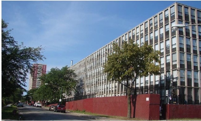
6531 S Lowe Ave, Chicago, IL 60621


NEARBY LISTINGS FOR SALE OR LEASE
Property Detail
6531 S Lowe Ave
Chicago-Naperville-Elgin, IL-IN-WI
Linden Grove
20-21-118-014-0000
(LINDEN) (GROVE) SUB OF NW35ACS & S90ACS OF NW SEC 21-38-14
Apartment
Cook
X
Illinois
17031C0520J
16,1
2023
2.75 AC
2024
Englewood
680900
Chicago
206,322 SF
DEMOGRAPHICS near 6531 S Lowe Ave
1 Mile
3 Mile
5 Mile
2024 Total Population
25,076
295,713
724,422
2029 Population
24,494
283,298
691,629
Pop Growth 2024-2029
(2.32%)
(4.20%)
(4.53%)
Average Age
38
38
39
2024 Total Households
9,742
114,318
277,250
HH Growth 2024-2029
(2.60%)
(4.36%)
(4.55%)
Median Household Inc
$21,685
$33,992
$43,710
Avg Household Size
2.40
2.40
2.50
2024 Avg HH Vehicles
1.00
1.00
1.00
Median Home Value
$116,100
$178,737
$208,625
Median Year Built
1950
1948
1949
Nearby Places
Map Layers
Map Styles
 Street
 Aerial
- Restaurants
- Banks
- Shops
- Fitness
- Groceries
PUBLIC TRANSPORTATION
TRANSIT/SUBWAY
Halsted Station (Green Line) (Green Line - Chicago Transit Authority "L" Trains (The "L"))
DRIVE
WALK
Distance
Halsted Station (Green Line) (Green Line - Chicago Transit Authority "L" Trains (The "L"))
1 min
8 min
0.5 mi
63rd Street Station (Red Line - Chicago Transit Authority "L" Trains (The "L"))
DRIVE
WALK
Distance
63rd Street Station (Red Line - Chicago Transit Authority "L" Trains (The "L"))
3 min
15 min
0.8 mi
COMMUTER RAIL
Gresham Station (Rock Island District Line - Northeast Illinois Regional Commuter Railroad (Metra))
DRIVE
WALK
Distance
Gresham Station (Rock Island District Line - Northeast Illinois Regional Commuter Railroad (Metra))
10 min
4.6 mi
Brainerd Station (Rock Island District Line - Northeast Illinois Regional Commuter Railroad (Metra))
DRIVE
WALK
Distance
Brainerd Station (Rock Island District Line - Northeast Illinois Regional Commuter Railroad (Metra))
13 min
5.5 mi
AIRPORT
Chicago Midway International
DRIVE
WALK
Distance
Chicago Midway International
24 min
7.1 mi
Chicago O'Hare International
DRIVE
WALK
Distance
Chicago O'Hare International
34 min
25.4 mi
Freight Ports
Port of Baltimore
DRIVE
WALK
Distance
Port of Baltimore
1 min
605.0 mi
Nearby Properties
Address
Land Use
TOTAL SIZE
Lot Size
Zoning
Address
Land Use
TOTAL SIZE
Lot Size
Zoning
10.73 AC
PD 1243
Address
Land Use
TOTAL SIZE
Lot Size
Zoning
134,800 SF
2.53 AC
PD 1273
Address
Land Use
TOTAL SIZE
Lot Size
Zoning
0.91 AC
PD 1177
Address
Land Use
TOTAL SIZE
Lot Size
Zoning
159,300 SF
13.36 AC
PD 425
Address
Land Use
TOTAL SIZE
Lot Size
Zoning
87,830 SF
0.76 AC
B1-1
Address
Land Use
TOTAL SIZE
Lot Size
Zoning
304,685 SF
1.11 AC
PD 1218
Address
Land Use
TOTAL SIZE
Lot Size
Zoning
7,200 SF
0.22 AC
B3-3
Address
Land Use
TOTAL SIZE
Lot Size
Zoning
PD 43
Address
Land Use
TOTAL SIZE
Lot Size
Zoning
1.65 AC
B2-3
Address
Land Use
TOTAL SIZE
Lot Size
Zoning
PD 43
Address
Land Use
TOTAL SIZE
Lot Size
Zoning
78,000 SF
0.62 AC
RM-5
Address
Land Use
TOTAL SIZE
Lot Size
Zoning
7.47 AC
RT-4
Address
Land Use
TOTAL SIZE
Lot Size
Zoning
283,228 SF
14.47 AC
PMD 8
Address
Land Use
TOTAL SIZE
Lot Size
Zoning
13,700 SF
0.33 AC
B3-2
Address
Land Use
TOTAL SIZE
Lot Size
Zoning
258,000 SF
13.22 AC
PMD 8
Address
Land Use
TOTAL SIZE
Lot Size
Zoning
141,165 SF
7.82 AC
PD 966
Address
Land Use
TOTAL SIZE
Lot Size
Zoning
15,052 SF
1.03 AC
PQ
Address
Land Use
TOTAL SIZE
Lot Size
Zoning
101,294 SF
8.10 AC
B3-1
Address
Land Use
TOTAL SIZE
Lot Size
Zoning
184,487 SF
0.66 AC
RM-5,RS-3
Address
Land Use
TOTAL SIZE
Lot Size
Zoning
111,198 SF
10.60 AC
PD 566
Address
Land Use
TOTAL SIZE
Lot Size
Zoning
743,663 SF
7.14 AC
RT-4
Address
Land Use
TOTAL SIZE
Lot Size
Zoning
15,600 SF
0.18 AC
C2-1
Address
Land Use
TOTAL SIZE
Lot Size
Zoning
0.54 AC
RS-3
Address
Land Use
TOTAL SIZE
Lot Size
Zoning
10,500 SF
0.75 AC
C2-3
Address
Land Use
TOTAL SIZE
Lot Size
Zoning
0.41 AC
RM-5
Address
Land Use
TOTAL SIZE
Lot Size
Zoning
0.39 AC
C2-3
Address
Land Use
TOTAL SIZE
Lot Size
Zoning
0.39 AC
C2-3
Address
Land Use
TOTAL SIZE
Lot Size
Zoning
0.37 AC
C2-3
Address
Land Use
TOTAL SIZE
Lot Size
Zoning
0.37 AC
C2-3
Address
Land Use
TOTAL SIZE
Lot Size
Zoning
11,700 SF
0.28 AC
B3-3
The World's #1 Commercial Real Estate Marketplace
Connect with us
© 2025 CoStar Group
The information above has been obtained from sources believed reliable. While we do not doubt its accuracy we have not verified it and make no guarantee, warranty or representation about it. It is your responsibility to independently confirm its accuracy and completeness. Any projections, opinions, assumptions, or estimates used are for example only and do not represent the current or future performance of the property. The value of this transaction to you depends on tax and other factors which should be evaluated by your tax, financial, and legal advisors. You and your advisors should conduct a careful, independent investigation of the property to determine to your satisfaction the suitability of the property for your needs.