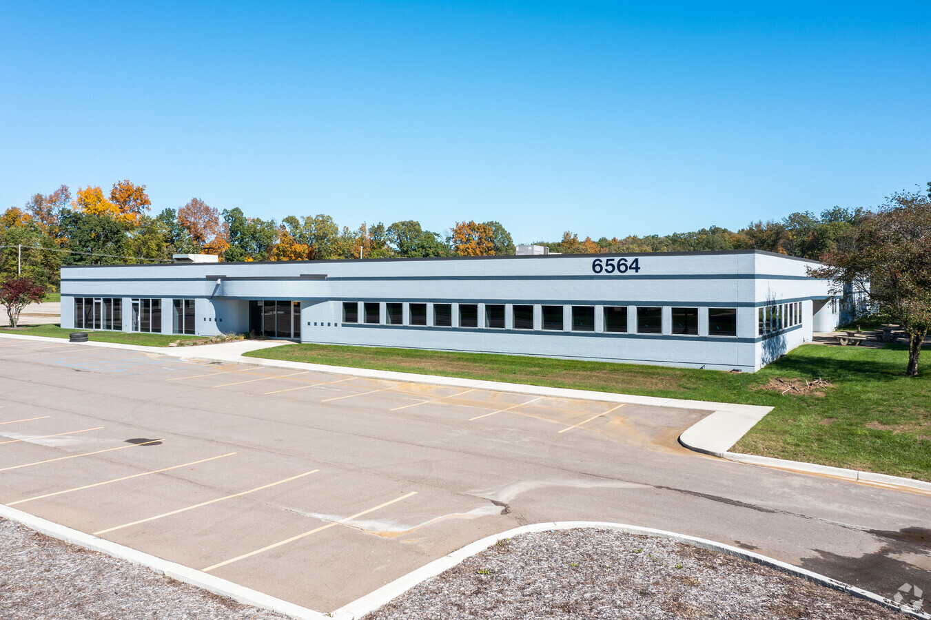
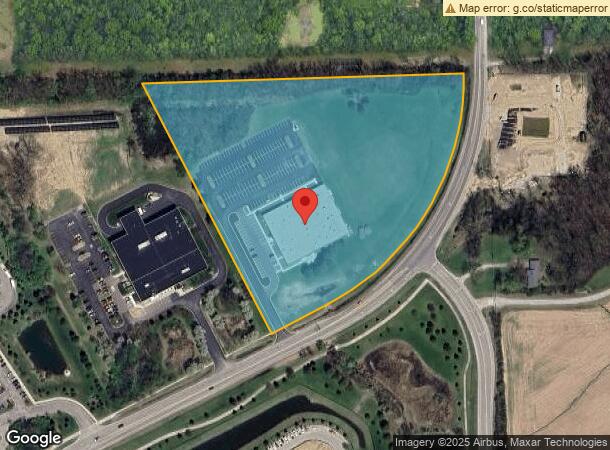
Property Record
6564 State Rd, Saline, MI 48176


NEARBY LISTINGS FOR SALE OR LEASE
Property Detail
6564 State Rd
12-28-300-021
PI 29-15A-1A-1 (29-400-001) COM W 1/4 COR OF SEC, TH S 1-21-6 W 13 FT, TH S 89- 21-12 E 337.14 FT TO POB, TH S 89-21-12 E
Industrialgeneral
Washtenaw
X
Michigan
26161C0405E
11.40 AC
2024
Washtenaw W of 23
2024
Detroit
415600
Ann Arbor, MI
32,361 SF
DEMOGRAPHICS near 6564 State Rd
1 Mile
3 Mile
5 Mile
2024 Total Population
2,478
23,669
85,278
2029 Population
2,482
23,398
84,432
Pop Growth 2024-2029
+ 0.16%
(1.14%)
(0.99%)
Average Age
39
41
40
2024 Total Households
847
8,681
35,557
HH Growth 2024-2029
+ 0.24%
(1.38%)
(1.16%)
Median Household Inc
$138,186
$112,194
$90,154
Avg Household Size
2.80
2.50
2.30
2024 Avg HH Vehicles
2.00
2.00
2.00
Median Home Value
$476,698
$393,474
$359,261
Median Year Built
2002
1992
1984
Nearby Places
- Restaurants
- Banks
- Shops
- Fitness
- Groceries
PUBLIC TRANSPORTATION
COMMUTER RAIL
Ann Arbor Amtrak Station (Wolverine - Amtrak)
DRIVE
WALK
Distance
Ann Arbor Amtrak Station (Wolverine - Amtrak)
16 min
7.0 mi
AIRPORT
Detroit Metro Wayne County
DRIVE
WALK
Distance
Detroit Metro Wayne County
32 min
24.5 mi
Freight Ports
Port of Toledo
DRIVE
WALK
Distance
Port of Toledo
72 min
54.9 mi
SALE & LEASE HISTORY
LISTING DATE
SALE/LEASE

Nov 29, 2022
For Lease
Aug 27, 2018
For Sale
Aug 07, 2019
For Lease
Aug 07, 2019
For Sale
Nearby Properties
Address
Land Use
TOTAL SIZE
Lot Size
Zoning
Address
Land Use
TOTAL SIZE
Lot Size
Zoning
282,382 SF
305.53 AC
RPD
Address
Land Use
TOTAL SIZE
Lot Size
Zoning
Address
Land Use
TOTAL SIZE
Lot Size
Zoning
253,702 SF
30.23 AC
Address
Land Use
TOTAL SIZE
Lot Size
Zoning
21.38 AC
R4B
Address
Land Use
TOTAL SIZE
Lot Size
Zoning
40.67 AC
Address
Land Use
TOTAL SIZE
Lot Size
Zoning
11.79 AC
M1
Address
Land Use
TOTAL SIZE
Lot Size
Zoning
18,148 SF
21.62 AC
BI
Address
Land Use
TOTAL SIZE
Lot Size
Zoning
Address
Land Use
TOTAL SIZE
Lot Size
Zoning
105,615 SF
26.31 AC
Address
Land Use
TOTAL SIZE
Lot Size
Zoning
Address
Land Use
TOTAL SIZE
Lot Size
Zoning
191,215 SF
30.23 AC
Address
Land Use
TOTAL SIZE
Lot Size
Zoning
17,228 SF
8.40 AC
Address
Land Use
TOTAL SIZE
Lot Size
Zoning
24,000 SF
21.97 AC
Address
Land Use
TOTAL SIZE
Lot Size
Zoning
3.47 AC
PUD
Address
Land Use
TOTAL SIZE
Lot Size
Zoning
88,657 SF
14.98 AC
Address
Land Use
TOTAL SIZE
Lot Size
Zoning
6.89 AC
R-1A
Address
Land Use
TOTAL SIZE
Lot Size
Zoning
189.08 AC
I-4
Address
Land Use
TOTAL SIZE
Lot Size
Zoning
154,987 SF
17.08 AC
II
Address
Land Use
TOTAL SIZE
Lot Size
Zoning
45.12 AC
IH
Address
Land Use
TOTAL SIZE
Lot Size
Zoning
Address
Land Use
TOTAL SIZE
Lot Size
Zoning
60,362 SF
7.69 AC
Address
Land Use
TOTAL SIZE
Lot Size
Zoning
4,964 SF
5.86 AC
Address
Land Use
TOTAL SIZE
Lot Size
Zoning
76,204 SF
12.41 AC
Address
Land Use
TOTAL SIZE
Lot Size
Zoning
2.30 AC
O
Address
Land Use
TOTAL SIZE
Lot Size
Zoning
255,838 SF
31.64 AC
II
Address
Land Use
TOTAL SIZE
Lot Size
Zoning
54,607 SF
14.17 AC
Address
Land Use
TOTAL SIZE
Lot Size
Zoning
84,415 SF
9.96 AC
II
Address
Land Use
TOTAL SIZE
Lot Size
Zoning
6.83 AC
I-2
Address
Land Use
TOTAL SIZE
Lot Size
Zoning
7.69 AC
Address
Land Use
TOTAL SIZE
Lot Size
Zoning
132,290 SF
30.91 AC
The World's #1 Commercial Real Estate Marketplace
Connect with us
© 2025 CoStar Group
The information above has been obtained from sources believed reliable. While we do not doubt its accuracy we have not verified it and make no guarantee, warranty or representation about it. It is your responsibility to independently confirm its accuracy and completeness. Any projections, opinions, assumptions, or estimates used are for example only and do not represent the current or future performance of the property. The value of this transaction to you depends on tax and other factors which should be evaluated by your tax, financial, and legal advisors. You and your advisors should conduct a careful, independent investigation of the property to determine to your satisfaction the suitability of the property for your needs.