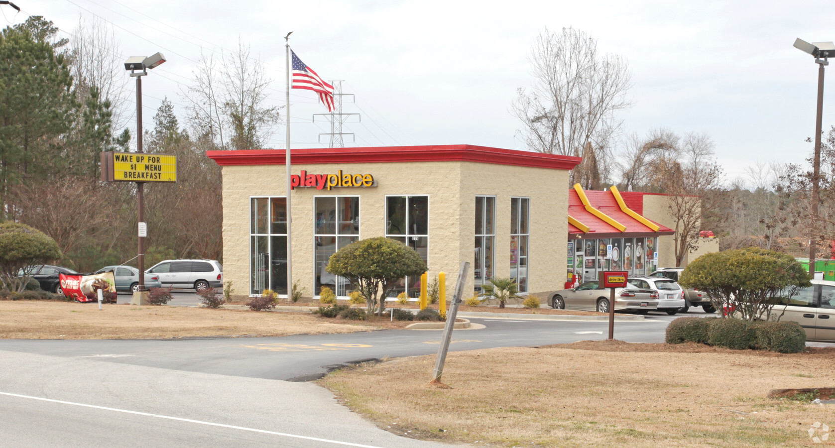
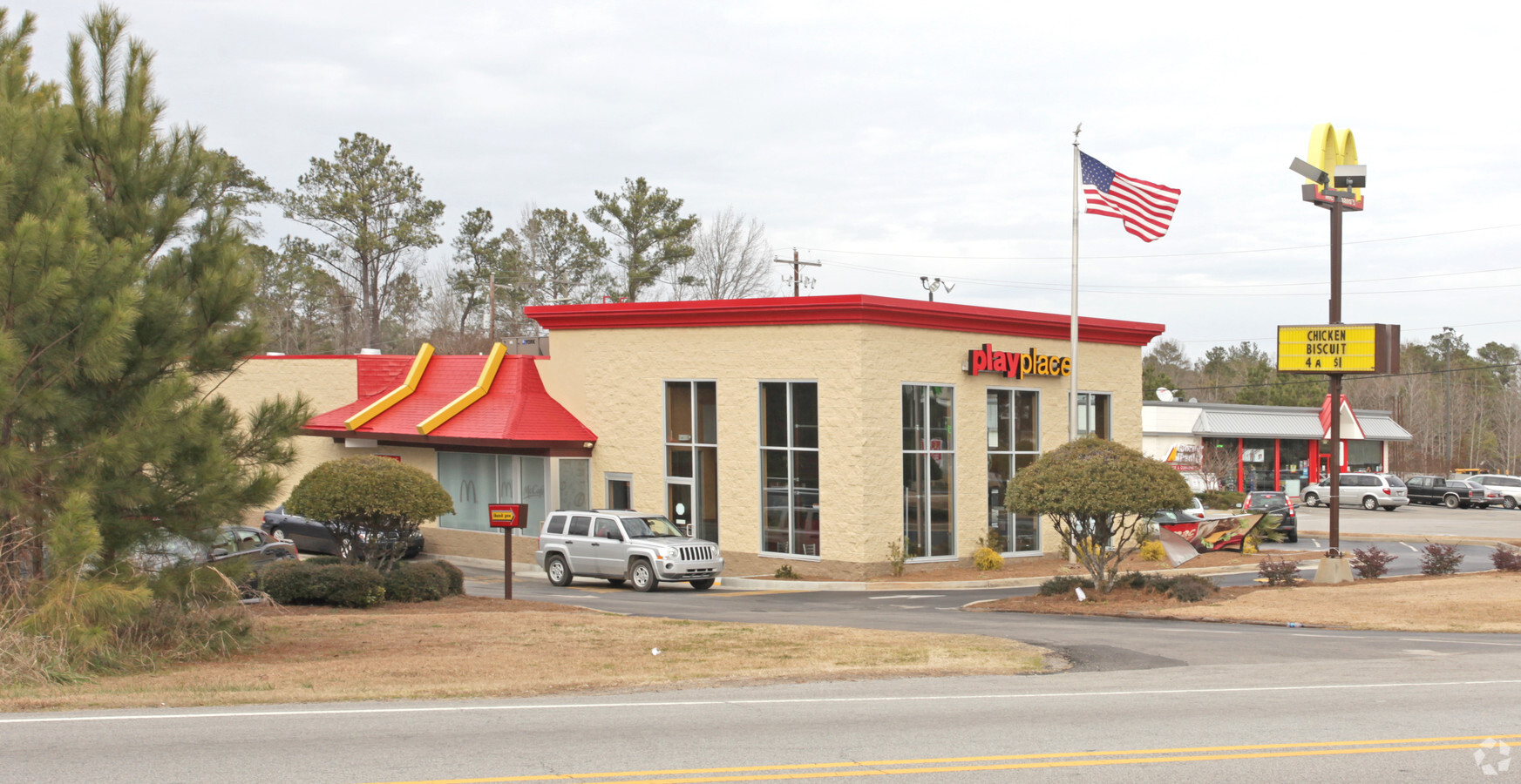
Property Record
659 Columbia Ave, Chapin, SC 29036
NEARBY LISTINGS FOR SALE OR LEASE
Property Detail
659 Columbia Ave
000300-04-049
PARCEL 1 & UN#D PARCEL
Restaurantdrivein
Lexington
X
South Carolina
45063C0040J
1.20 AC
2024
Dutch Fork/Irmo
2024
Columbia
021204
Columbia, SC
3,719 SF
DEMOGRAPHICS near 659 Columbia Ave
1 Mile
3 Mile
5 Mile
2024 Total Population
186
6,194
23,200
2029 Population
207
6,660
24,545
Pop Growth 2024-2029
+ 11.29%
+ 7.52%
+ 5.80%
Average Age
40
40
40
2024 Total Households
66
2,312
8,524
HH Growth 2024-2029
+ 12.12%
+ 7.57%
+ 5.98%
Median Household Inc
$81,818
$81,836
$96,742
Avg Household Size
2.70
2.60
2.70
2024 Avg HH Vehicles
2.00
2.00
2.00
Median Home Value
$252,083
$253,124
$304,784
Median Year Built
2002
2001
2002
Nearby Places
- Restaurants
- Banks
- Shops
- Fitness
- Groceries
PUBLIC TRANSPORTATION
AIRPORT
Columbia Metro
DRIVE
WALK
Distance
Columbia Metro
39 min
26.3 mi
Freight Ports
North Charleston Terminal
DRIVE
WALK
Distance
North Charleston Terminal
139 min
122.6 mi
Nearby Properties
Address
Land Use
TOTAL SIZE
Lot Size
Zoning
Address
Land Use
TOTAL SIZE
Lot Size
Zoning
10,764 SF
1.84 AC
GC
Address
Land Use
TOTAL SIZE
Lot Size
Zoning
46,031 SF
12.16 AC
GC
Address
Land Use
TOTAL SIZE
Lot Size
Zoning
9,124 SF
4.11 AC
RU
Address
Land Use
TOTAL SIZE
Lot Size
Zoning
960 SF
45 AC
RU
Address
Land Use
TOTAL SIZE
Lot Size
Zoning
3,573 SF
4 AC
Address
Land Use
TOTAL SIZE
Lot Size
Zoning
3,848 SF
1.13 AC
RU
Address
Land Use
TOTAL SIZE
Lot Size
Zoning
61,972 SF
7.82 AC
GC
Address
Land Use
TOTAL SIZE
Lot Size
Zoning
66,432 SF
2.89 AC
GC
Address
Land Use
TOTAL SIZE
Lot Size
Zoning
100,075 SF
12.10 AC
LM
Address
Land Use
TOTAL SIZE
Lot Size
Zoning
46,244 SF
2.50 AC
INC
Address
Land Use
TOTAL SIZE
Lot Size
Zoning
1,984 SF
1.36 AC
GC
Address
Land Use
TOTAL SIZE
Lot Size
Zoning
43,119 SF
5.99 AC
GC
Address
Land Use
TOTAL SIZE
Lot Size
Zoning
32,737 SF
4.76 AC
ID
Address
Land Use
TOTAL SIZE
Lot Size
Zoning
3,600 SF
2.83 AC
RU
Address
Land Use
TOTAL SIZE
Lot Size
Zoning
11,300 SF
1.23 AC
ID
Address
Land Use
TOTAL SIZE
Lot Size
Zoning
3,165 SF
1.78 AC
RU
Address
Land Use
TOTAL SIZE
Lot Size
Zoning
31,790 SF
16.26 AC
Address
Land Use
TOTAL SIZE
Lot Size
Zoning
18.55 AC
RU
Address
Land Use
TOTAL SIZE
Lot Size
Zoning
13,310 SF
1.46 AC
GC
Address
Land Use
TOTAL SIZE
Lot Size
Zoning
15,302 SF
24.12 AC
OC
Address
Land Use
TOTAL SIZE
Lot Size
Zoning
35,515 SF
5.72 AC
GC
Address
Land Use
TOTAL SIZE
Lot Size
Zoning
2,400 SF
9.76 AC
RU
Address
Land Use
TOTAL SIZE
Lot Size
Zoning
0.83 AC
GC
Address
Land Use
TOTAL SIZE
Lot Size
Zoning
5,124 SF
3.91 AC
GC
Address
Land Use
TOTAL SIZE
Lot Size
Zoning
190,700 SF
8.18 AC
GC
Address
Land Use
TOTAL SIZE
Lot Size
Zoning
39.90 AC
OC
Address
Land Use
TOTAL SIZE
Lot Size
Zoning
24.64 AC
Address
Land Use
TOTAL SIZE
Lot Size
Zoning
10 AC
RU
Address
Land Use
TOTAL SIZE
Lot Size
Zoning
12,074 SF
1.66 AC
GC
Address
Land Use
TOTAL SIZE
Lot Size
Zoning
35.87 AC
OC
The World's #1 Commercial Real Estate Marketplace
Connect with us
© 2025 CoStar Group
The information above has been obtained from sources believed reliable. While we do not doubt its accuracy we have not verified it and make no guarantee, warranty or representation about it. It is your responsibility to independently confirm its accuracy and completeness. Any projections, opinions, assumptions, or estimates used are for example only and do not represent the current or future performance of the property. The value of this transaction to you depends on tax and other factors which should be evaluated by your tax, financial, and legal advisors. You and your advisors should conduct a careful, independent investigation of the property to determine to your satisfaction the suitability of the property for your needs.