Property Record
660 Beachland Blvd, Vero Beach, FL 32963


NEARBY LISTINGS FOR SALE OR LEASE
Property Detail
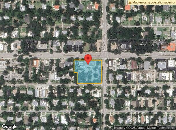
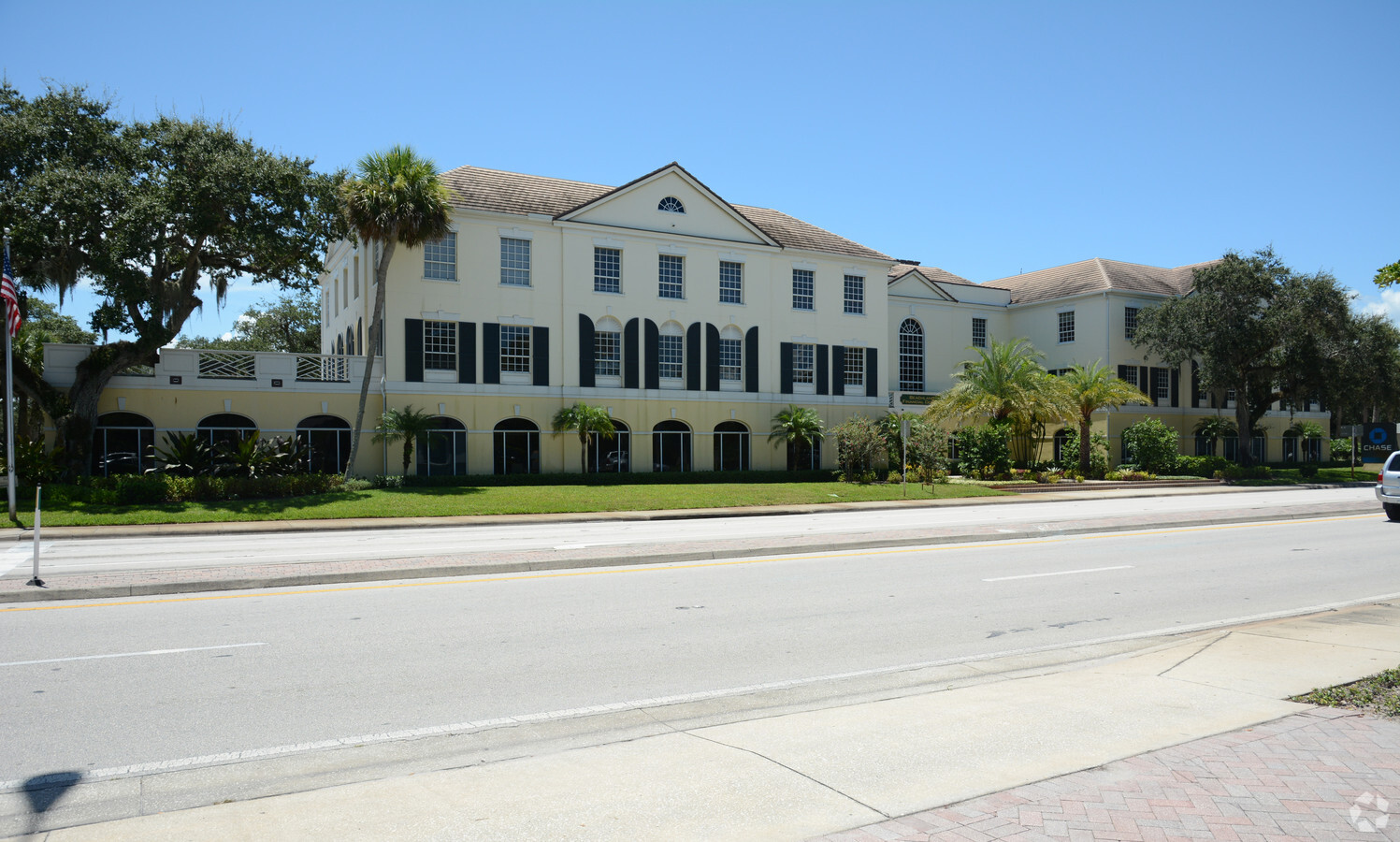
660 Beachland Blvd
Sebastian-Vero Beach, FL
Vero Beach Estates
32-40-32-00006-0140-00013.0
VERO BEACH ESTATES VERO BEACH ESTATES PBS 5-8 THE E 48 FT O F LOT 13, LOTS 14-17 LESS THE E 10 FT AN D LOTS 37-42 LESS THE E 10 FT
Officebuilding
Indian River
X
Florida
12061C0263J
13
2023
2.03 AC
2024
Fort Pierce/Port St Lucie
050504
Other Market Areas
27,781 SF
DEMOGRAPHICS near 660 Beachland Blvd
1 Mile
3 Mile
5 Mile
2024 Total Population
4,500
26,616
65,190
2029 Population
5,303
30,566
73,582
Pop Growth 2024-2029
+ 17.84%
+ 14.84%
+ 12.87%
Average Age
60
54
51
2024 Total Households
2,328
13,903
30,791
HH Growth 2024-2029
+ 17.27%
+ 14.44%
+ 12.72%
Median Household Inc
$104,095
$58,695
$59,295
Avg Household Size
1.90
1.80
2.00
2024 Avg HH Vehicles
2.00
1.00
2.00
Median Home Value
$641,892
$437,066
$311,083
Median Year Built
1977
1982
1983
Nearby Places
- Restaurants
- Banks
- Shops
- Fitness
- Groceries
Nearby Properties
Address
Land Use
TOTAL SIZE
Lot Size
Zoning
Address
Land Use
TOTAL SIZE
Lot Size
Zoning
634,259 SF
53.45 AC
MED
Address
Land Use
TOTAL SIZE
Lot Size
Zoning
303,447 SF
26.90 AC
M
Address
Land Use
TOTAL SIZE
Lot Size
Zoning
39,873 SF
7.61 AC
GU
Address
Land Use
TOTAL SIZE
Lot Size
Zoning
240,516 SF
39.71 AC
RM-8
Address
Land Use
TOTAL SIZE
Lot Size
Zoning
125,677 SF
2.17 AC
DTW
Address
Land Use
TOTAL SIZE
Lot Size
Zoning
2,518 SF
3.16 AC
P-2
Address
Land Use
TOTAL SIZE
Lot Size
Zoning
313,820 SF
21.83 AC
RM-10 EX
Address
Land Use
TOTAL SIZE
Lot Size
Zoning
80,682 SF
24.97 AC
R-1A
Address
Land Use
TOTAL SIZE
Lot Size
Zoning
67,334 SF
9.63 AC
MED
Address
Land Use
TOTAL SIZE
Lot Size
Zoning
149,178 SF
10.72 AC
C-1B
Address
Land Use
TOTAL SIZE
Lot Size
Zoning
235,921 SF
28.80 AC
RM-8
Address
Land Use
TOTAL SIZE
Lot Size
Zoning
82,427 SF
2.48 AC
C-1A
Address
Land Use
TOTAL SIZE
Lot Size
Zoning
69,942 SF
10.47 AC
MED
Address
Land Use
TOTAL SIZE
Lot Size
Zoning
6,949 SF
8.17 AC
P-2
Address
Land Use
TOTAL SIZE
Lot Size
Zoning
231,651 SF
16.23 AC
RM-10
Address
Land Use
TOTAL SIZE
Lot Size
Zoning
39,798 SF
1.31 AC
C-1A
Address
Land Use
TOTAL SIZE
Lot Size
Zoning
2,888 SF
95.84 AC
R-1AA
Address
Land Use
TOTAL SIZE
Lot Size
Zoning
76,484 SF
7.03 AC
P-2
Address
Land Use
TOTAL SIZE
Lot Size
Zoning
1,500 SF
34.50 AC
P-2
Address
Land Use
TOTAL SIZE
Lot Size
Zoning
5,268 SF
4.62 AC
R-1
Address
Land Use
TOTAL SIZE
Lot Size
Zoning
2,232 SF
8.35 AC
C-1B
Address
Land Use
TOTAL SIZE
Lot Size
Zoning
150,160 SF
13.12 AC
PD
Address
Land Use
TOTAL SIZE
Lot Size
Zoning
3,540 SF
218.41 AC
ALI-A2
Address
Land Use
TOTAL SIZE
Lot Size
Zoning
29,804 SF
498.76 AC
CON-1
Address
Land Use
TOTAL SIZE
Lot Size
Zoning
2,418 SF
9.77 AC
C-2M
Address
Land Use
TOTAL SIZE
Lot Size
Zoning
9,215 SF
4.58 AC
RM-10/12
Address
Land Use
TOTAL SIZE
Lot Size
Zoning
9,481 SF
0.38 AC
RM-10
Address
Land Use
TOTAL SIZE
Lot Size
Zoning
169,566 SF
12.93 AC
RM-8
Address
Land Use
TOTAL SIZE
Lot Size
Zoning
7,590 SF
8.62 AC
R-1A
Address
Land Use
TOTAL SIZE
Lot Size
Zoning
1,807 SF
2.40 AC
C-1A
The World's #1 Commercial Real Estate Marketplace
Connect with us
© 2025 CoStar Group
The information above has been obtained from sources believed reliable. While we do not doubt its accuracy we have not verified it and make no guarantee, warranty or representation about it. It is your responsibility to independently confirm its accuracy and completeness. Any projections, opinions, assumptions, or estimates used are for example only and do not represent the current or future performance of the property. The value of this transaction to you depends on tax and other factors which should be evaluated by your tax, financial, and legal advisors. You and your advisors should conduct a careful, independent investigation of the property to determine to your satisfaction the suitability of the property for your needs.