Property Record
2915 N Gloryland Ave, Charlotte, NC 28213
Current Lease Availabilities
NEARBY LISTINGS FOR SALE OR LEASE
Property Detail
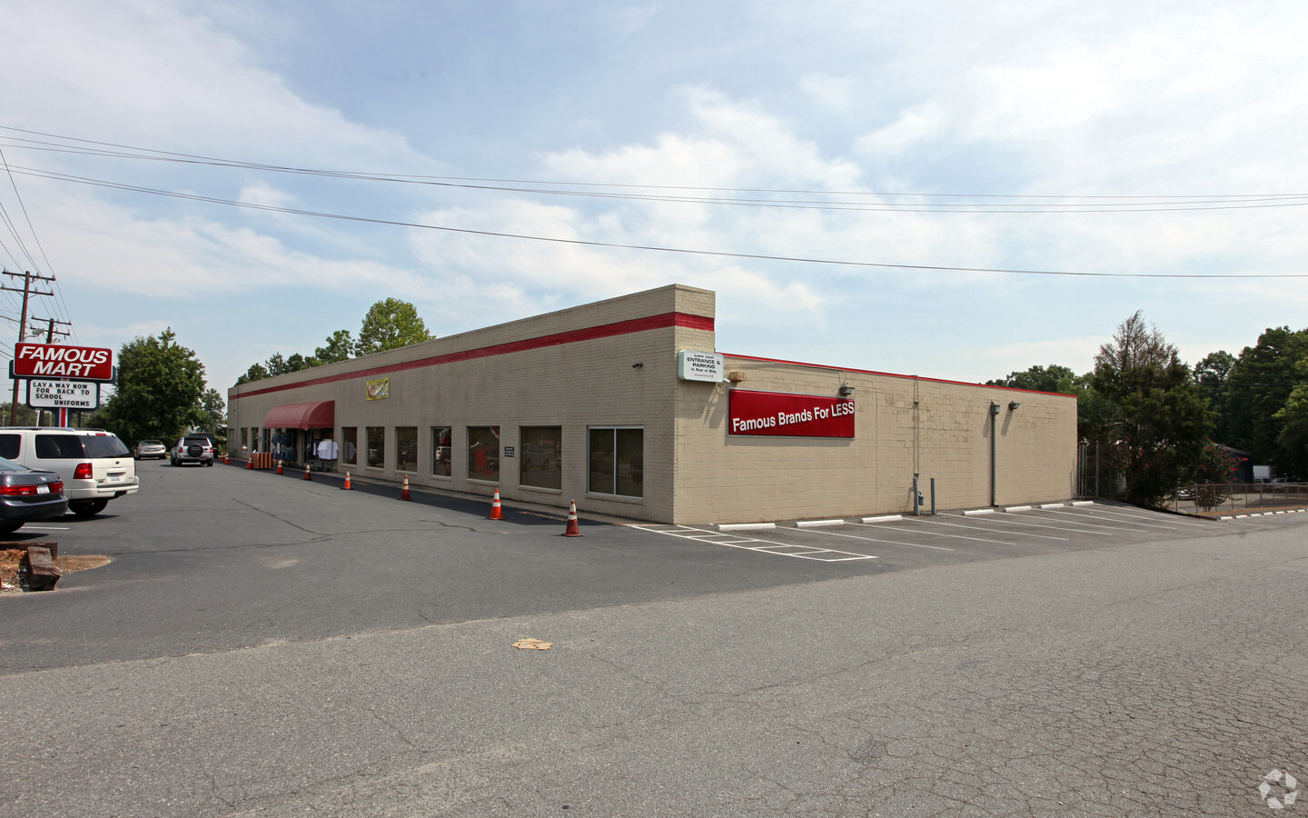
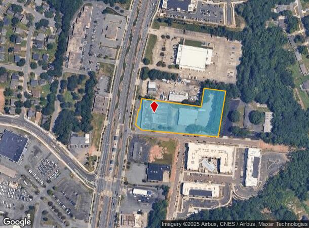
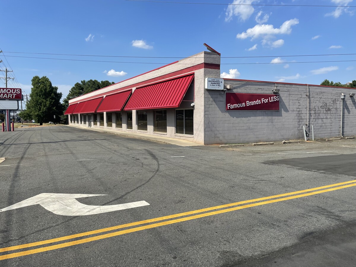
2915 N Gloryland Ave
Charlotte-Concord-Gastonia, NC-SC
Lincoln Heights
049-081-05
SEE 4908105
Commercialnec
Mecklenburg
X
North Carolina
3710457600K
5
2023
3.01 AC
2023
Northeast
001505
Charlotte
39,810 SF
DEMOGRAPHICS near 2915 N Gloryland Ave
1 Mile
3 Mile
5 Mile
2024 Total Population
15,284
88,064
239,739
2029 Population
16,686
94,046
254,774
Pop Growth 2024-2029
+ 9.17%
+ 6.79%
+ 6.27%
Average Age
33
35
35
2024 Total Households
5,251
33,813
96,427
HH Growth 2024-2029
+ 9.10%
+ 6.82%
+ 6.41%
Median Household Inc
$40,401
$49,221
$56,615
Avg Household Size
2.70
2.50
2.40
2024 Avg HH Vehicles
2.00
2.00
2.00
Median Home Value
$164,571
$207,039
$255,314
Median Year Built
1991
1991
1993
Nearby Places
- Restaurants
- Banks
- Shops
- Fitness
- Groceries
PUBLIC TRANSPORTATION
TRANSIT/SUBWAY
Tom Hunter Station (Light Rail - Lynx Blue Line - CATS)
DRIVE
WALK
Distance
Tom Hunter Station (Light Rail - Lynx Blue Line - CATS)
1 min
3 min
0.2 mi
University City Blvd Station (Light Rail - Lynx Blue Line - CATS)
DRIVE
WALK
Distance
University City Blvd Station (Light Rail - Lynx Blue Line - CATS)
3 min
14 min
0.7 mi
COMMUTER RAIL
Charlotte Amtrak Station (Carolinian - Amtrak, Crescent - Amtrak, Piedmont - Amtrak)
DRIVE
WALK
Distance
Charlotte Amtrak Station (Carolinian - Amtrak, Crescent - Amtrak, Piedmont - Amtrak)
11 min
5.3 mi
AIRPORT
Concord-Padgett Regional
DRIVE
WALK
Distance
Concord-Padgett Regional
17 min
9.9 mi
Charlotte/Douglas International
DRIVE
WALK
Distance
Charlotte/Douglas International
25 min
15.3 mi
Freight Ports
North Charleston Terminal
DRIVE
WALK
Distance
North Charleston Terminal
239 min
207.6 mi
Nearby Properties
Address
Land Use
TOTAL SIZE
Lot Size
Zoning
Address
Land Use
TOTAL SIZE
Lot Size
Zoning
2,022,784 SF
654.80 AC
INST
Address
Land Use
TOTAL SIZE
Lot Size
Zoning
2,215,042 SF
68.45 AC
RE2
Address
Land Use
TOTAL SIZE
Lot Size
Zoning
2,534,387 SF
135.23 AC
RE2
Address
Land Use
TOTAL SIZE
Lot Size
Zoning
628,300 SF
197.32 AC
INST
Address
Land Use
TOTAL SIZE
Lot Size
Zoning
727,169 SF
6.06 AC
INST
Address
Land Use
TOTAL SIZE
Lot Size
Zoning
419,364 SF
17.40 AC
Address
Land Use
TOTAL SIZE
Lot Size
Zoning
285,032 SF
9.43 AC
UR2CD
Address
Land Use
TOTAL SIZE
Lot Size
Zoning
401,069 SF
31.52 AC
R12MFCD
Address
Land Use
TOTAL SIZE
Lot Size
Zoning
324,898 SF
22.31 AC
R17MFCD
Address
Land Use
TOTAL SIZE
Lot Size
Zoning
389,680 SF
28.82 AC
R17MFCD
Address
Land Use
TOTAL SIZE
Lot Size
Zoning
335,688 SF
22.54 AC
Address
Land Use
TOTAL SIZE
Lot Size
Zoning
358,524 SF
23.80 AC
R17MFCD
Address
Land Use
TOTAL SIZE
Lot Size
Zoning
330,598 SF
20.29 AC
Address
Land Use
TOTAL SIZE
Lot Size
Zoning
325,799 SF
37.65 AC
R9MFCD
Address
Land Use
TOTAL SIZE
Lot Size
Zoning
464,520 SF
3.43 AC
Address
Land Use
TOTAL SIZE
Lot Size
Zoning
352,085 SF
23.73 AC
NS
Address
Land Use
TOTAL SIZE
Lot Size
Zoning
306,583 SF
24.15 AC
Address
Land Use
TOTAL SIZE
Lot Size
Zoning
276,596 SF
41.26 AC
Address
Land Use
TOTAL SIZE
Lot Size
Zoning
218,242 SF
17.09 AC
MUDDO
Address
Land Use
TOTAL SIZE
Lot Size
Zoning
205,022 SF
15.68 AC
R9MFCD
Address
Land Use
TOTAL SIZE
Lot Size
Zoning
227,216 SF
16.09 AC
RE-2
Address
Land Use
TOTAL SIZE
Lot Size
Zoning
261,810 SF
46.15 AC
R3
Address
Land Use
TOTAL SIZE
Lot Size
Zoning
311,358 SF
8.95 AC
B2
Address
Land Use
TOTAL SIZE
Lot Size
Zoning
312,279 SF
4.93 AC
R17MF
Address
Land Use
TOTAL SIZE
Lot Size
Zoning
407,265 SF
38.18 AC
RE-1(CD)
Address
Land Use
TOTAL SIZE
Lot Size
Zoning
231,937 SF
14.34 AC
B1SCD
Address
Land Use
TOTAL SIZE
Lot Size
Zoning
238,537 SF
16.52 AC
R17MFCD
Address
Land Use
TOTAL SIZE
Lot Size
Zoning
251,930 SF
7.51 AC
B2CD
Address
Land Use
TOTAL SIZE
Lot Size
Zoning
181,510 SF
10.85 AC
R17MFCD
Address
Land Use
TOTAL SIZE
Lot Size
Zoning
392,372 SF
31.82 AC
R17MF
The World's #1 Commercial Real Estate Marketplace
Connect with us
© 2025 CoStar Group
The information above has been obtained from sources believed reliable. While we do not doubt its accuracy we have not verified it and make no guarantee, warranty or representation about it. It is your responsibility to independently confirm its accuracy and completeness. Any projections, opinions, assumptions, or estimates used are for example only and do not represent the current or future performance of the property. The value of this transaction to you depends on tax and other factors which should be evaluated by your tax, financial, and legal advisors. You and your advisors should conduct a careful, independent investigation of the property to determine to your satisfaction the suitability of the property for your needs.