Property Record
6601 Cal Turner Dr, San Antonio, TX 78220
NEARBY LISTINGS FOR SALE OR LEASE
Property Detail
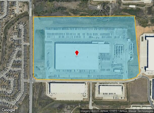
6601 Cal Turner Dr
San Antonio-New Braunfels, TX
Cb 5100C (South Foster Industrial Park U
05100-302-0020
CB 5100C (SOUTH FOSTER INDUSTRIAL PARK UT-2), BLK 2, LOT 2 EXC W IRR 30 FT OF 2 2019-REMAINS PER DEED 20180140275 EXE 07-12-2018 2015-NEW ACCT PER SPLIT PER PLAT 9669/105-113 FILED 6/3/2014
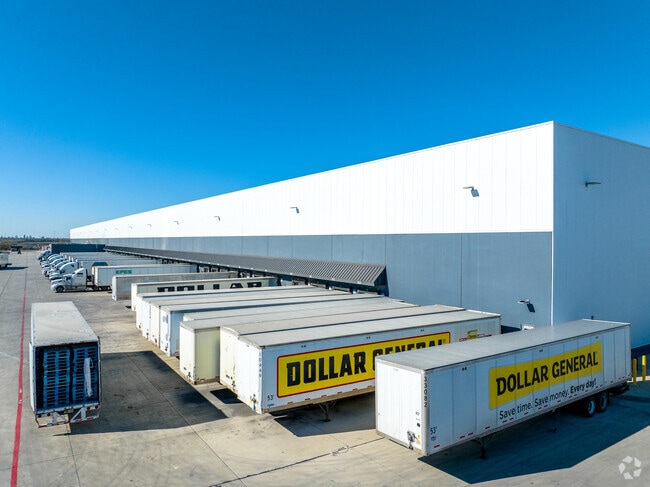
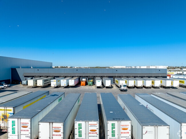
Warehouse
Bexar
AE
Texas
48029C0440H
2
2024
109.87 AC
2025
South
131200
San Antonio
434,029 SF
DEMOGRAPHICS near 6601 Cal Turner Dr
1 Mile
3 Mile
5 Mile
2024 Total Population
1,998
40,377
134,946
2029 Population
2,212
43,273
144,744
Pop Growth 2024-2029
+ 10.71%
+ 7.17%
+ 7.26%
Average Age
34
35
35
2024 Total Households
678
13,107
44,573
HH Growth 2024-2029
+ 10.77%
+ 7.40%
+ 7.41%
Median Household Inc
$46,875
$55,625
$56,038
Avg Household Size
3.00
3.00
2.90
2024 Avg HH Vehicles
2.00
2.00
2.00
Median Home Value
$220,974
$176,748
$168,341
Median Year Built
1998
1991
1993
Nearby Places
Map Layers
Map Styles
 Street
 Aerial
- Restaurants
- Banks
- Shops
- Fitness
- Groceries
PUBLIC TRANSPORTATION
COMMUTER RAIL
San Antonio Amtrak Station (Sunset Limited - Amtrak, Texas Eagle - Amtrak)
DRIVE
WALK
Distance
San Antonio Amtrak Station (Sunset Limited - Amtrak, Texas Eagle - Amtrak)
17 min
8.2 mi
AIRPORT
San Antonio International
DRIVE
WALK
Distance
San Antonio International
26 min
15.5 mi
Freight Ports
Calhoun Port
DRIVE
WALK
Distance
Calhoun Port
172 min
141.3 mi
Nearby Properties
Address
Land Use
TOTAL SIZE
Lot Size
Zoning
Address
Land Use
TOTAL SIZE
Lot Size
Zoning
545,980 SF
125.36 AC
Address
Land Use
TOTAL SIZE
Lot Size
Zoning
122,130 SF
541.40 AC
Address
Land Use
TOTAL SIZE
Lot Size
Zoning
397,806 SF
15.08 AC
Address
Land Use
TOTAL SIZE
Lot Size
Zoning
690,500 SF
16.96 AC
Address
Land Use
TOTAL SIZE
Lot Size
Zoning
359,459 SF
15.81 AC
Address
Land Use
TOTAL SIZE
Lot Size
Zoning
435,592 SF
31.43 AC
Address
Land Use
TOTAL SIZE
Lot Size
Zoning
Address
Land Use
TOTAL SIZE
Lot Size
Zoning
35.76 AC
Address
Land Use
TOTAL SIZE
Lot Size
Zoning
42.04 AC
Address
Land Use
TOTAL SIZE
Lot Size
Zoning
387,440 SF
27.71 AC
Address
Land Use
TOTAL SIZE
Lot Size
Zoning
252,465 SF
37.40 AC
Address
Land Use
TOTAL SIZE
Lot Size
Zoning
74.65 AC
Address
Land Use
TOTAL SIZE
Lot Size
Zoning
41.63 AC
Address
Land Use
TOTAL SIZE
Lot Size
Zoning
325,434 SF
21.47 AC
Address
Land Use
TOTAL SIZE
Lot Size
Zoning
33.77 AC
Address
Land Use
TOTAL SIZE
Lot Size
Zoning
280,365 SF
17.72 AC
Address
Land Use
TOTAL SIZE
Lot Size
Zoning
258,063 SF
24.55 AC
Address
Land Use
TOTAL SIZE
Lot Size
Zoning
306,000 SF
20.23 AC
Address
Land Use
TOTAL SIZE
Lot Size
Zoning
14.14 AC
Address
Land Use
TOTAL SIZE
Lot Size
Zoning
251,680 SF
15.52 AC
Address
Land Use
TOTAL SIZE
Lot Size
Zoning
224,840 SF
17.27 AC
Address
Land Use
TOTAL SIZE
Lot Size
Zoning
199,280 SF
11.50 AC
Address
Land Use
TOTAL SIZE
Lot Size
Zoning
18.35 AC
Address
Land Use
TOTAL SIZE
Lot Size
Zoning
17.47 AC
Address
Land Use
TOTAL SIZE
Lot Size
Zoning
68,055 SF
18.06 AC
Address
Land Use
TOTAL SIZE
Lot Size
Zoning
12.55 AC
Address
Land Use
TOTAL SIZE
Lot Size
Zoning
141,955 SF
121.60 AC
Address
Land Use
TOTAL SIZE
Lot Size
Zoning
361,780 SF
19.99 AC
Address
Land Use
TOTAL SIZE
Lot Size
Zoning
24.75 AC
The World's #1 Commercial Real Estate Marketplace
Connect with us
© 2026 CoStar Group
The information above has been obtained from sources believed reliable. While we do not doubt its accuracy we have not verified it and make no guarantee, warranty or representation about it. It is your responsibility to independently confirm its accuracy and completeness. Any projections, opinions, assumptions, or estimates used are for example only and do not represent the current or future performance of the property. The value of this transaction to you depends on tax and other factors which should be evaluated by your tax, financial, and legal advisors. You and your advisors should conduct a careful, independent investigation of the property to determine to your satisfaction the suitability of the property for your needs.