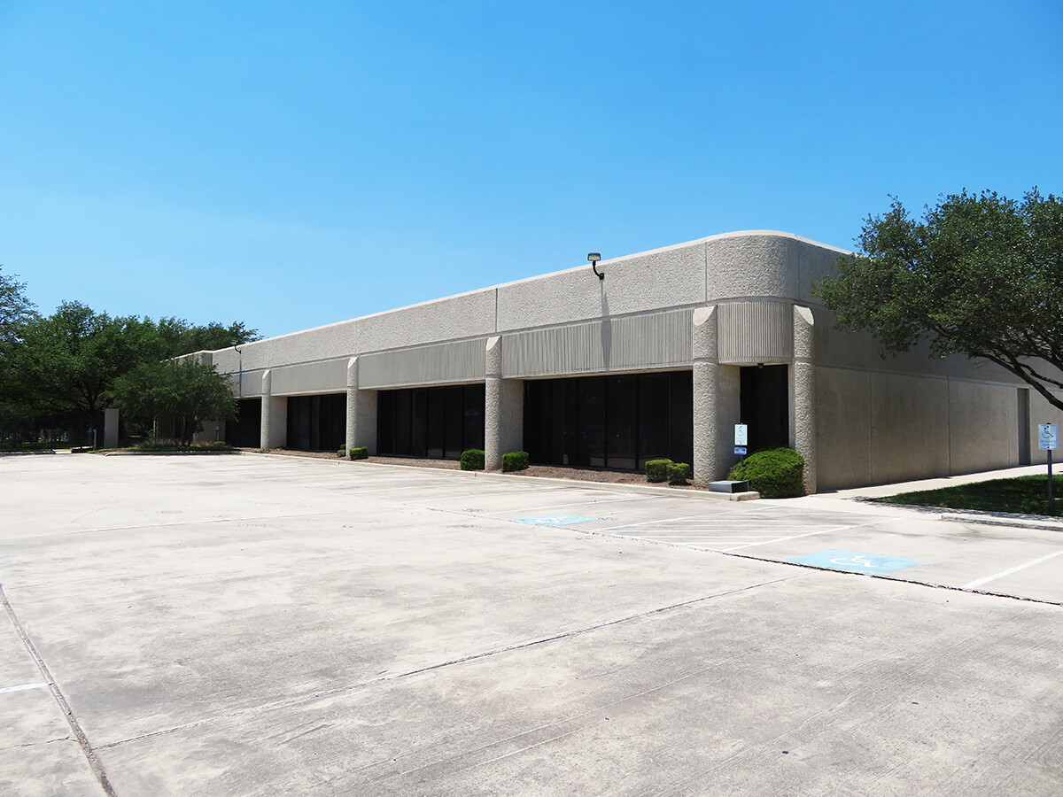
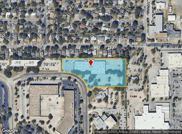
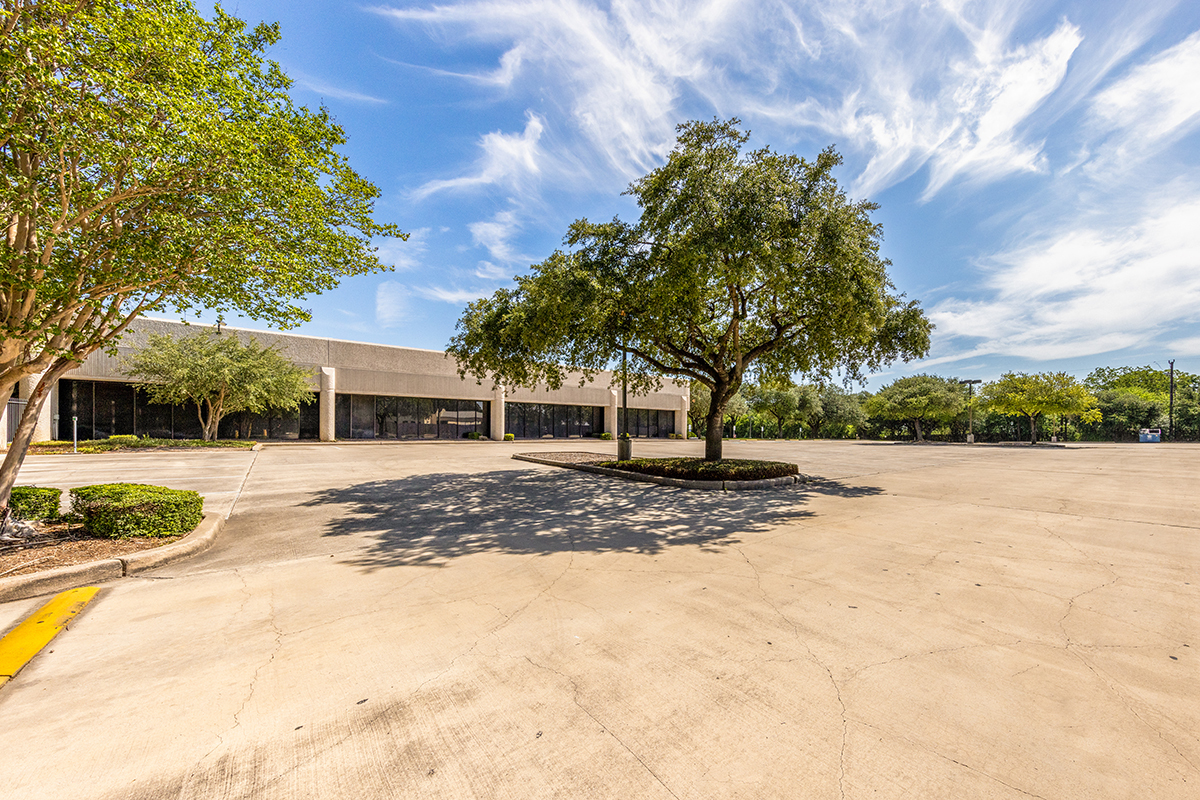
Property Record
6603 First Park Ten Blvd, San Antonio, TX 78213
Current Lease Availabilities
NEARBY LISTINGS FOR SALE OR LEASE
Property Detail
6603 First Park Ten Blvd
San Antonio-New Braunfels, TX
Conv A/S Code
14987-000-0102
NCB 14987 BLK LOT 10 (1.666 AC) & 46 (2.895 AC) PARK TEN 2013-MERGED PIDS 565078 AND 565114 PER APPRAISER REQUEST CR#29562. JF/GIS/4-12-13
Scientificpharmaceuticalmedicalresearchfacility
Bexar
X
Texas
48029C0381H
102
2023
4.56 AC
2023
Northwest
180901
San Antonio
42,342 SF
DEMOGRAPHICS near 6603 First Park Ten Blvd
1 Mile
3 Mile
5 Mile
2024 Total Population
16,950
141,440
395,494
2029 Population
18,023
149,865
420,572
Pop Growth 2024-2029
+ 6.33%
+ 5.96%
+ 6.34%
Average Age
39
39
38
2024 Total Households
6,899
57,262
161,295
HH Growth 2024-2029
+ 6.73%
+ 6.23%
+ 6.70%
Median Household Inc
$36,706
$44,020
$47,382
Avg Household Size
2.40
2.40
2.30
2024 Avg HH Vehicles
2.00
2.00
2.00
Median Home Value
$156,330
$177,654
$186,559
Median Year Built
1963
1966
1973
Nearby Places
- Restaurants
- Banks
- Shops
- Fitness
- Groceries
PUBLIC TRANSPORTATION
COMMUTER RAIL
San Antonio Amtrak Station (Sunset Limited - Amtrak, Texas Eagle - Amtrak)
DRIVE
WALK
Distance
San Antonio Amtrak Station (Sunset Limited - Amtrak, Texas Eagle - Amtrak)
16 min
8.8 mi
AIRPORT
San Antonio International
DRIVE
WALK
Distance
San Antonio International
11 min
6.6 mi
Freight Ports
Calhoun Port
DRIVE
WALK
Distance
Calhoun Port
192 min
156.2 mi
Nearby Properties
Address
Land Use
TOTAL SIZE
Lot Size
Zoning
Address
Land Use
TOTAL SIZE
Lot Size
Zoning
1,414,945 SF
16.77 AC
Address
Land Use
TOTAL SIZE
Lot Size
Zoning
609,267 SF
30.47 AC
Address
Land Use
TOTAL SIZE
Lot Size
Zoning
429,561 SF
25.70 AC
Address
Land Use
TOTAL SIZE
Lot Size
Zoning
482,412 SF
22.97 AC
Address
Land Use
TOTAL SIZE
Lot Size
Zoning
97.47 AC
Address
Land Use
TOTAL SIZE
Lot Size
Zoning
227,744 SF
3.99 AC
Address
Land Use
TOTAL SIZE
Lot Size
Zoning
293,420 SF
9.24 AC
Address
Land Use
TOTAL SIZE
Lot Size
Zoning
506,058 SF
25.23 AC
Address
Land Use
TOTAL SIZE
Lot Size
Zoning
211,045 SF
8.08 AC
Address
Land Use
TOTAL SIZE
Lot Size
Zoning
356,368 SF
18.58 AC
Address
Land Use
TOTAL SIZE
Lot Size
Zoning
63.25 AC
Address
Land Use
TOTAL SIZE
Lot Size
Zoning
256,678 SF
4.42 AC
Address
Land Use
TOTAL SIZE
Lot Size
Zoning
61.64 AC
Address
Land Use
TOTAL SIZE
Lot Size
Zoning
181,290 SF
5.57 AC
Address
Land Use
TOTAL SIZE
Lot Size
Zoning
137,036 SF
4.73 AC
Address
Land Use
TOTAL SIZE
Lot Size
Zoning
138,674 SF
11.14 AC
Address
Land Use
TOTAL SIZE
Lot Size
Zoning
207,445 SF
9.55 AC
Address
Land Use
TOTAL SIZE
Lot Size
Zoning
392,678 SF
21.04 AC
Address
Land Use
TOTAL SIZE
Lot Size
Zoning
302,836 SF
15.96 AC
Address
Land Use
TOTAL SIZE
Lot Size
Zoning
122,292 SF
12.82 AC
Address
Land Use
TOTAL SIZE
Lot Size
Zoning
191,827 SF
7.01 AC
Address
Land Use
TOTAL SIZE
Lot Size
Zoning
279,112 SF
10.62 AC
Address
Land Use
TOTAL SIZE
Lot Size
Zoning
217,700 SF
11.90 AC
Address
Land Use
TOTAL SIZE
Lot Size
Zoning
206,623 SF
2.70 AC
Address
Land Use
TOTAL SIZE
Lot Size
Zoning
307,052 SF
9.91 AC
Address
Land Use
TOTAL SIZE
Lot Size
Zoning
311,088 SF
6.89 AC
Address
Land Use
TOTAL SIZE
Lot Size
Zoning
184,262 SF
6.13 AC
Address
Land Use
TOTAL SIZE
Lot Size
Zoning
173,363 SF
10.29 AC
Address
Land Use
TOTAL SIZE
Lot Size
Zoning
238,247 SF
44 SF
Address
Land Use
TOTAL SIZE
Lot Size
Zoning
160,152 SF
4.18 AC
The World's #1 Commercial Real Estate Marketplace
Connect with us
© 2025 CoStar Group
The information above has been obtained from sources believed reliable. While we do not doubt its accuracy we have not verified it and make no guarantee, warranty or representation about it. It is your responsibility to independently confirm its accuracy and completeness. Any projections, opinions, assumptions, or estimates used are for example only and do not represent the current or future performance of the property. The value of this transaction to you depends on tax and other factors which should be evaluated by your tax, financial, and legal advisors. You and your advisors should conduct a careful, independent investigation of the property to determine to your satisfaction the suitability of the property for your needs.