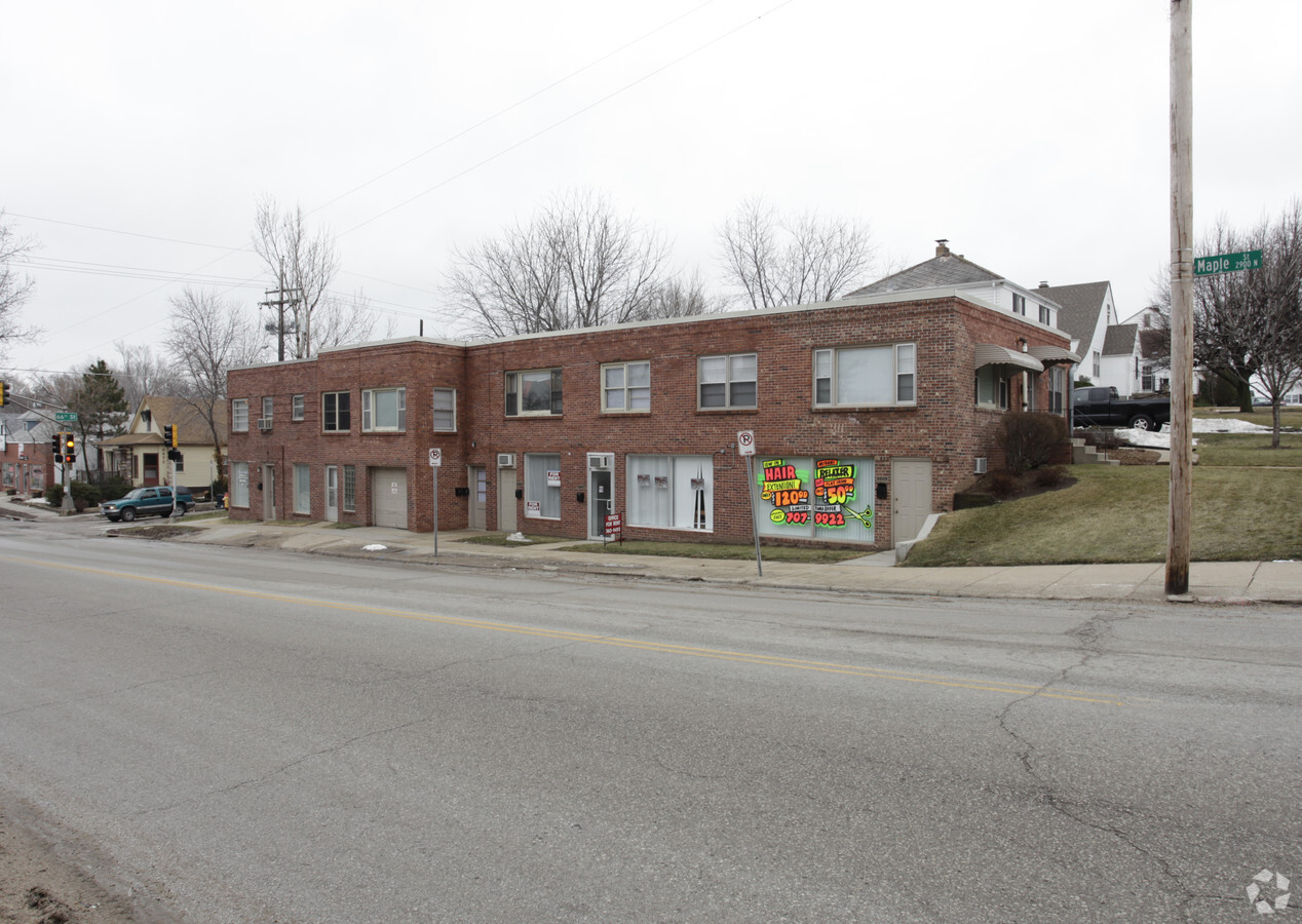
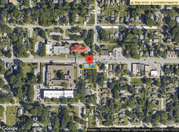
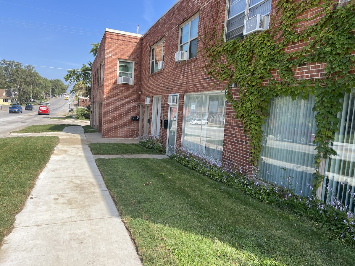
Property Record
6601 Maple St, Omaha, NE 68104
Current Lease Availabilities
NEARBY LISTINGS FOR SALE OR LEASE
Property Detail
6601 Maple St
Omaha-Council Bluffs, NE-IA
Burnham Place
3257-0000-07
BURNHAM PLACE LOT 1 BLOCK 1 N 48.5 W 133 FT 48.5 X 133
Storebuilding
Douglas
X
Nebraska
31055C0217H
1
2023
0.15 AC
2023
Northeast Omaha
005600
Omaha/Council Bluffs
10,042 SF
DEMOGRAPHICS near 6601 Maple St
1 Mile
3 Mile
5 Mile
2024 Total Population
16,954
124,475
278,748
2029 Population
17,166
126,426
283,696
Pop Growth 2024-2029
+ 1.25%
+ 1.57%
+ 1.78%
Average Age
37
38
37
2024 Total Households
7,233
51,594
116,524
HH Growth 2024-2029
+ 1.29%
+ 1.63%
+ 1.89%
Median Household Inc
$56,033
$55,928
$56,199
Avg Household Size
2.30
2.30
2.30
2024 Avg HH Vehicles
2.00
2.00
2.00
Median Home Value
$154,597
$175,347
$181,535
Median Year Built
1953
1960
1964
Nearby Places
- Restaurants
- Banks
- Shops
- Fitness
- Groceries
PUBLIC TRANSPORTATION
COMMUTER RAIL
Omaha Amtrak Station (California Zephyr - Amtrak)
DRIVE
WALK
Distance
Omaha Amtrak Station (California Zephyr - Amtrak)
14 min
6.6 mi
AIRPORT
Eppley Airfield
DRIVE
WALK
Distance
Eppley Airfield
18 min
7.3 mi
Freight Ports
Tulsa Port Of Catoosa
DRIVE
WALK
Distance
Tulsa Port Of Catoosa
471 min
423.0 mi
Nearby Properties
Address
Land Use
TOTAL SIZE
Lot Size
Zoning
Address
Land Use
TOTAL SIZE
Lot Size
Zoning
370,431 SF
8.57 AC
Address
Land Use
TOTAL SIZE
Lot Size
Zoning
702,563 SF
18.85 AC
Address
Land Use
TOTAL SIZE
Lot Size
Zoning
687,804 SF
23.14 AC
Address
Land Use
TOTAL SIZE
Lot Size
Zoning
304,034 SF
5.11 AC
R7
Address
Land Use
TOTAL SIZE
Lot Size
Zoning
282,688 SF
18.71 AC
Address
Land Use
TOTAL SIZE
Lot Size
Zoning
238,954 SF
14.65 AC
Address
Land Use
TOTAL SIZE
Lot Size
Zoning
256,558 SF
7 AC
GI
Address
Land Use
TOTAL SIZE
Lot Size
Zoning
216,496 SF
12 AC
Address
Land Use
TOTAL SIZE
Lot Size
Zoning
255,205 SF
9.41 AC
R6
Address
Land Use
TOTAL SIZE
Lot Size
Zoning
246,606 SF
13.02 AC
CC
Address
Land Use
TOTAL SIZE
Lot Size
Zoning
248,169 SF
10.39 AC
Address
Land Use
TOTAL SIZE
Lot Size
Zoning
241,004 SF
8.80 AC
Address
Land Use
TOTAL SIZE
Lot Size
Zoning
231,890 SF
7.81 AC
Address
Land Use
TOTAL SIZE
Lot Size
Zoning
125,945 SF
Address
Land Use
TOTAL SIZE
Lot Size
Zoning
103,227 SF
8.41 AC
Address
Land Use
TOTAL SIZE
Lot Size
Zoning
199,734 SF
3.10 AC
Address
Land Use
TOTAL SIZE
Lot Size
Zoning
216,667 SF
8.13 AC
Address
Land Use
TOTAL SIZE
Lot Size
Zoning
310,638 SF
4 AC
GO
Address
Land Use
TOTAL SIZE
Lot Size
Zoning
139,930 SF
1.34 AC
Address
Land Use
TOTAL SIZE
Lot Size
Zoning
148,404 SF
7.77 AC
GO
Address
Land Use
TOTAL SIZE
Lot Size
Zoning
173,179 SF
3.05 AC
Address
Land Use
TOTAL SIZE
Lot Size
Zoning
107,631 SF
3.87 AC
Address
Land Use
TOTAL SIZE
Lot Size
Zoning
142,075 SF
12.60 AC
Address
Land Use
TOTAL SIZE
Lot Size
Zoning
208,262 SF
5 AC
LO
Address
Land Use
TOTAL SIZE
Lot Size
Zoning
95,367 SF
1.75 AC
R5
Address
Land Use
TOTAL SIZE
Lot Size
Zoning
291,270 SF
6.77 AC
Address
Land Use
TOTAL SIZE
Lot Size
Zoning
244,112 SF
4.72 AC
R7
Address
Land Use
TOTAL SIZE
Lot Size
Zoning
185,179 SF
2.64 AC
Address
Land Use
TOTAL SIZE
Lot Size
Zoning
172,716 SF
10.16 AC
R6
Address
Land Use
TOTAL SIZE
Lot Size
Zoning
105,484 SF
7.89 AC
The World's #1 Commercial Real Estate Marketplace
Connect with us
© 2025 CoStar Group
The information above has been obtained from sources believed reliable. While we do not doubt its accuracy we have not verified it and make no guarantee, warranty or representation about it. It is your responsibility to independently confirm its accuracy and completeness. Any projections, opinions, assumptions, or estimates used are for example only and do not represent the current or future performance of the property. The value of this transaction to you depends on tax and other factors which should be evaluated by your tax, financial, and legal advisors. You and your advisors should conduct a careful, independent investigation of the property to determine to your satisfaction the suitability of the property for your needs.