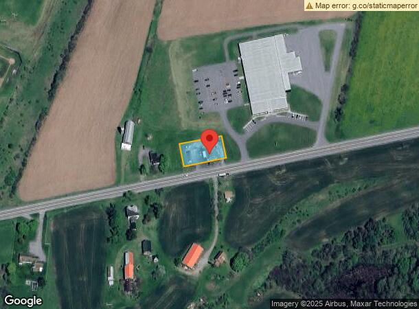
Property Record
661 Us Highway 20, West Winfield, NY 13491
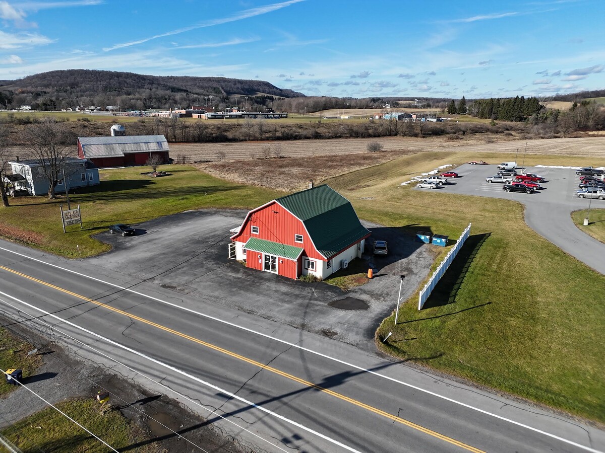
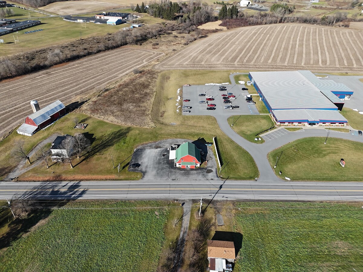
This Property Is For Sale
NEARBY LISTINGS FOR SALE OR LEASE
-
-
View all West Winfield listings for sale on LoopNet.com
Property Detail
661 Us Highway 20
Utica-Rome, NY
Herkimer
215689-137-001-0001-027-000-0000
New York
Restaurantbuilding
27.000
2024
0.41 AC
2023
Herkimer County
010100
Utica/Rome
3,108 SF
DEMOGRAPHICS near 661 Us Highway 20
1 Mile
3 Mile
5 Mile
2024 Total Population
698
1,634
4,475
2029 Population
664
1,565
4,334
Pop Growth 2024-2029
(4.87%)
(4.22%)
(3.15%)
Average Age
43
43
42
2024 Total Households
293
678
1,796
HH Growth 2024-2029
(5.12%)
(4.28%)
(3.06%)
Median Household Inc
$48,055
$50,096
$55,374
Avg Household Size
2.40
2.40
2.50
2024 Avg HH Vehicles
2.00
2.00
2.00
Median Home Value
$129,081
$129,816
$131,047
Median Year Built
1961
1965
1972
Nearby Places
- Restaurants
- Banks
- Shops
- Fitness
- Groceries
Nearby Properties
Address
Land Use
TOTAL SIZE
Lot Size
Zoning
Address
Land Use
TOTAL SIZE
Lot Size
Zoning
8,760 SF
55.80 AC
C
Address
Land Use
TOTAL SIZE
Lot Size
Zoning
95,000 SF
47.20 AC
17000
Address
Land Use
TOTAL SIZE
Lot Size
Zoning
80,070 SF
15.10 AC
17201
Address
Land Use
TOTAL SIZE
Lot Size
Zoning
75,087 SF
21.60 AC
17002
Address
Land Use
TOTAL SIZE
Lot Size
Zoning
17,065 SF
2.20 AC
Address
Land Use
TOTAL SIZE
Lot Size
Zoning
53,710 SF
48.40 AC
RA
Address
Land Use
TOTAL SIZE
Lot Size
Zoning
7,956 SF
0.22 AC
17201
Address
Land Use
TOTAL SIZE
Lot Size
Zoning
Address
Land Use
TOTAL SIZE
Lot Size
Zoning
6,242 SF
0.90 AC
17201
Address
Land Use
TOTAL SIZE
Lot Size
Zoning
Address
Land Use
TOTAL SIZE
Lot Size
Zoning
21,228 SF
2.60 AC
17200
Address
Land Use
TOTAL SIZE
Lot Size
Zoning
10,756 SF
0.23 AC
17201
Address
Land Use
TOTAL SIZE
Lot Size
Zoning
15,872 SF
1.20 AC
R
Address
Land Use
TOTAL SIZE
Lot Size
Zoning
9,120 SF
5.10 AC
RA
Address
Land Use
TOTAL SIZE
Lot Size
Zoning
4,010 SF
0.43 AC
17200
Address
Land Use
TOTAL SIZE
Lot Size
Zoning
23,000 SF
17.20 AC
17000
Address
Land Use
TOTAL SIZE
Lot Size
Zoning
2,891 SF
640 AC
RA
Address
Land Use
TOTAL SIZE
Lot Size
Zoning
394.34 AC
01 - NOT Z
Address
Land Use
TOTAL SIZE
Lot Size
Zoning
Address
Land Use
TOTAL SIZE
Lot Size
Zoning
4,000 SF
0.75 AC
17200
Address
Land Use
TOTAL SIZE
Lot Size
Zoning
7,200 SF
2.20 AC
17002
Address
Land Use
TOTAL SIZE
Lot Size
Zoning
6,790 SF
0.45 AC
17200
Address
Land Use
TOTAL SIZE
Lot Size
Zoning
8,750 SF
1.50 AC
17200
Address
Land Use
TOTAL SIZE
Lot Size
Zoning
4,500 SF
10 AC
01 - NOT Z
Address
Land Use
TOTAL SIZE
Lot Size
Zoning
15 AC
R
Address
Land Use
TOTAL SIZE
Lot Size
Zoning
299.52 AC
01 - NOT Z
Address
Land Use
TOTAL SIZE
Lot Size
Zoning
1,200 SF
0.01 AC
17230
Address
Land Use
TOTAL SIZE
Lot Size
Zoning
1,260 SF
229 AC
A
Address
Land Use
TOTAL SIZE
Lot Size
Zoning
1,450 SF
99 AC
RA
Address
Land Use
TOTAL SIZE
Lot Size
Zoning
2,160 SF
177.80 AC
RA
The World's #1 Commercial Real Estate Marketplace
Connect with us
© 2025 CoStar Group
The information above has been obtained from sources believed reliable. While we do not doubt its accuracy we have not verified it and make no guarantee, warranty or representation about it. It is your responsibility to independently confirm its accuracy and completeness. Any projections, opinions, assumptions, or estimates used are for example only and do not represent the current or future performance of the property. The value of this transaction to you depends on tax and other factors which should be evaluated by your tax, financial, and legal advisors. You and your advisors should conduct a careful, independent investigation of the property to determine to your satisfaction the suitability of the property for your needs.