Property Record
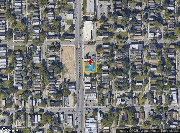
6617 S Ashland Ave, Chicago, IL 60636


NEARBY LISTINGS FOR SALE OR LEASE
Property Detail
6617 S Ashland Ave
20-20-116-005-0000
E S Kirklands Sub
Commercialbuilding
Cook
X
Illinois
17031C0520J
7-10
2022
0.26 AC
2024
Englewood
671600
Chicago
10,703 SF
Chicago-Naperville-Elgin, IL-IN-WI
DEMOGRAPHICS near 6617 S Ashland Ave
1 Mile
3 Mile
5 Mile
2024 Total Population
30,064
285,178
722,149
2029 Population
28,929
269,950
688,391
Pop Growth 2024-2029
(3.78%)
(5.34%)
(4.67%)
Average Age
38
37
38
2024 Total Households
10,270
96,795
269,000
HH Growth 2024-2029
(4.16%)
(5.50%)
(4.75%)
Median Household Inc
$28,422
$35,393
$45,528
Avg Household Size
2.70
2.80
2.60
2024 Avg HH Vehicles
1.00
1.00
1.00
Median Home Value
$97,774
$171,801
$215,927
Median Year Built
1947
1948
1950
Nearby Places
- Restaurants
- Banks
- Shops
- Fitness
- Groceries
PUBLIC TRANSPORTATION
TRANSIT/SUBWAY
Ashland & 63Rd Street Station (Green Line - Chicago Transit Authority "L" Trains (The "L"))
DRIVE
WALK
Distance
Ashland & 63Rd Street Station (Green Line - Chicago Transit Authority "L" Trains (The "L"))
1 min
7 min
0.4 mi
COMMUTER RAIL
Wrightwood Station (SouthWest Service - Northeast Illinois Regional Commuter Railroad (Metra))
DRIVE
WALK
Distance
Wrightwood Station (SouthWest Service - Northeast Illinois Regional Commuter Railroad (Metra))
7 min
3.3 mi
Gresham Station (Rock Island District Line - Northeast Illinois Regional Commuter Railroad (Metra))
DRIVE
WALK
Distance
Gresham Station (Rock Island District Line - Northeast Illinois Regional Commuter Railroad (Metra))
7 min
3.6 mi
AIRPORT
Chicago Midway International
DRIVE
WALK
Distance
Chicago Midway International
12 min
6.1 mi
Chicago O'Hare International
DRIVE
WALK
Distance
Chicago O'Hare International
41 min
24.4 mi
Freight Ports
Port Milwaukee
DRIVE
WALK
Distance
Port Milwaukee
119 min
92.7 mi
SALE & LEASE HISTORY
LISTING DATE
SALE/LEASE

Sep 25, 2016
For Lease
Jan 30, 2019
For Sale
Nearby Properties
Address
Land Use
TOTAL SIZE
Lot Size
Zoning
Address
Land Use
TOTAL SIZE
Lot Size
Zoning
1,615,006 SF
41.91 AC
PMD13
Address
Land Use
TOTAL SIZE
Lot Size
Zoning
134,800 SF
2.53 AC
PD 1273
Address
Land Use
TOTAL SIZE
Lot Size
Zoning
0.91 AC
PD 1177
Address
Land Use
TOTAL SIZE
Lot Size
Zoning
869,660 SF
0.86 AC
PMD 8
Address
Land Use
TOTAL SIZE
Lot Size
Zoning
87,830 SF
0.76 AC
B1-1
Address
Land Use
TOTAL SIZE
Lot Size
Zoning
1,460,910 SF
2.28 AC
PMD 8,M1-1
Address
Land Use
TOTAL SIZE
Lot Size
Zoning
0.84 AC
B1-3
Address
Land Use
TOTAL SIZE
Lot Size
Zoning
260,481 SF
12.93 AC
PD 463
Address
Land Use
TOTAL SIZE
Lot Size
Zoning
151,175 SF
11.53 AC
PD 966
Address
Land Use
TOTAL SIZE
Lot Size
Zoning
7,200 SF
0.22 AC
B3-3
Address
Land Use
TOTAL SIZE
Lot Size
Zoning
352,529 SF
12.77 AC
PMD 8
Address
Land Use
TOTAL SIZE
Lot Size
Zoning
151,303 SF
0.88 AC
PD 568
Address
Land Use
TOTAL SIZE
Lot Size
Zoning
7.47 AC
RT-4
Address
Land Use
TOTAL SIZE
Lot Size
Zoning
1.65 AC
B2-3
Address
Land Use
TOTAL SIZE
Lot Size
Zoning
141,165 SF
7.82 AC
PD 966
Address
Land Use
TOTAL SIZE
Lot Size
Zoning
85,990 SF
6.46 AC
PD 411
Address
Land Use
TOTAL SIZE
Lot Size
Zoning
210,520 SF
6.93 AC
PMD 8
Address
Land Use
TOTAL SIZE
Lot Size
Zoning
324,200 SF
1.87 AC
PMD 8
Address
Land Use
TOTAL SIZE
Lot Size
Zoning
258,000 SF
13.22 AC
PMD 8
Address
Land Use
TOTAL SIZE
Lot Size
Zoning
194,208 SF
8.23 AC
PMD 8
Address
Land Use
TOTAL SIZE
Lot Size
Zoning
105,818 SF
9.17 AC
PD 910
Address
Land Use
TOTAL SIZE
Lot Size
Zoning
166,292 SF
5.95 AC
PMD13
Address
Land Use
TOTAL SIZE
Lot Size
Zoning
496,300 SF
1.07 AC
PMD 8
Address
Land Use
TOTAL SIZE
Lot Size
Zoning
743,663 SF
7.14 AC
RT-4
Address
Land Use
TOTAL SIZE
Lot Size
Zoning
134,300 SF
4.02 AC
PMD 8
Address
Land Use
TOTAL SIZE
Lot Size
Zoning
13,700 SF
0.33 AC
B3-2
Address
Land Use
TOTAL SIZE
Lot Size
Zoning
170,150 SF
2.63 AC
M2-2
Address
Land Use
TOTAL SIZE
Lot Size
Zoning
65,186 SF
10.47 AC
PD 566
Address
Land Use
TOTAL SIZE
Lot Size
Zoning
0.25 AC
PD 548
Address
Land Use
TOTAL SIZE
Lot Size
Zoning
144,548 SF
9.88 AC
PMD 8
The World's #1 Commercial Real Estate Marketplace
Connect with us
© 2025 CoStar Group
The information above has been obtained from sources believed reliable. While we do not doubt its accuracy we have not verified it and make no guarantee, warranty or representation about it. It is your responsibility to independently confirm its accuracy and completeness. Any projections, opinions, assumptions, or estimates used are for example only and do not represent the current or future performance of the property. The value of this transaction to you depends on tax and other factors which should be evaluated by your tax, financial, and legal advisors. You and your advisors should conduct a careful, independent investigation of the property to determine to your satisfaction the suitability of the property for your needs.