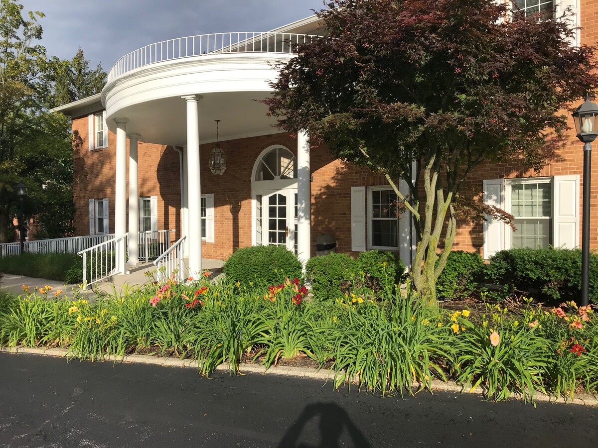
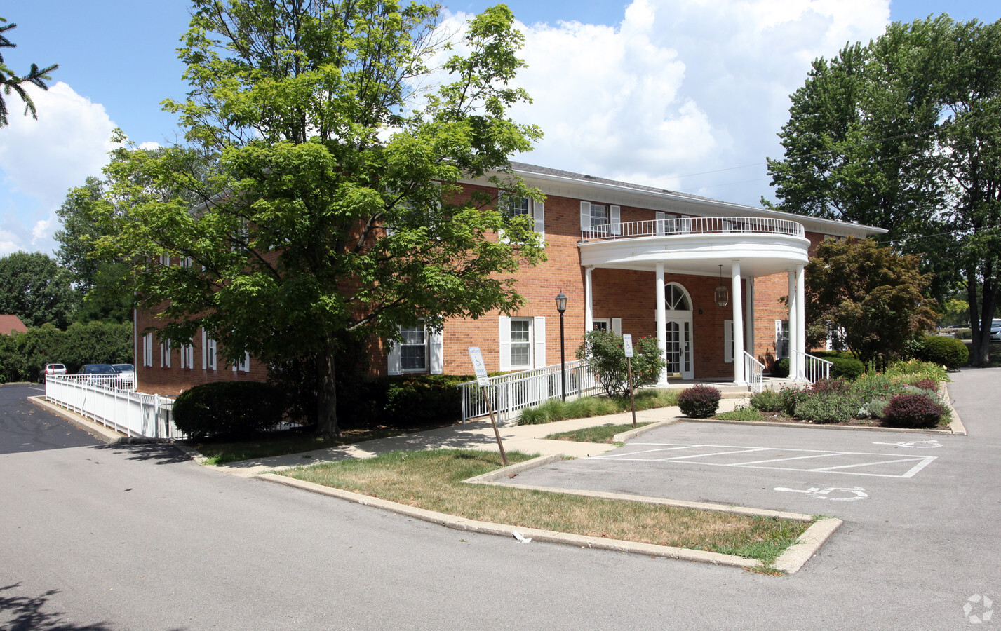
Property Record
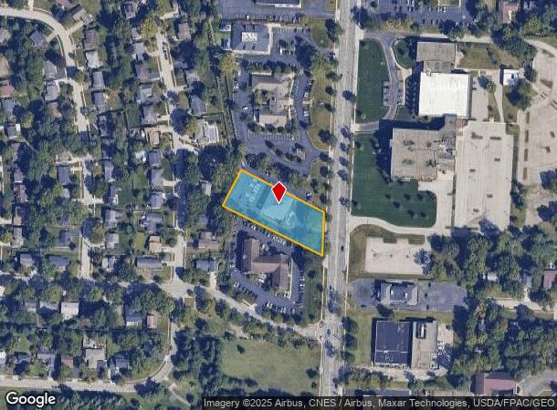
6649 N High St, Worthington, OH 43085

NEARBY LISTINGS FOR SALE OR LEASE
Property Detail
6649 N High St
100-003714
6649 N HIGH ST 1.012 ACRES LOT 32-33-34-35-36
Officebuilding
Franklin
X
Ohio
39049C0157K
33
2023
1.01 AC
2023
Worthington
006721
Columbus
18,240 SF
Columbus, OH
DEMOGRAPHICS near 6649 N High St
1 Mile
3 Mile
5 Mile
2024 Total Population
8,986
100,250
295,160
2029 Population
8,932
100,195
298,711
Pop Growth 2024-2029
(0.60%)
(0.05%)
+ 1.20%
Average Age
43
39
38
2024 Total Households
3,597
42,052
123,126
HH Growth 2024-2029
(0.67%)
(0.05%)
+ 1.20%
Median Household Inc
$108,164
$77,127
$74,997
Avg Household Size
2.40
2.30
2.30
2024 Avg HH Vehicles
2.00
2.00
2.00
Median Home Value
$356,822
$288,658
$285,961
Median Year Built
1966
1976
1979
Nearby Places
- Restaurants
- Banks
- Shops
- Fitness
- Groceries
PUBLIC TRANSPORTATION
AIRPORT
John Glenn Columbus International
DRIVE
WALK
Distance
John Glenn Columbus International
22 min
15.6 mi
Rickenbacker International
DRIVE
WALK
Distance
Rickenbacker International
38 min
25.2 mi
Freight Ports
Port of Toledo
DRIVE
WALK
Distance
Port of Toledo
169 min
134.1 mi
SALE & LEASE HISTORY
LISTING DATE
SALE/LEASE

Sep 10, 2021
For Lease
Oct 25, 2016
For Lease
Jul 20, 2017
For Lease
Jan 22, 2020
For Lease
Jan 06, 2023
For Lease
Jan 05, 2022
For Lease
Nearby Properties
Address
Land Use
TOTAL SIZE
Lot Size
Zoning
Address
Land Use
TOTAL SIZE
Lot Size
Zoning
133,425 SF
20.51 AC
Address
Land Use
TOTAL SIZE
Lot Size
Zoning
383,533 SF
84.68 AC
Address
Land Use
TOTAL SIZE
Lot Size
Zoning
206,724 SF
7.60 AC
Address
Land Use
TOTAL SIZE
Lot Size
Zoning
171,631 SF
17.55 AC
Address
Land Use
TOTAL SIZE
Lot Size
Zoning
1,070,310 SF
2.65 AC
Address
Land Use
TOTAL SIZE
Lot Size
Zoning
286,169 SF
11.08 AC
Address
Land Use
TOTAL SIZE
Lot Size
Zoning
785,616 SF
53.89 AC
Address
Land Use
TOTAL SIZE
Lot Size
Zoning
109,480 SF
17.86 AC
Address
Land Use
TOTAL SIZE
Lot Size
Zoning
733,806 SF
27.30 AC
Address
Land Use
TOTAL SIZE
Lot Size
Zoning
166,396 SF
11.68 AC
Address
Land Use
TOTAL SIZE
Lot Size
Zoning
249,917 SF
19.18 AC
Address
Land Use
TOTAL SIZE
Lot Size
Zoning
116,928 SF
22.86 AC
Address
Land Use
TOTAL SIZE
Lot Size
Zoning
148.89 AC
Address
Land Use
TOTAL SIZE
Lot Size
Zoning
266,792 SF
9.03 AC
Address
Land Use
TOTAL SIZE
Lot Size
Zoning
413,781 SF
78.36 AC
Address
Land Use
TOTAL SIZE
Lot Size
Zoning
162,728 SF
4.80 AC
Address
Land Use
TOTAL SIZE
Lot Size
Zoning
187,562 SF
8.76 AC
Address
Land Use
TOTAL SIZE
Lot Size
Zoning
62,702 SF
38.69 AC
Address
Land Use
TOTAL SIZE
Lot Size
Zoning
132,804 SF
11.54 AC
Address
Land Use
TOTAL SIZE
Lot Size
Zoning
546,096 SF
8.48 AC
Address
Land Use
TOTAL SIZE
Lot Size
Zoning
260,802 SF
8.80 AC
Address
Land Use
TOTAL SIZE
Lot Size
Zoning
183,424 SF
9.20 AC
Address
Land Use
TOTAL SIZE
Lot Size
Zoning
147,582 SF
5.75 AC
Address
Land Use
TOTAL SIZE
Lot Size
Zoning
170,237 SF
97.38 AC
Address
Land Use
TOTAL SIZE
Lot Size
Zoning
368,077 SF
7.87 AC
Address
Land Use
TOTAL SIZE
Lot Size
Zoning
554,268 SF
23.53 AC
Address
Land Use
TOTAL SIZE
Lot Size
Zoning
69.13 AC
Address
Land Use
TOTAL SIZE
Lot Size
Zoning
24,004 SF
20.30 AC
Address
Land Use
TOTAL SIZE
Lot Size
Zoning
445,497 SF
18.03 AC
Address
Land Use
TOTAL SIZE
Lot Size
Zoning
111,168 SF
19.43 AC
The World's #1 Commercial Real Estate Marketplace
Connect with us
© 2025 CoStar Group
The information above has been obtained from sources believed reliable. While we do not doubt its accuracy we have not verified it and make no guarantee, warranty or representation about it. It is your responsibility to independently confirm its accuracy and completeness. Any projections, opinions, assumptions, or estimates used are for example only and do not represent the current or future performance of the property. The value of this transaction to you depends on tax and other factors which should be evaluated by your tax, financial, and legal advisors. You and your advisors should conduct a careful, independent investigation of the property to determine to your satisfaction the suitability of the property for your needs.