Property Record
665 Martinsville Rd, Basking Ridge, NJ 07920

NEARBY LISTINGS FOR SALE OR LEASE
-
-
View all Basking Ridge listings for lease on LoopNet.com
Property Detail
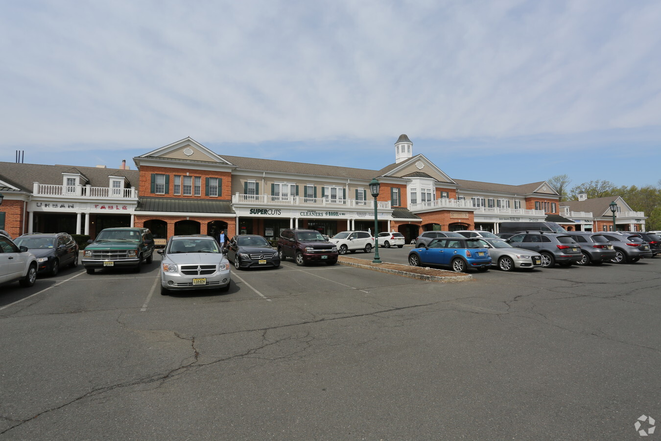
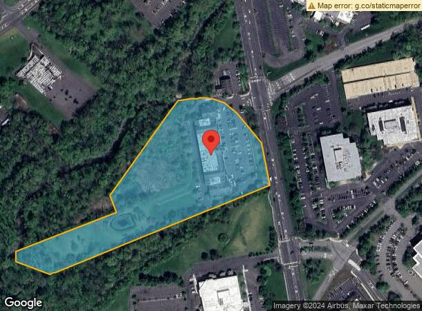
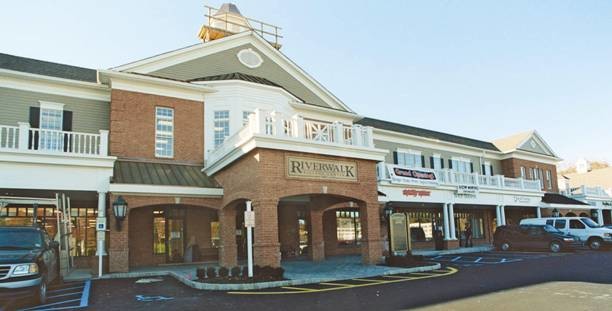
665 Martinsville Rd
Newark, NJ-PA
ADDITIONAL LOTS: 49,853 SF GROSS
02-11201-0000-00010
Somerset
Commercialnec
New Jersey
2024
10
2024
7.35 AC
052604
Route 78 East
47,604 SF
Northern New Jersey
DEMOGRAPHICS near 665 Martinsville Rd
1 Mile
3 Mile
5 Mile
2024 Total Population
2,970
31,470
77,792
2029 Population
2,961
31,416
77,675
Pop Growth 2024-2029
(0.30%)
(0.17%)
(0.15%)
Average Age
43
43
43
2024 Total Households
1,284
11,675
28,906
HH Growth 2024-2029
(0.39%)
(0.19%)
(0.18%)
Median Household Inc
$139,480
$170,117
$164,952
Avg Household Size
2.20
2.60
2.60
2024 Avg HH Vehicles
2.00
2.00
2.00
Median Home Value
$378,779
$699,238
$677,977
Median Year Built
1985
1986
1982
Nearby Places
- Restaurants
- Banks
- Shops
- Fitness
- Groceries
PUBLIC TRANSPORTATION
COMMUTER RAIL
Lyons (Morris & Essex Gladstone Branch - NJ Transit Commuter Rail (NJ Transit))
Drive
Walk
Distance
Lyons (Morris & Essex Gladstone Branch - NJ Transit Commuter Rail (NJ Transit))
7 min
3.1 mi
Millington (Morris & Essex Gladstone Branch - NJ Transit Commuter Rail (NJ Transit))
Drive
Walk
Distance
Millington (Morris & Essex Gladstone Branch - NJ Transit Commuter Rail (NJ Transit))
8 min
4.4 mi
AIRPORT
Newark Liberty International
Drive
Walk
Distance
Newark Liberty International
32 min
26.1 mi
Trenton Mercer
Drive
Walk
Distance
Trenton Mercer
61 min
39.6 mi
Freight Ports
New York Container Terminal
Drive
Walk
Distance
New York Container Terminal
42 min
29.1 mi
SALE & LEASE HISTORY
LISTING DATE
SALE/LEASE

Sep 24, 2016
For Lease
Nearby Properties
Address
Land Use
TOTAL SIZE
Lot Size
Zoning
Address
Land Use
TOTAL SIZE
Lot Size
Zoning
52.31 AC
OR
Address
Land Use
TOTAL SIZE
Lot Size
Zoning
56.79 AC
R2
Address
Land Use
TOTAL SIZE
Lot Size
Zoning
155.97 AC
P4
Address
Land Use
TOTAL SIZE
Lot Size
Zoning
290,000 SF
51.96 AC
E4
Address
Land Use
TOTAL SIZE
Lot Size
Zoning
141.44 AC
P4
Address
Land Use
TOTAL SIZE
Lot Size
Zoning
85,000 SF
25.62 AC
E3
Address
Land Use
TOTAL SIZE
Lot Size
Zoning
46.96 AC
OR
Address
Land Use
TOTAL SIZE
Lot Size
Zoning
1,976 SF
22.03 AC
B5
Address
Land Use
TOTAL SIZE
Lot Size
Zoning
839.97 AC
P1
Address
Land Use
TOTAL SIZE
Lot Size
Zoning
15 AC
R2
Address
Land Use
TOTAL SIZE
Lot Size
Zoning
7,082 SF
10 AC
R3
Address
Land Use
TOTAL SIZE
Lot Size
Zoning
21,500 SF
9.66 AC
E4
Address
Land Use
TOTAL SIZE
Lot Size
Zoning
31.58 AC
OR
Address
Land Use
TOTAL SIZE
Lot Size
Zoning
115.79 AC
OR
Address
Land Use
TOTAL SIZE
Lot Size
Zoning
25.64 AC
E2
Address
Land Use
TOTAL SIZE
Lot Size
Zoning
28,856 SF
7.98 AC
E3
Address
Land Use
TOTAL SIZE
Lot Size
Zoning
126,360 SF
36.03 AC
E3
Address
Land Use
TOTAL SIZE
Lot Size
Zoning
13.07 AC
OR
Address
Land Use
TOTAL SIZE
Lot Size
Zoning
1,096 SF
15.12 AC
R5
Address
Land Use
TOTAL SIZE
Lot Size
Zoning
1,428 SF
19.52 AC
E2
Address
Land Use
TOTAL SIZE
Lot Size
Zoning
40.36 AC
OR
Address
Land Use
TOTAL SIZE
Lot Size
Zoning
62,250 SF
14.42 AC
E2
Address
Land Use
TOTAL SIZE
Lot Size
Zoning
2,765 SF
9.10 AC
R6
Address
Land Use
TOTAL SIZE
Lot Size
Zoning
15.22 AC
OR
Address
Land Use
TOTAL SIZE
Lot Size
Zoning
34.61 AC
E3
Address
Land Use
TOTAL SIZE
Lot Size
Zoning
67,407 SF
42.14 AC
R1
Address
Land Use
TOTAL SIZE
Lot Size
Zoning
40.72 AC
OR
Address
Land Use
TOTAL SIZE
Lot Size
Zoning
12 AC
P3
Address
Land Use
TOTAL SIZE
Lot Size
Zoning
5.71 AC
OR
Address
Land Use
TOTAL SIZE
Lot Size
Zoning
4,323 SF
90.86 AC
R5
Start a new search to find other properties for sale or lease
Connect with us
© 2024 CoStar Group
The information above has been obtained from sources believed reliable. While we do not doubt its accuracy we have not verified it and make no guarantee, warranty or representation about it. It is your responsibility to independently confirm its accuracy and completeness. Any projections, opinions, assumptions, or estimates used are for example only and do not represent the current or future performance of the property. The value of this transaction to you depends on tax and other factors which should be evaluated by your tax, financial, and legal advisors. You and your advisors should conduct a careful, independent investigation of the property to determine to your satisfaction the suitability of the property for your needs.