Property Record
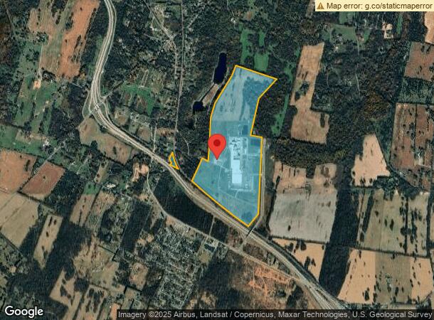
665 N N Port Ave, Shenandoah Junction, WV 25442

NEARBY LISTINGS FOR SALE OR LEASE
Property Detail
665 N N Port Ave
08-12-00010003
136.45 AC JEFFERSON ORCHARDS
Manufacturinglight
Jefferson
X
West Virginia
54037C0020E
136.45 AC
0
Jefferson County
2024
Washington, DC
972204
Washington-Arlington-Alexandria, DC-VA-MD-WV
DEMOGRAPHICS near 665 N N Port Ave
1 Mile
3 Mile
5 Mile
2024 Total Population
993
4,466
22,651
2029 Population
1,041
4,714
24,411
Pop Growth 2024-2029
+ 4.83%
+ 5.55%
+ 7.77%
Average Age
40
41
40
2024 Total Households
348
1,607
8,322
HH Growth 2024-2029
+ 4.89%
+ 5.66%
+ 7.94%
Median Household Inc
$74,999
$93,587
$92,362
Avg Household Size
2.70
2.60
2.60
2024 Avg HH Vehicles
2.00
2.00
2.00
Median Home Value
$293,749
$304,558
$284,080
Median Year Built
1990
1988
1995
Nearby Places
- Restaurants
- Banks
- Shops
- Fitness
- Groceries
PUBLIC TRANSPORTATION
COMMUTER RAIL
Duffields (Brunswick Line - Maryland Area Regional Commuter Trains (The MARC))
DRIVE
WALK
Distance
Duffields (Brunswick Line - Maryland Area Regional Commuter Trains (The MARC))
16 min
6.6 mi
Martinsburg (Brunswick Line - Maryland Area Regional Commuter Trains (The MARC))
DRIVE
WALK
Distance
Martinsburg (Brunswick Line - Maryland Area Regional Commuter Trains (The MARC))
18 min
9.9 mi
AIRPORT
Hagerstown Regional/Richard A Henson Field
DRIVE
WALK
Distance
Hagerstown Regional/Richard A Henson Field
48 min
34.9 mi
Freight Ports
Port of Baltimore
DRIVE
WALK
Distance
Port of Baltimore
108 min
83.3 mi
Nearby Properties
Address
Land Use
TOTAL SIZE
Lot Size
Zoning
Address
Land Use
TOTAL SIZE
Lot Size
Zoning
41.98 AC
Address
Land Use
TOTAL SIZE
Lot Size
Zoning
Address
Land Use
TOTAL SIZE
Lot Size
Zoning
24.59 AC
Address
Land Use
TOTAL SIZE
Lot Size
Zoning
56.10 AC
Address
Land Use
TOTAL SIZE
Lot Size
Zoning
Address
Land Use
TOTAL SIZE
Lot Size
Zoning
28.49 AC
Address
Land Use
TOTAL SIZE
Lot Size
Zoning
14.15 AC
Address
Land Use
TOTAL SIZE
Lot Size
Zoning
Address
Land Use
TOTAL SIZE
Lot Size
Zoning
16.05 AC
Address
Land Use
TOTAL SIZE
Lot Size
Zoning
2.47 AC
Address
Land Use
TOTAL SIZE
Lot Size
Zoning
Address
Land Use
TOTAL SIZE
Lot Size
Zoning
Address
Land Use
TOTAL SIZE
Lot Size
Zoning
Address
Land Use
TOTAL SIZE
Lot Size
Zoning
Address
Land Use
TOTAL SIZE
Lot Size
Zoning
Address
Land Use
TOTAL SIZE
Lot Size
Zoning
10.50 AC
Address
Land Use
TOTAL SIZE
Lot Size
Zoning
Address
Land Use
TOTAL SIZE
Lot Size
Zoning
Address
Land Use
TOTAL SIZE
Lot Size
Zoning
Address
Land Use
TOTAL SIZE
Lot Size
Zoning
Address
Land Use
TOTAL SIZE
Lot Size
Zoning
6.24 AC
Address
Land Use
TOTAL SIZE
Lot Size
Zoning
173.58 AC
Address
Land Use
TOTAL SIZE
Lot Size
Zoning
1.67 AC
Address
Land Use
TOTAL SIZE
Lot Size
Zoning
4,042 SF
142.59 AC
Address
Land Use
TOTAL SIZE
Lot Size
Zoning
Address
Land Use
TOTAL SIZE
Lot Size
Zoning
Address
Land Use
TOTAL SIZE
Lot Size
Zoning
Address
Land Use
TOTAL SIZE
Lot Size
Zoning
Address
Land Use
TOTAL SIZE
Lot Size
Zoning
The World's #1 Commercial Real Estate Marketplace
Connect with us
© 2025 CoStar Group
The information above has been obtained from sources believed reliable. While we do not doubt its accuracy we have not verified it and make no guarantee, warranty or representation about it. It is your responsibility to independently confirm its accuracy and completeness. Any projections, opinions, assumptions, or estimates used are for example only and do not represent the current or future performance of the property. The value of this transaction to you depends on tax and other factors which should be evaluated by your tax, financial, and legal advisors. You and your advisors should conduct a careful, independent investigation of the property to determine to your satisfaction the suitability of the property for your needs.