Property Record
6654 Dunnsville Rd, Altamont, NY 12009
NEARBY LISTINGS FOR SALE OR LEASE
-
-
View all Altamont listings for sale on LoopNet.com
Property Detail
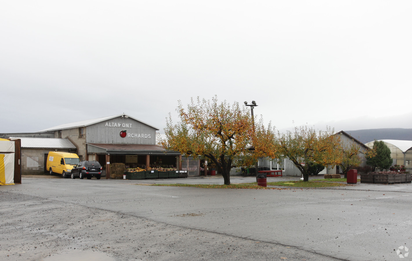
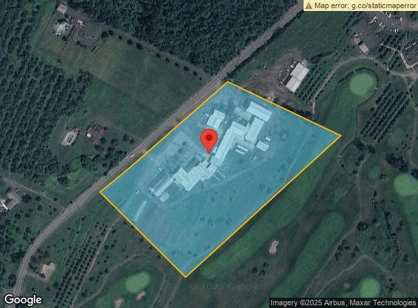
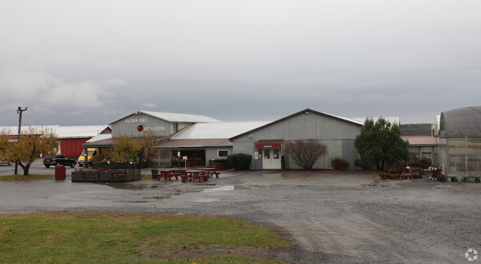
6654 Dunnsville Rd
Albany-Schenectady-Troy, NY
LANDS OF ABBRUZZESE LOT 2
013089-037-000-0002-002-013-0000
Albany
Orchard
New York
X
2.013
36001C0132D
9 AC
2024
W Outer Albany County
2023
Albany/Schenectady/Troy
014613
DEMOGRAPHICS near 6654 Dunnsville Rd
1 Mile
3 Mile
5 Mile
2024 Total Population
269
5,156
31,442
2029 Population
266
5,117
32,031
Pop Growth 2024-2029
(1.12%)
(0.76%)
+ 1.87%
Average Age
43
44
43
2024 Total Households
118
2,104
12,758
HH Growth 2024-2029
(1.69%)
(0.76%)
+ 2.15%
Median Household Inc
$48,333
$85,570
$95,387
Avg Household Size
2.30
2.40
2.40
2024 Avg HH Vehicles
2.00
2.00
2.00
Median Home Value
$344,444
$307,143
$274,558
Median Year Built
1958
1966
1974
Nearby Places
- Restaurants
- Banks
- Shops
- Fitness
- Groceries
PUBLIC TRANSPORTATION
COMMUTER RAIL
Schenectady (Adirondack - VIA Rail, Empire Service - VIA Rail, Ethan Allen Express - VIA Rail, Lake Shore Limited - VIA Rail, Maple Leaf - VIA Rail, Toronto - New York - VIA Rail)
DRIVE
WALK
Distance
Schenectady (Adirondack - VIA Rail, Empire Service - VIA Rail, Ethan Allen Express - VIA Rail, Lake Shore Limited - VIA Rail, Maple Leaf - VIA Rail, Toronto - New York - VIA Rail)
18 min
8.9 mi
AIRPORT
Albany International
DRIVE
WALK
Distance
Albany International
32 min
18.2 mi
Freight Ports
Albany, NY Port
DRIVE
WALK
Distance
Albany, NY Port
35 min
20.9 mi
Nearby Properties
Address
Land Use
TOTAL SIZE
Lot Size
Zoning
Address
Land Use
TOTAL SIZE
Lot Size
Zoning
463.50 AC
RA3
Address
Land Use
TOTAL SIZE
Lot Size
Zoning
4,600 SF
30.70 AC
R10
Address
Land Use
TOTAL SIZE
Lot Size
Zoning
89,640 SF
6 AC
MR
Address
Land Use
TOTAL SIZE
Lot Size
Zoning
18,706 SF
43.70 AC
A-1
Address
Land Use
TOTAL SIZE
Lot Size
Zoning
800 SF
86.03 AC
RA5
Address
Land Use
TOTAL SIZE
Lot Size
Zoning
40,438 SF
11.10 AC
R10
Address
Land Use
TOTAL SIZE
Lot Size
Zoning
Address
Land Use
TOTAL SIZE
Lot Size
Zoning
73.70 AC
RA3
Address
Land Use
TOTAL SIZE
Lot Size
Zoning
8,670 SF
94.40 AC
RA5
Address
Land Use
TOTAL SIZE
Lot Size
Zoning
1,824 SF
54.60 AC
RA3
Address
Land Use
TOTAL SIZE
Lot Size
Zoning
6,000 SF
10.60 AC
IN
Address
Land Use
TOTAL SIZE
Lot Size
Zoning
8,760 SF
70.17 AC
RA3
Address
Land Use
TOTAL SIZE
Lot Size
Zoning
15,472 SF
42.60 AC
RA5
Address
Land Use
TOTAL SIZE
Lot Size
Zoning
Address
Land Use
TOTAL SIZE
Lot Size
Zoning
31.55 AC
RA3
Address
Land Use
TOTAL SIZE
Lot Size
Zoning
9,472 SF
2.90 AC
R15
Address
Land Use
TOTAL SIZE
Lot Size
Zoning
12,475 SF
0.97 AC
R15
Address
Land Use
TOTAL SIZE
Lot Size
Zoning
10,166 SF
1.40 AC
R10
Address
Land Use
TOTAL SIZE
Lot Size
Zoning
11,966 SF
0.86 AC
R10
Address
Land Use
TOTAL SIZE
Lot Size
Zoning
6,944 SF
6.20 AC
R10M
Address
Land Use
TOTAL SIZE
Lot Size
Zoning
7,267 SF
44 AC
RA3
Address
Land Use
TOTAL SIZE
Lot Size
Zoning
7,969 SF
1.90 AC
RA3
Address
Land Use
TOTAL SIZE
Lot Size
Zoning
66 AC
RA3
Address
Land Use
TOTAL SIZE
Lot Size
Zoning
16,500 SF
3.65 AC
LB
Address
Land Use
TOTAL SIZE
Lot Size
Zoning
162.70 AC
RA3
Address
Land Use
TOTAL SIZE
Lot Size
Zoning
8,725 SF
1.30 AC
R10
Address
Land Use
TOTAL SIZE
Lot Size
Zoning
4,924 SF
3.50 AC
RA3
Address
Land Use
TOTAL SIZE
Lot Size
Zoning
3,904 SF
50 AC
Address
Land Use
TOTAL SIZE
Lot Size
Zoning
3,243 SF
1.25 AC
LB
Address
Land Use
TOTAL SIZE
Lot Size
Zoning
17.30 AC
AGR
The World's #1 Commercial Real Estate Marketplace
Connect with us
© 2025 CoStar Group
The information above has been obtained from sources believed reliable. While we do not doubt its accuracy we have not verified it and make no guarantee, warranty or representation about it. It is your responsibility to independently confirm its accuracy and completeness. Any projections, opinions, assumptions, or estimates used are for example only and do not represent the current or future performance of the property. The value of this transaction to you depends on tax and other factors which should be evaluated by your tax, financial, and legal advisors. You and your advisors should conduct a careful, independent investigation of the property to determine to your satisfaction the suitability of the property for your needs.