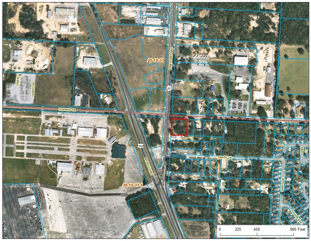
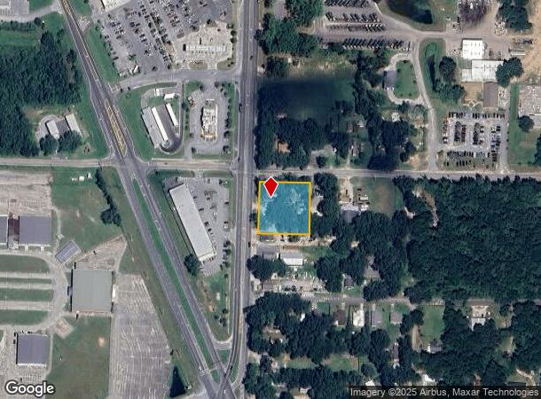
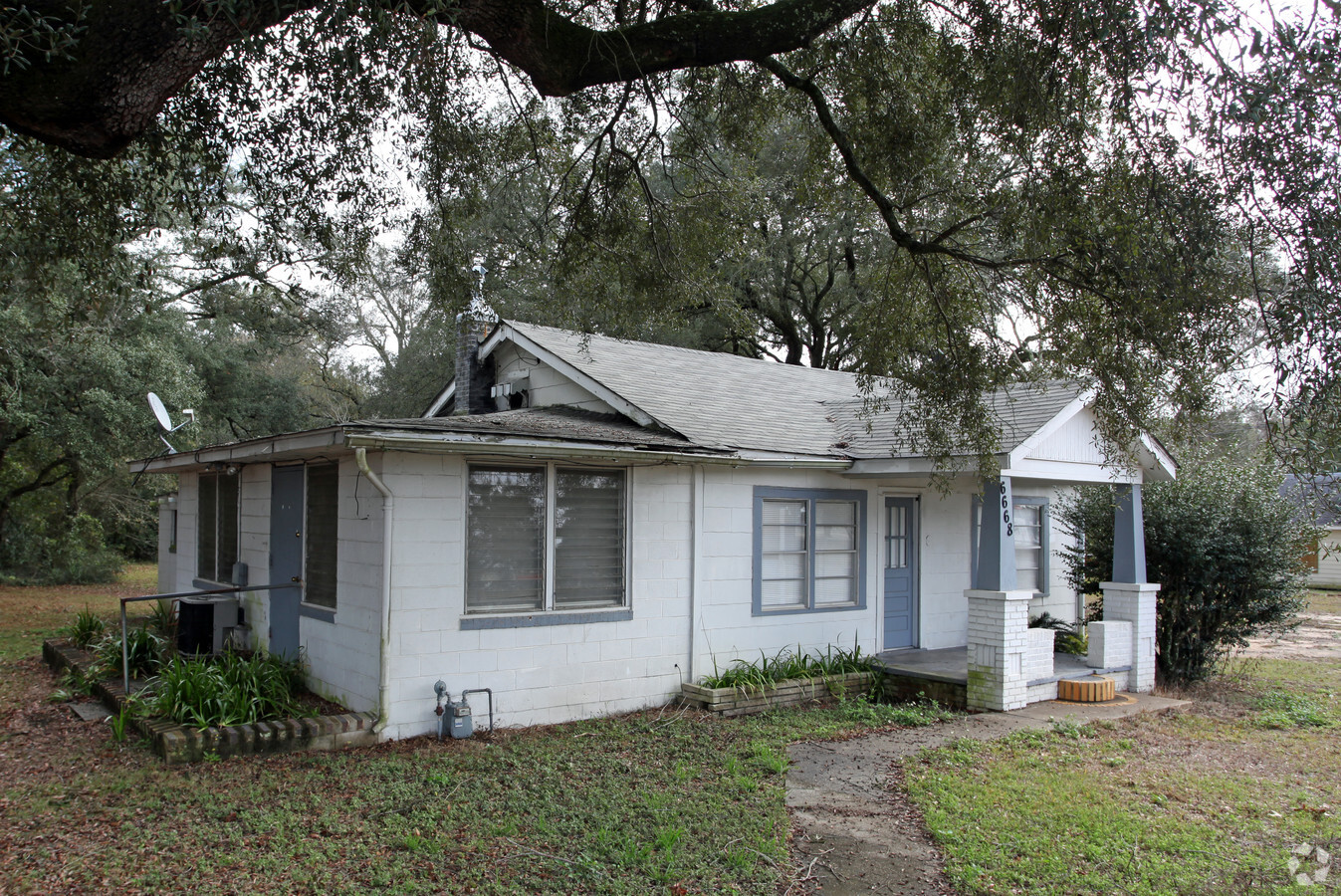
Property Record
6668 Pine Forest Rd, Pensacola, FL 32526

NEARBY LISTINGS FOR SALE OR LEASE
Property Detail
6668 Pine Forest Rd
Pensacola-Ferry Pass-Brent, FL
Subdivision Number: 1204
39-1S-31-1204-000-000
Escambia
Sfr
Florida
X
0.89 AC
12033C0360G
Ensley/N Brent
1,072 SF
Pensacola
DEMOGRAPHICS near 6668 Pine Forest Rd
1 Mile
3 Mile
5 Mile
2024 Total Population
5,824
42,172
116,438
2029 Population
5,853
42,625
119,046
Pop Growth 2024-2029
+ 0.50%
+ 1.07%
+ 2.24%
Average Age
40
40
38
2024 Total Households
2,378
16,299
44,237
HH Growth 2024-2029
+ 0.50%
+ 1.01%
+ 2.27%
Median Household Inc
$59,548
$51,454
$48,816
Avg Household Size
2.40
2.50
2.40
2024 Avg HH Vehicles
2.00
2.00
2.00
Median Home Value
$163,141
$158,275
$153,338
Median Year Built
1990
1980
1980
Nearby Places
- Restaurants
- Banks
- Shops
- Fitness
- Groceries
PUBLIC TRANSPORTATION
AIRPORT
Pensacola International
DRIVE
WALK
Distance
Pensacola International
19 min
8.8 mi
Freight Ports
Port of Mobile
DRIVE
WALK
Distance
Port of Mobile
59 min
50.9 mi
Nearby Properties
Address
Land Use
TOTAL SIZE
Lot Size
Zoning
Address
Land Use
TOTAL SIZE
Lot Size
Zoning
305,650 SF
21.90 AC
HDMU
Address
Land Use
TOTAL SIZE
Lot Size
Zoning
1,350,030 SF
80 AC
REC
Address
Land Use
TOTAL SIZE
Lot Size
Zoning
250,232 SF
19.24 AC
HDR
Address
Land Use
TOTAL SIZE
Lot Size
Zoning
178,038 SF
11.03 AC
COM
Address
Land Use
TOTAL SIZE
Lot Size
Zoning
141,728 SF
8.59 AC
COM
Address
Land Use
TOTAL SIZE
Lot Size
Zoning
158,233 SF
9.15 AC
HDMU
Address
Land Use
TOTAL SIZE
Lot Size
Zoning
83,923 SF
6.70 AC
HC/LI
Address
Land Use
TOTAL SIZE
Lot Size
Zoning
129,518 SF
6.44 AC
HDMU
Address
Land Use
TOTAL SIZE
Lot Size
Zoning
131,408 SF
21.67 AC
HC/LI
Address
Land Use
TOTAL SIZE
Lot Size
Zoning
103,671 SF
13.96 AC
HDMU
Address
Land Use
TOTAL SIZE
Lot Size
Zoning
137,280 SF
11.94 AC
HC/LI
Address
Land Use
TOTAL SIZE
Lot Size
Zoning
23,322 SF
7.92 AC
HC/LI
Address
Land Use
TOTAL SIZE
Lot Size
Zoning
64,600 SF
18.78 AC
HC/LI
Address
Land Use
TOTAL SIZE
Lot Size
Zoning
70,890 SF
7.68 AC
HC/LI
Address
Land Use
TOTAL SIZE
Lot Size
Zoning
64,870 SF
5.35 AC
HDMU
Address
Land Use
TOTAL SIZE
Lot Size
Zoning
102,019 SF
9.85 AC
COM
Address
Land Use
TOTAL SIZE
Lot Size
Zoning
78,092 SF
13.08 AC
HC/LI
Address
Land Use
TOTAL SIZE
Lot Size
Zoning
3,926 SF
57.46 AC
HDMU
Address
Land Use
TOTAL SIZE
Lot Size
Zoning
84,005 SF
7.93 AC
COM
Address
Land Use
TOTAL SIZE
Lot Size
Zoning
51,241 SF
5.95 AC
HC/LI
Address
Land Use
TOTAL SIZE
Lot Size
Zoning
39,755 SF
38.74 AC
HC/LI
Address
Land Use
TOTAL SIZE
Lot Size
Zoning
57,494 SF
5.48 AC
COM
Address
Land Use
TOTAL SIZE
Lot Size
Zoning
57,364 SF
7 AC
HC/LI
Address
Land Use
TOTAL SIZE
Lot Size
Zoning
48,100 SF
3.69 AC
COM
Address
Land Use
TOTAL SIZE
Lot Size
Zoning
58,090 SF
8.53 AC
HC/LI
Address
Land Use
TOTAL SIZE
Lot Size
Zoning
54,312 SF
6.32 AC
HDMU
Address
Land Use
TOTAL SIZE
Lot Size
Zoning
48,922 SF
3.25 AC
COM
Address
Land Use
TOTAL SIZE
Lot Size
Zoning
78,951 SF
3.50 AC
COM
Address
Land Use
TOTAL SIZE
Lot Size
Zoning
51,259 SF
6.46 AC
COM
Address
Land Use
TOTAL SIZE
Lot Size
Zoning
121,151 SF
121.70 AC
HC/LI
The World's #1 Commercial Real Estate Marketplace
Connect with us
© 2025 CoStar Group
The information above has been obtained from sources believed reliable. While we do not doubt its accuracy we have not verified it and make no guarantee, warranty or representation about it. It is your responsibility to independently confirm its accuracy and completeness. Any projections, opinions, assumptions, or estimates used are for example only and do not represent the current or future performance of the property. The value of this transaction to you depends on tax and other factors which should be evaluated by your tax, financial, and legal advisors. You and your advisors should conduct a careful, independent investigation of the property to determine to your satisfaction the suitability of the property for your needs.