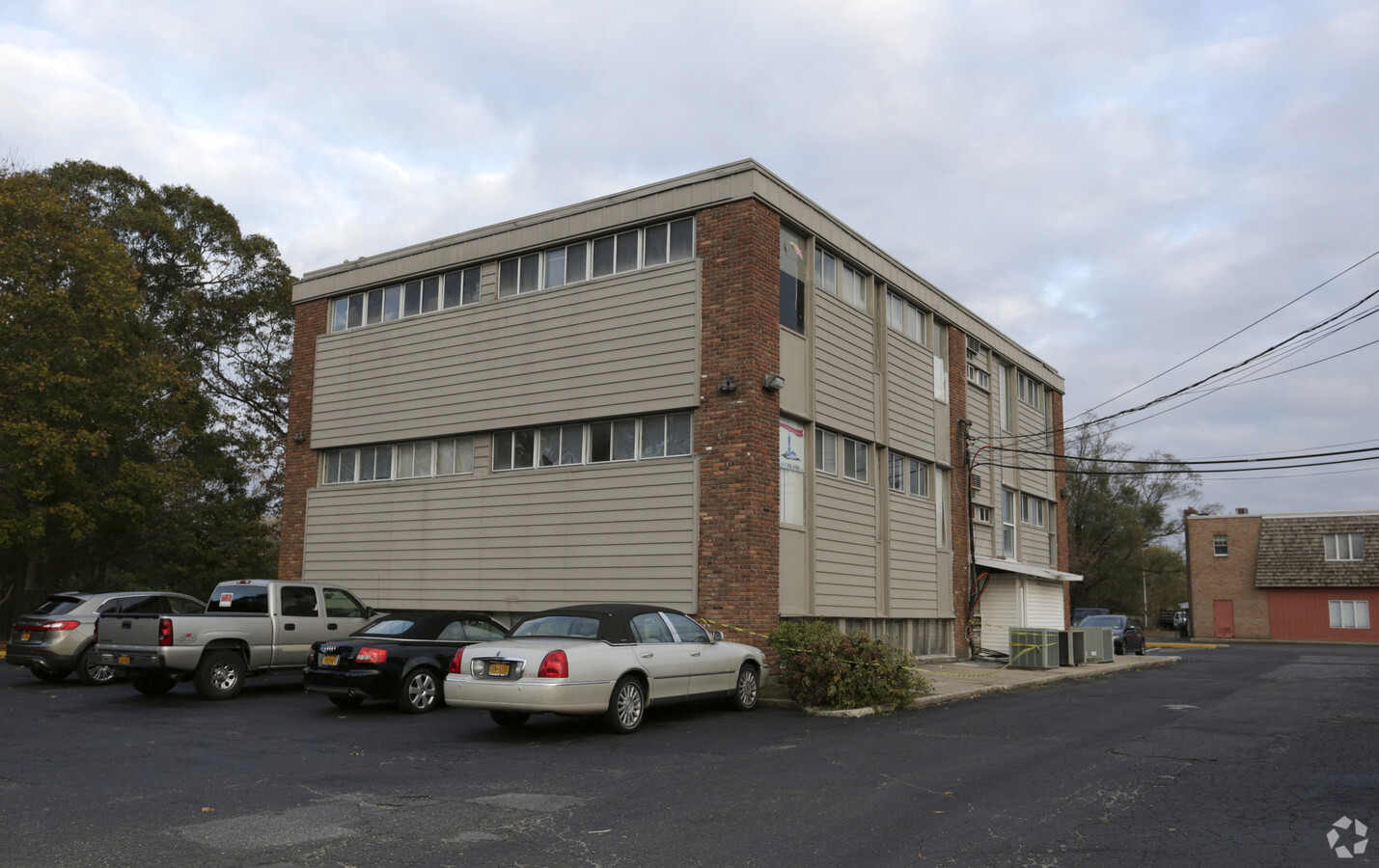
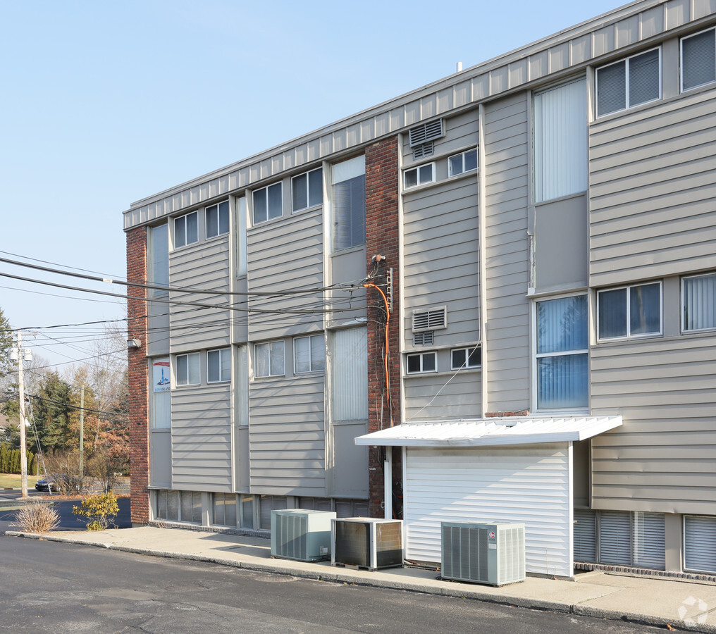
Property Record
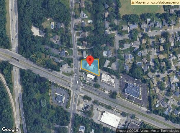
67 Harned Rd, Commack, NY 11725
NEARBY LISTINGS FOR SALE OR LEASE
Property Detail
67 Harned Rd
Nassau County-Suffolk County, NY
3-100927 TC-52 FORTE K L COOPERVET MEM HY ETALL COOPER E
0800-119-00-02-00-023-000
Suffolk
Officebuilding
New York
X
23
36103C0635H
0.50 AC
2023
Western Suffolk
2023
Long Island (New York)
135201
DEMOGRAPHICS near 67 Harned Rd
1 Mile
3 Mile
5 Mile
2024 Total Population
10,748
68,899
200,868
2029 Population
10,659
67,892
196,706
Pop Growth 2024-2029
(0.83%)
(1.46%)
(2.07%)
Average Age
42
42
41
2024 Total Households
3,687
22,014
61,393
HH Growth 2024-2029
(1.08%)
(1.72%)
(2.28%)
Median Household Inc
$148,670
$154,321
$140,078
Avg Household Size
2.90
3.00
3.10
2024 Avg HH Vehicles
2.00
2.00
2.00
Median Home Value
$633,557
$658,130
$623,362
Median Year Built
1962
1964
1964
Nearby Places
- Restaurants
- Banks
- Shops
- Fitness
- Groceries
PUBLIC TRANSPORTATION
COMMUTER RAIL
Kings Park Station (Port Jefferson Branch - Long Island Rail Road)
DRIVE
WALK
Distance
Kings Park Station (Port Jefferson Branch - Long Island Rail Road)
7 min
4.4 mi
Northport Station (Port Jefferson Branch - Long Island Rail Road)
DRIVE
WALK
Distance
Northport Station (Port Jefferson Branch - Long Island Rail Road)
11 min
5.0 mi
AIRPORT
Long Island MacArthur
DRIVE
WALK
Distance
Long Island MacArthur
18 min
11.2 mi
John F Kennedy International
DRIVE
WALK
Distance
John F Kennedy International
51 min
39.4 mi
Freight Ports
Port of New Haven
DRIVE
WALK
Distance
Port of New Haven
132 min
54.7 mi
SALE & LEASE HISTORY
LISTING DATE
SALE/LEASE

Mar 04, 2020
For Lease
Nearby Properties
Address
Land Use
TOTAL SIZE
Lot Size
Zoning
Address
Land Use
TOTAL SIZE
Lot Size
Zoning
196.07 AC
AAA
Address
Land Use
TOTAL SIZE
Lot Size
Zoning
26.60 AC
Address
Land Use
TOTAL SIZE
Lot Size
Zoning
10.20 AC
B
Address
Land Use
TOTAL SIZE
Lot Size
Zoning
3.01 AC
GSE
Address
Land Use
TOTAL SIZE
Lot Size
Zoning
67.94 AC
Address
Land Use
TOTAL SIZE
Lot Size
Zoning
21.50 AC
Address
Land Use
TOTAL SIZE
Lot Size
Zoning
3.63 AC
IND2
Address
Land Use
TOTAL SIZE
Lot Size
Zoning
1.12 AC
BUS1
Address
Land Use
TOTAL SIZE
Lot Size
Zoning
22.80 AC
Address
Land Use
TOTAL SIZE
Lot Size
Zoning
14.13 AC
Address
Land Use
TOTAL SIZE
Lot Size
Zoning
3.30 AC
IND1
Address
Land Use
TOTAL SIZE
Lot Size
Zoning
3.37 AC
IND1
Address
Land Use
TOTAL SIZE
Lot Size
Zoning
23.60 AC
Address
Land Use
TOTAL SIZE
Lot Size
Zoning
Address
Land Use
TOTAL SIZE
Lot Size
Zoning
2.76 AC
BUS1
Address
Land Use
TOTAL SIZE
Lot Size
Zoning
8.90 AC
BUS3
Address
Land Use
TOTAL SIZE
Lot Size
Zoning
18.82 AC
Address
Land Use
TOTAL SIZE
Lot Size
Zoning
12.30 AC
Address
Land Use
TOTAL SIZE
Lot Size
Zoning
10.40 AC
B
Address
Land Use
TOTAL SIZE
Lot Size
Zoning
17.20 AC
Address
Land Use
TOTAL SIZE
Lot Size
Zoning
6.41 AC
Address
Land Use
TOTAL SIZE
Lot Size
Zoning
88,200 SF
11.20 AC
Address
Land Use
TOTAL SIZE
Lot Size
Zoning
9.30 AC
Address
Land Use
TOTAL SIZE
Lot Size
Zoning
9.30 AC
Address
Land Use
TOTAL SIZE
Lot Size
Zoning
12.80 AC
Address
Land Use
TOTAL SIZE
Lot Size
Zoning
1.42 AC
BUS1
Address
Land Use
TOTAL SIZE
Lot Size
Zoning
6.75 AC
Address
Land Use
TOTAL SIZE
Lot Size
Zoning
1.90 AC
IND2
Address
Land Use
TOTAL SIZE
Lot Size
Zoning
1.26 AC
GSD
Address
Land Use
TOTAL SIZE
Lot Size
Zoning
0.80 AC
BUS1
The World's #1 Commercial Real Estate Marketplace
Connect with us
© 2025 CoStar Group
The information above has been obtained from sources believed reliable. While we do not doubt its accuracy we have not verified it and make no guarantee, warranty or representation about it. It is your responsibility to independently confirm its accuracy and completeness. Any projections, opinions, assumptions, or estimates used are for example only and do not represent the current or future performance of the property. The value of this transaction to you depends on tax and other factors which should be evaluated by your tax, financial, and legal advisors. You and your advisors should conduct a careful, independent investigation of the property to determine to your satisfaction the suitability of the property for your needs.