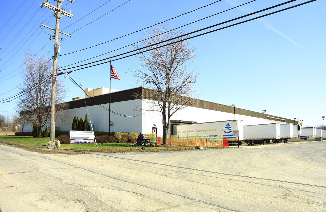
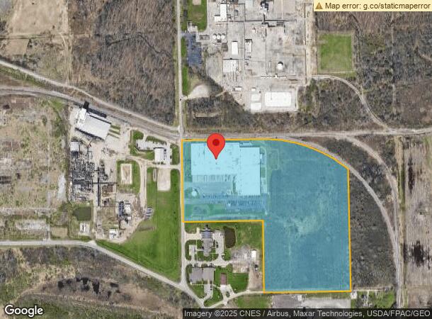
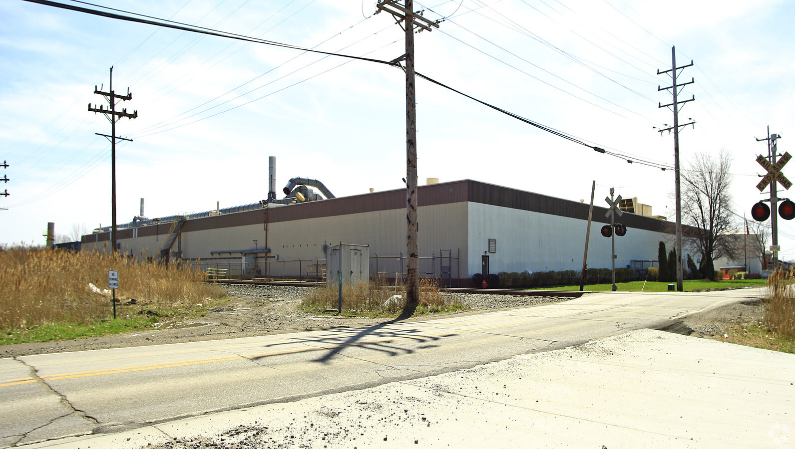
Property Record
670 Hardy Rd, Painesville, OH 44077
NEARBY LISTINGS FOR SALE OR LEASE
Property Detail
670 Hardy Rd
Cleveland-Elyria, OH
Hardy Farm #2
11-B-042-0-00-004
LOT 2 TRACT 2
Industrialgeneral
Lake
X
Ohio
39085C0038G
2
2024
28.69 AC
2023
East Lake County
204800
Cleveland
179,065 SF
DEMOGRAPHICS near 670 Hardy Rd
1 Mile
3 Mile
5 Mile
2024 Total Population
2,602
27,025
53,533
2029 Population
2,626
26,974
53,549
Pop Growth 2024-2029
+ 0.92%
(0.19%)
+ 0.03%
Average Age
42
40
41
2024 Total Households
1,034
10,779
21,335
HH Growth 2024-2029
+ 0.97%
(0.21%)
(0.01%)
Median Household Inc
$80,269
$58,582
$69,217
Avg Household Size
2.50
2.40
2.40
2024 Avg HH Vehicles
2.00
2.00
2.00
Median Home Value
$163,866
$152,736
$167,295
Median Year Built
1992
1970
1971
Nearby Places
- Restaurants
- Banks
- Shops
- Fitness
- Groceries
Nearby Properties
Address
Land Use
TOTAL SIZE
Lot Size
Zoning
Address
Land Use
TOTAL SIZE
Lot Size
Zoning
78,850 SF
12.95 AC
Address
Land Use
TOTAL SIZE
Lot Size
Zoning
160,976 SF
3.31 AC
B-4
Address
Land Use
TOTAL SIZE
Lot Size
Zoning
165,749 SF
8 AC
R-1
Address
Land Use
TOTAL SIZE
Lot Size
Zoning
78,850 SF
Address
Land Use
TOTAL SIZE
Lot Size
Zoning
113,375 SF
2.73 AC
B-3
Address
Land Use
TOTAL SIZE
Lot Size
Zoning
82,044 SF
8.79 AC
Address
Land Use
TOTAL SIZE
Lot Size
Zoning
153,534 SF
36.47 AC
I2
Address
Land Use
TOTAL SIZE
Lot Size
Zoning
47,436 SF
16.83 AC
R1
Address
Land Use
TOTAL SIZE
Lot Size
Zoning
47,934 SF
0.73 AC
B-4
Address
Land Use
TOTAL SIZE
Lot Size
Zoning
Address
Land Use
TOTAL SIZE
Lot Size
Zoning
74,502 SF
6.35 AC
R-1
Address
Land Use
TOTAL SIZE
Lot Size
Zoning
142,393 SF
11.81 AC
Address
Land Use
TOTAL SIZE
Lot Size
Zoning
75,593 SF
2.49 AC
B-3
Address
Land Use
TOTAL SIZE
Lot Size
Zoning
134,697 SF
8.72 AC
Address
Land Use
TOTAL SIZE
Lot Size
Zoning
53.90 AC
Address
Land Use
TOTAL SIZE
Lot Size
Zoning
95,628 SF
8.95 AC
R-3
Address
Land Use
TOTAL SIZE
Lot Size
Zoning
50,644 SF
250.64 AC
I-2
Address
Land Use
TOTAL SIZE
Lot Size
Zoning
79,825 SF
9.28 AC
R-1
Address
Land Use
TOTAL SIZE
Lot Size
Zoning
1,081,037 SF
142.16 AC
I-2
Address
Land Use
TOTAL SIZE
Lot Size
Zoning
100,142 SF
25.07 AC
Address
Land Use
TOTAL SIZE
Lot Size
Zoning
38,249 SF
3.66 AC
Address
Land Use
TOTAL SIZE
Lot Size
Zoning
56,688 SF
6.78 AC
Address
Land Use
TOTAL SIZE
Lot Size
Zoning
80,107 SF
36.67 AC
I-2
Address
Land Use
TOTAL SIZE
Lot Size
Zoning
63,102 SF
8.86 AC
Address
Land Use
TOTAL SIZE
Lot Size
Zoning
61,897 SF
4.87 AC
R1
Address
Land Use
TOTAL SIZE
Lot Size
Zoning
1,372 SF
90.54 AC
I-2
Address
Land Use
TOTAL SIZE
Lot Size
Zoning
62,554 SF
3.26 AC
R-1
Address
Land Use
TOTAL SIZE
Lot Size
Zoning
67,272 SF
3.88 AC
B-4
Address
Land Use
TOTAL SIZE
Lot Size
Zoning
87,433 SF
55.12 AC
I-2
The World's #1 Commercial Real Estate Marketplace
Connect with us
© 2025 CoStar Group
The information above has been obtained from sources believed reliable. While we do not doubt its accuracy we have not verified it and make no guarantee, warranty or representation about it. It is your responsibility to independently confirm its accuracy and completeness. Any projections, opinions, assumptions, or estimates used are for example only and do not represent the current or future performance of the property. The value of this transaction to you depends on tax and other factors which should be evaluated by your tax, financial, and legal advisors. You and your advisors should conduct a careful, independent investigation of the property to determine to your satisfaction the suitability of the property for your needs.