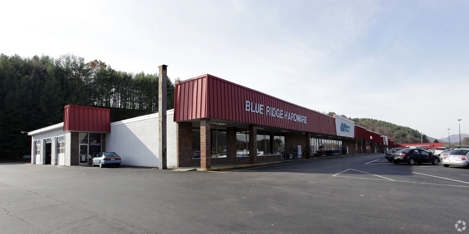
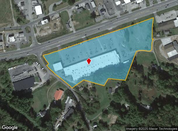
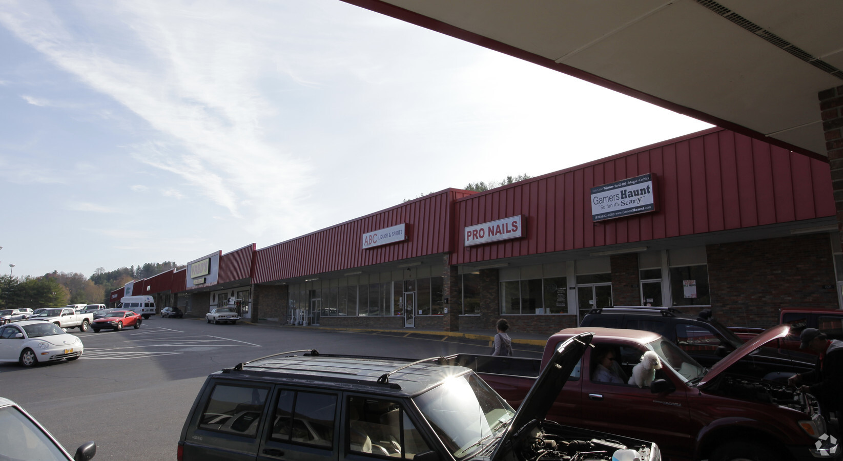
Property Record
671 W Us Highway 19E Byp, Burnsville, NC 28714
NEARBY LISTINGS FOR SALE OR LEASE
-
-
View all Burnsville listings for sale on LoopNet.com
Property Detail
671 W Us Highway 19E Byp
Communitycenter
Yancey
X
North Carolina
3710082000J
10.03 AC
2024
North Carolina West/Cherokee Area
2024
Other Market Areas
960300
082013031317.000
80,677 SF
DEMOGRAPHICS near 671 W Us Highway 19E Byp
1 Mile
3 Mile
5 Mile
2024 Total Population
1,441
5,126
8,668
2029 Population
1,482
5,324
9,035
Pop Growth 2024-2029
+ 2.85%
+ 3.86%
+ 4.23%
Average Age
47
46
46
2024 Total Households
678
2,341
3,896
HH Growth 2024-2029
+ 2.65%
+ 3.67%
+ 4.06%
Median Household Inc
$42,551
$44,109
$44,959
Avg Household Size
2.10
2.10
2.20
2024 Avg HH Vehicles
2.00
2.00
2.00
Median Home Value
$203,571
$206,339
$207,100
Median Year Built
1979
1980
1982
Nearby Places
- Restaurants
- Banks
- Shops
- Fitness
- Groceries
Nearby Properties
Address
Land Use
TOTAL SIZE
Lot Size
Zoning
Address
Land Use
TOTAL SIZE
Lot Size
Zoning
20.24 AC
Address
Land Use
TOTAL SIZE
Lot Size
Zoning
48.63 AC
Address
Land Use
TOTAL SIZE
Lot Size
Zoning
64,754 SF
5.72 AC
C-2
Address
Land Use
TOTAL SIZE
Lot Size
Zoning
3,429.20 AC
Address
Land Use
TOTAL SIZE
Lot Size
Zoning
28,062 SF
4.54 AC
Address
Land Use
TOTAL SIZE
Lot Size
Zoning
44,884 SF
3.78 AC
R-10
Address
Land Use
TOTAL SIZE
Lot Size
Zoning
50,040 SF
7.10 AC
C-2
Address
Land Use
TOTAL SIZE
Lot Size
Zoning
667.37 AC
Address
Land Use
TOTAL SIZE
Lot Size
Zoning
13,138 SF
1.62 AC
C-2
Address
Land Use
TOTAL SIZE
Lot Size
Zoning
669.71 AC
Address
Land Use
TOTAL SIZE
Lot Size
Zoning
7,710 SF
0.48 AC
Address
Land Use
TOTAL SIZE
Lot Size
Zoning
4,762 SF
8.64 AC
C-2
Address
Land Use
TOTAL SIZE
Lot Size
Zoning
614.74 AC
Address
Land Use
TOTAL SIZE
Lot Size
Zoning
6,115 SF
1.87 AC
Address
Land Use
TOTAL SIZE
Lot Size
Zoning
52,800 SF
6.90 AC
I-1
Address
Land Use
TOTAL SIZE
Lot Size
Zoning
4,600 SF
3.01 AC
C-2
Address
Land Use
TOTAL SIZE
Lot Size
Zoning
39,146 SF
4.46 AC
C-2
Address
Land Use
TOTAL SIZE
Lot Size
Zoning
687.20 AC
Address
Land Use
TOTAL SIZE
Lot Size
Zoning
6,550 SF
1.69 AC
Address
Land Use
TOTAL SIZE
Lot Size
Zoning
466.94 AC
Address
Land Use
TOTAL SIZE
Lot Size
Zoning
5,972 SF
3.86 AC
Address
Land Use
TOTAL SIZE
Lot Size
Zoning
10,113 SF
1.50 AC
C-2
Address
Land Use
TOTAL SIZE
Lot Size
Zoning
7,008 SF
0.67 AC
Address
Land Use
TOTAL SIZE
Lot Size
Zoning
10,240 SF
3.04 AC
R-10
Address
Land Use
TOTAL SIZE
Lot Size
Zoning
495 AC
Address
Land Use
TOTAL SIZE
Lot Size
Zoning
320.25 AC
Address
Land Use
TOTAL SIZE
Lot Size
Zoning
20,650 SF
3.04 AC
Address
Land Use
TOTAL SIZE
Lot Size
Zoning
4,227 SF
1.03 AC
C-2
Address
Land Use
TOTAL SIZE
Lot Size
Zoning
17,881 SF
125 AC
The World's #1 Commercial Real Estate Marketplace
Connect with us
© 2025 CoStar Group
The information above has been obtained from sources believed reliable. While we do not doubt its accuracy we have not verified it and make no guarantee, warranty or representation about it. It is your responsibility to independently confirm its accuracy and completeness. Any projections, opinions, assumptions, or estimates used are for example only and do not represent the current or future performance of the property. The value of this transaction to you depends on tax and other factors which should be evaluated by your tax, financial, and legal advisors. You and your advisors should conduct a careful, independent investigation of the property to determine to your satisfaction the suitability of the property for your needs.