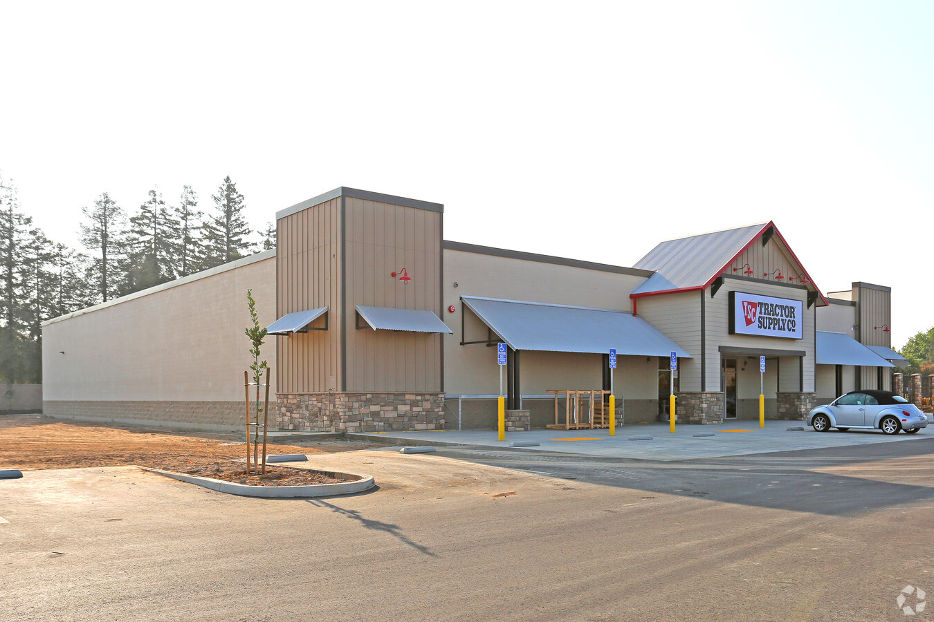
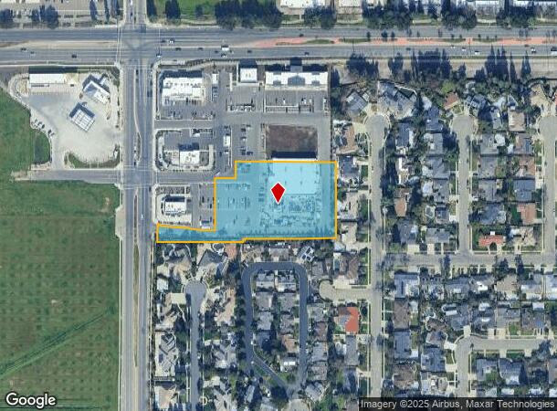
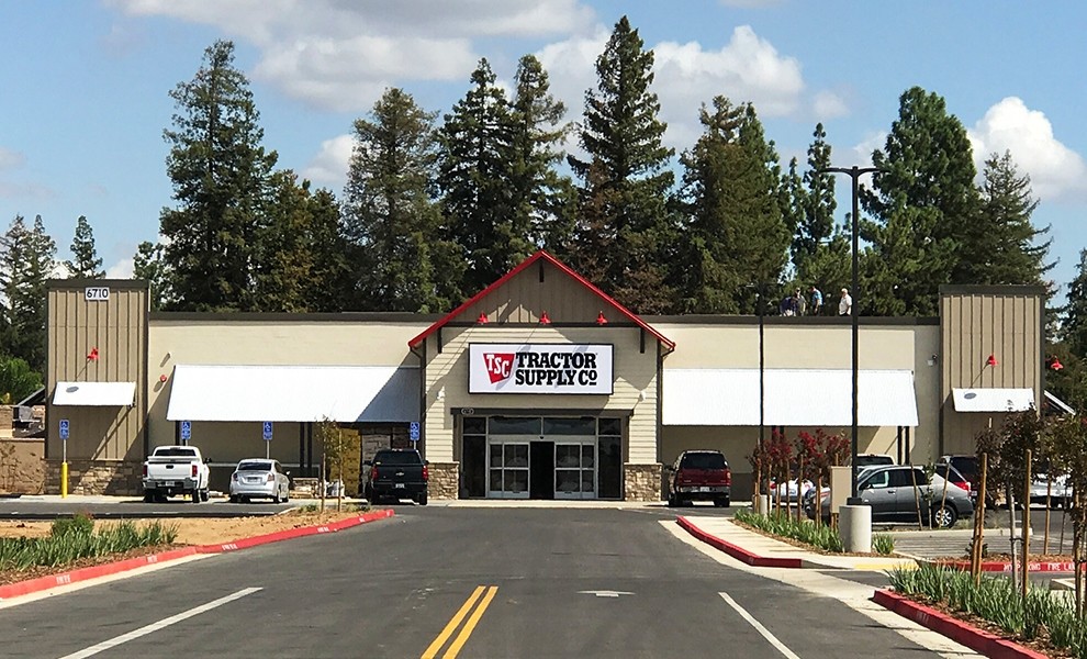
Property Record
6710 N Brawley Ave, Fresno, CA 93711
NEARBY LISTINGS FOR SALE OR LEASE
Property Detail
6710 N Brawley Ave
406-411-59
Parcel
Storebuilding
2.66 AC PAR B & POR PAR A OF P/M 2001-02 BK 61/61
X
Fresno
06019C1555H
California
2023
2.66 AC
2023
N Shaw/W Blackstone
004214
Fresno
18,880 SF
Fresno, CA
DEMOGRAPHICS near 6710 N Brawley Ave
1 Mile
3 Mile
5 Mile
2024 Total Population
12,814
90,966
211,336
2029 Population
13,067
92,999
215,906
Pop Growth 2024-2029
+ 1.97%
+ 2.23%
+ 2.16%
Average Age
41
39
37
2024 Total Households
5,017
32,641
73,398
HH Growth 2024-2029
+ 1.93%
+ 2.23%
+ 2.14%
Median Household Inc
$78,707
$77,058
$68,969
Avg Household Size
2.50
2.70
2.80
2024 Avg HH Vehicles
2.00
2.00
2.00
Median Home Value
$420,268
$374,232
$342,745
Median Year Built
1987
1988
1981
Nearby Places
- Restaurants
- Banks
- Shops
- Fitness
- Groceries
PUBLIC TRANSPORTATION
AIRPORT
Fresno Yosemite International
Drive
Walk
Distance
Fresno Yosemite International
21 min
12.6 mi
Freight Ports
Port of Stockton
Drive
Walk
Distance
Port of Stockton
144 min
120.5 mi
SALE & LEASE HISTORY
LISTING DATE
SALE/LEASE

Aug 15, 2017
For Sale
Apr 14, 2017
For Lease
Nearby Properties
Address
Land Use
TOTAL SIZE
Lot Size
Zoning
Address
Land Use
TOTAL SIZE
Lot Size
Zoning
477820
18.78 AC
RA
Address
Land Use
TOTAL SIZE
Lot Size
Zoning
412974
29.02 AC
R2
Address
Land Use
TOTAL SIZE
Lot Size
Zoning
423568
32.25 AC
R2
Address
Land Use
TOTAL SIZE
Lot Size
Zoning
234370
23 AC
SPLIT
Address
Land Use
TOTAL SIZE
Lot Size
Zoning
278502
19.42 AC
SPLIT
Address
Land Use
TOTAL SIZE
Lot Size
Zoning
178900
11.68 AC
CP
Address
Land Use
TOTAL SIZE
Lot Size
Zoning
82970
8.19 AC
CR
Address
Land Use
TOTAL SIZE
Lot Size
Zoning
232183
18.32 AC
R2A
Address
Land Use
TOTAL SIZE
Lot Size
Zoning
54758
8 AC
AE5
Address
Land Use
TOTAL SIZE
Lot Size
Zoning
176228
10.17 AC
R2
Address
Land Use
TOTAL SIZE
Lot Size
Zoning
150437
14.72 AC
SPLIT
Address
Land Use
TOTAL SIZE
Lot Size
Zoning
139072
11.15 AC
C3
Address
Land Use
TOTAL SIZE
Lot Size
Zoning
56331
5.31 AC
CM
Address
Land Use
TOTAL SIZE
Lot Size
Zoning
83800
4.04 AC
R2
Address
Land Use
TOTAL SIZE
Lot Size
Zoning
45388
9.25 AC
C6
Address
Land Use
TOTAL SIZE
Lot Size
Zoning
45226
2.77 AC
C2
Address
Land Use
TOTAL SIZE
Lot Size
Zoning
51363
3.14 AC
CG
Address
Land Use
TOTAL SIZE
Lot Size
Zoning
38016
3.18 AC
CM
Address
Land Use
TOTAL SIZE
Lot Size
Zoning
53033
7.09 AC
C1
Address
Land Use
TOTAL SIZE
Lot Size
Zoning
128386
8.30 AC
R2
Address
Land Use
TOTAL SIZE
Lot Size
Zoning
207808
17.59 AC
CM
Address
Land Use
TOTAL SIZE
Lot Size
Zoning
111149
8.22 AC
RM1
Address
Land Use
TOTAL SIZE
Lot Size
Zoning
57445
5.81 AC
Address
Land Use
TOTAL SIZE
Lot Size
Zoning
28247
3.47 AC
CM
Address
Land Use
TOTAL SIZE
Lot Size
Zoning
92279
0.01 AC
CM
Address
Land Use
TOTAL SIZE
Lot Size
Zoning
182722
13.29 AC
R2
Address
Land Use
TOTAL SIZE
Lot Size
Zoning
42166
1.63 AC
CM
Address
Land Use
TOTAL SIZE
Lot Size
Zoning
103332
6.63 AC
R2
Address
Land Use
TOTAL SIZE
Lot Size
Zoning
56490
1.93 AC
CP
Address
Land Use
TOTAL SIZE
Lot Size
Zoning
132690
7.86 AC
RA
Start a new search to find other properties for sale or lease
Connect with us
© 2024 CoStar Group
The information above has been obtained from sources believed reliable. While we do not doubt its accuracy we have not verified it and make no guarantee, warranty or representation about it. It is your responsibility to independently confirm its accuracy and completeness. Any projections, opinions, assumptions, or estimates used are for example only and do not represent the current or future performance of the property. The value of this transaction to you depends on tax and other factors which should be evaluated by your tax, financial, and legal advisors. You and your advisors should conduct a careful, independent investigation of the property to determine to your satisfaction the suitability of the property for your needs.