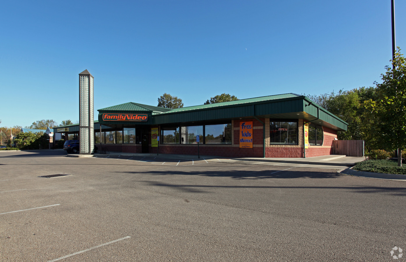
Property Record
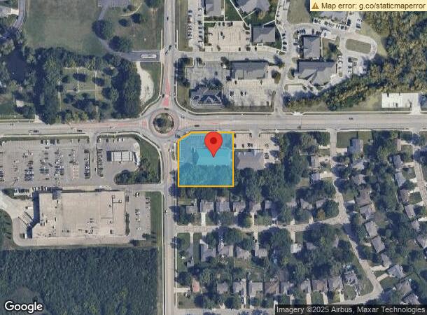
6749 Sw 29Th St, Topeka, KS 66614
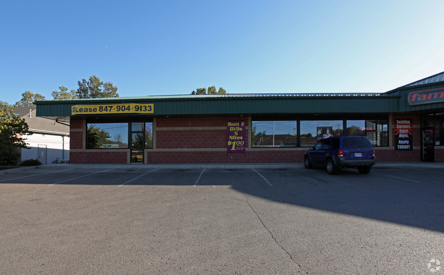
Current Lease Availabilities
NEARBY LISTINGS FOR SALE OR LEASE
Property Detail
6749 Sw 29Th St
Topeka, KS
Sherwood Estates Sub #64
144-17-0-20-05-003-000
SHERWOOD ESTATES SUB #64, S17, T12, R15, BLOCK A, LOT 1, ACRES 1.26, BLK A LOT 1 SHERWOOD ESTATES SUB # 64 LESS ROW
Storebuilding
Shawnee
X
Kansas
20177C0194E
1
2023
1.26 AC
2023
Topeka
003605
Kansas City
8,602 SF
DEMOGRAPHICS near 6749 Sw 29Th St
1 Mile
3 Mile
5 Mile
2024 Total Population
7,990
39,181
78,885
2029 Population
7,807
38,447
77,767
Pop Growth 2024-2029
(2.29%)
(1.87%)
(1.42%)
Average Age
42
42
42
2024 Total Households
3,227
16,960
34,696
HH Growth 2024-2029
(2.45%)
(1.98%)
(1.50%)
Median Household Inc
$80,396
$67,710
$60,429
Avg Household Size
2.40
2.20
2.20
2024 Avg HH Vehicles
2.00
2.00
2.00
Median Home Value
$202,945
$175,234
$157,866
Median Year Built
1988
1981
1973
Nearby Places
- Restaurants
- Banks
- Shops
- Fitness
- Groceries
PUBLIC TRANSPORTATION
COMMUTER RAIL
Topeka Amtrak Station (Southwest Chief - Amtrak)
DRIVE
WALK
Distance
Topeka Amtrak Station (Southwest Chief - Amtrak)
15 min
9.7 mi
Freight Ports
Tulsa Port Of Catoosa
DRIVE
WALK
Distance
Tulsa Port Of Catoosa
275 min
225.8 mi
Nearby Properties
Address
Land Use
TOTAL SIZE
Lot Size
Zoning
Address
Land Use
TOTAL SIZE
Lot Size
Zoning
218,962 SF
49.63 AC
R1
Address
Land Use
TOTAL SIZE
Lot Size
Zoning
43,282 SF
19.33 AC
PUD,M2
Address
Land Use
TOTAL SIZE
Lot Size
Zoning
208,685 SF
38.23 AC
R1
Address
Land Use
TOTAL SIZE
Lot Size
Zoning
52,375 SF
12.94 AC
RR1
Address
Land Use
TOTAL SIZE
Lot Size
Zoning
88,935 SF
20.24 AC
C4
Address
Land Use
TOTAL SIZE
Lot Size
Zoning
6.95 AC
PUD,OI1
Address
Land Use
TOTAL SIZE
Lot Size
Zoning
175,246 SF
80.42 AC
R1
Address
Land Use
TOTAL SIZE
Lot Size
Zoning
81,364 SF
19.52 AC
R1
Address
Land Use
TOTAL SIZE
Lot Size
Zoning
53,136 SF
18.28 AC
PUD,M2
Address
Land Use
TOTAL SIZE
Lot Size
Zoning
11.05 AC
PUD,C2,C4,
Address
Land Use
TOTAL SIZE
Lot Size
Zoning
71,575 SF
10.93 AC
C2,C4
Address
Land Use
TOTAL SIZE
Lot Size
Zoning
26.73 AC
PUD,R1
Address
Land Use
TOTAL SIZE
Lot Size
Zoning
19,892 SF
3.51 AC
M4
Address
Land Use
TOTAL SIZE
Lot Size
Zoning
31,132 SF
111.35 AC
R1
Address
Land Use
TOTAL SIZE
Lot Size
Zoning
59,337 SF
6.84 AC
R1
Address
Land Use
TOTAL SIZE
Lot Size
Zoning
72,482 SF
19.53 AC
R1
Address
Land Use
TOTAL SIZE
Lot Size
Zoning
51,636 SF
3.89 AC
C4
Address
Land Use
TOTAL SIZE
Lot Size
Zoning
36,511 SF
7.05 AC
R1
Address
Land Use
TOTAL SIZE
Lot Size
Zoning
57,380 SF
15.03 AC
RR1
Address
Land Use
TOTAL SIZE
Lot Size
Zoning
74,659 SF
15.24 AC
RR1
Address
Land Use
TOTAL SIZE
Lot Size
Zoning
50,795 SF
7.70 AC
R1
Address
Land Use
TOTAL SIZE
Lot Size
Zoning
58,568 SF
8.73 AC
R1
Address
Land Use
TOTAL SIZE
Lot Size
Zoning
61,383 SF
8.09 AC
R1
Address
Land Use
TOTAL SIZE
Lot Size
Zoning
135,625 SF
23.52 AC
PUD,M2
Address
Land Use
TOTAL SIZE
Lot Size
Zoning
115,103 SF
9.35 AC
C4
Address
Land Use
TOTAL SIZE
Lot Size
Zoning
30,902 SF
2.83 AC
PUD,C4
Address
Land Use
TOTAL SIZE
Lot Size
Zoning
40,280 SF
6.54 AC
R1
Address
Land Use
TOTAL SIZE
Lot Size
Zoning
42,415 SF
7.56 AC
R1
Address
Land Use
TOTAL SIZE
Lot Size
Zoning
51,933 SF
16.73 AC
PUD,M2
Address
Land Use
TOTAL SIZE
Lot Size
Zoning
41,923 SF
7.39 AC
R1
The World's #1 Commercial Real Estate Marketplace
Connect with us
© 2025 CoStar Group
The information above has been obtained from sources believed reliable. While we do not doubt its accuracy we have not verified it and make no guarantee, warranty or representation about it. It is your responsibility to independently confirm its accuracy and completeness. Any projections, opinions, assumptions, or estimates used are for example only and do not represent the current or future performance of the property. The value of this transaction to you depends on tax and other factors which should be evaluated by your tax, financial, and legal advisors. You and your advisors should conduct a careful, independent investigation of the property to determine to your satisfaction the suitability of the property for your needs.