Property Record
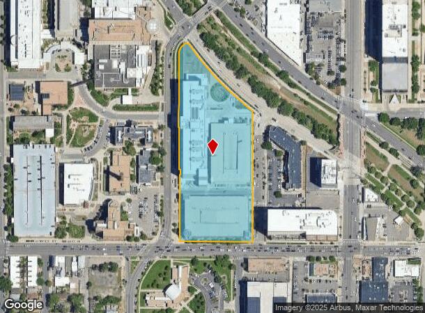
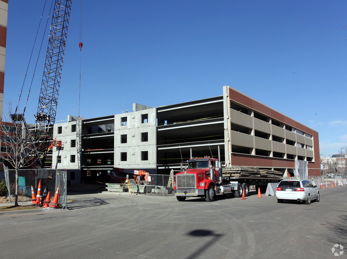
675 Acoma St, Denver, CO 80204

NEARBY LISTINGS FOR SALE OR LEASE
Property Detail
675 Acoma St
5036-23-013
Whitsitts Add
Miscellaneous
WHITSITTS ADD B15 BEG SW COR B15 TH N 234.83FT NE 39.26FT SE CV/R 18.7FT S42.0521E 64.92 FT S38.5354E 54.94FT S40.5912E 52.16FT CV/L 180.55FT W 289.81 FT TPOB & N/2 VAC W 7TH ADJ
X
Denver
0800460201H
Colorado
0
5.16 AC
2023
South Midtown
0018002032
Denver
796,150 SF
Denver-Aurora-Lakewood, CO
DEMOGRAPHICS near 675 Acoma St
1 Mile
3 Mile
5 Mile
2024 Total Population
42,106
247,161
534,028
2029 Population
42,956
251,629
540,277
Pop Growth 2024-2029
+ 2.02%
+ 1.81%
+ 1.17%
Average Age
37
38
38
2024 Total Households
25,741
130,455
250,087
HH Growth 2024-2029
+ 1.93%
+ 1.93%
+ 1.27%
Median Household Inc
$71,897
$86,948
$82,925
Avg Household Size
1.50
1.80
2.00
2024 Avg HH Vehicles
1.00
1.00
2.00
Median Home Value
$582,109
$704,705
$637,231
Median Year Built
1965
1973
1965
Nearby Places
- Restaurants
- Banks
- Shops
- Fitness
- Groceries
PUBLIC TRANSPORTATION
COMMUTER RAIL
Denver (California Zephyr - Amtrak)
DRIVE
WALK
Distance
Denver (California Zephyr - Amtrak)
6 min
2.2 mi
Union Station: Lodo-Coors Field-16Th Street Mall (C Line - Denver Regional Transportation District Light Rail (TheRide), E Line - Denver Regional Transportation District Light Rail (TheRide), W Line - Denver Regional Transportation District Light Rail (TheRide))
DRIVE
WALK
Distance
Union Station: Lodo-Coors Field-16Th Street Mall (C Line - Denver Regional Transportation District Light Rail (TheRide), E Line - Denver Regional Transportation District Light Rail (TheRide), W Line - Denver Regional Transportation District Light Rail (TheRide))
5 min
2.2 mi
AIRPORT
Denver International
DRIVE
WALK
Distance
Denver International
38 min
26.7 mi
Freight Ports
Tulsa Port Of Catoosa
DRIVE
WALK
Distance
Tulsa Port Of Catoosa
735 min
712.2 mi
Nearby Properties
Address
Land Use
TOTAL SIZE
Lot Size
Zoning
Address
Land Use
TOTAL SIZE
Lot Size
Zoning
2,424,680 SF
21.15 AC
D-TD
Address
Land Use
TOTAL SIZE
Lot Size
Zoning
1,721,086 SF
21.34 AC
C-MU-30
Address
Land Use
TOTAL SIZE
Lot Size
Zoning
859,638 SF
10.04 AC
B-3
Address
Land Use
TOTAL SIZE
Lot Size
Zoning
1,323,471 SF
10.26 AC
CMP-H
Address
Land Use
TOTAL SIZE
Lot Size
Zoning
1,248,868 SF
0.90 AC
D-TD
Address
Land Use
TOTAL SIZE
Lot Size
Zoning
1,661,628 SF
1.56 AC
D-C
Address
Land Use
TOTAL SIZE
Lot Size
Zoning
1,567,575 SF
1.40 AC
D-C
Address
Land Use
TOTAL SIZE
Lot Size
Zoning
1,399,487 SF
16.14 AC
CMP-H
Address
Land Use
TOTAL SIZE
Lot Size
Zoning
1,312,939 SF
1.15 AC
D-C
Address
Land Use
TOTAL SIZE
Lot Size
Zoning
1,286,459 SF
2.44 AC
PUD
Address
Land Use
TOTAL SIZE
Lot Size
Zoning
784,978 SF
1.15 AC
D-C
Address
Land Use
TOTAL SIZE
Lot Size
Zoning
697,516 SF
3.05 AC
D-CV
Address
Land Use
TOTAL SIZE
Lot Size
Zoning
1,097,914 SF
0.23 AC
D-C
Address
Land Use
TOTAL SIZE
Lot Size
Zoning
688,230 SF
0.94 AC
PUD
Address
Land Use
TOTAL SIZE
Lot Size
Zoning
150,202 SF
13.24 AC
T-MU-30
Address
Land Use
TOTAL SIZE
Lot Size
Zoning
513,131 SF
0.57 AC
D-C
Address
Land Use
TOTAL SIZE
Lot Size
Zoning
1,563,630 SF
2.53 AC
D-C
Address
Land Use
TOTAL SIZE
Lot Size
Zoning
1,027,206 SF
2.44 AC
D-C
Address
Land Use
TOTAL SIZE
Lot Size
Zoning
892,018 SF
2.42 AC
D-C
Address
Land Use
TOTAL SIZE
Lot Size
Zoning
321,759 SF
0.88 AC
PUD
Address
Land Use
TOTAL SIZE
Lot Size
Zoning
405,974 SF
1.78 AC
PUD
Address
Land Use
TOTAL SIZE
Lot Size
Zoning
1,375,437 SF
2.46 AC
D-C
Address
Land Use
TOTAL SIZE
Lot Size
Zoning
492,926 SF
1.16 AC
PUD
Address
Land Use
TOTAL SIZE
Lot Size
Zoning
1,024,471 SF
2.45 AC
D-C
Address
Land Use
TOTAL SIZE
Lot Size
Zoning
1,114,003 SF
2.45 AC
D-C
Address
Land Use
TOTAL SIZE
Lot Size
Zoning
618,768 SF
1.23 AC
D-C
Address
Land Use
TOTAL SIZE
Lot Size
Zoning
778,340 SF
0.61 AC
D-C
Address
Land Use
TOTAL SIZE
Lot Size
Zoning
515,064 SF
1.25 AC
D-LD
Address
Land Use
TOTAL SIZE
Lot Size
Zoning
764,724 SF
1 AC
D-C
Address
Land Use
TOTAL SIZE
Lot Size
Zoning
937,062 SF
1.95 AC
D-C
The World's #1 Commercial Real Estate Marketplace
Connect with us
© 2025 CoStar Group
The information above has been obtained from sources believed reliable. While we do not doubt its accuracy we have not verified it and make no guarantee, warranty or representation about it. It is your responsibility to independently confirm its accuracy and completeness. Any projections, opinions, assumptions, or estimates used are for example only and do not represent the current or future performance of the property. The value of this transaction to you depends on tax and other factors which should be evaluated by your tax, financial, and legal advisors. You and your advisors should conduct a careful, independent investigation of the property to determine to your satisfaction the suitability of the property for your needs.