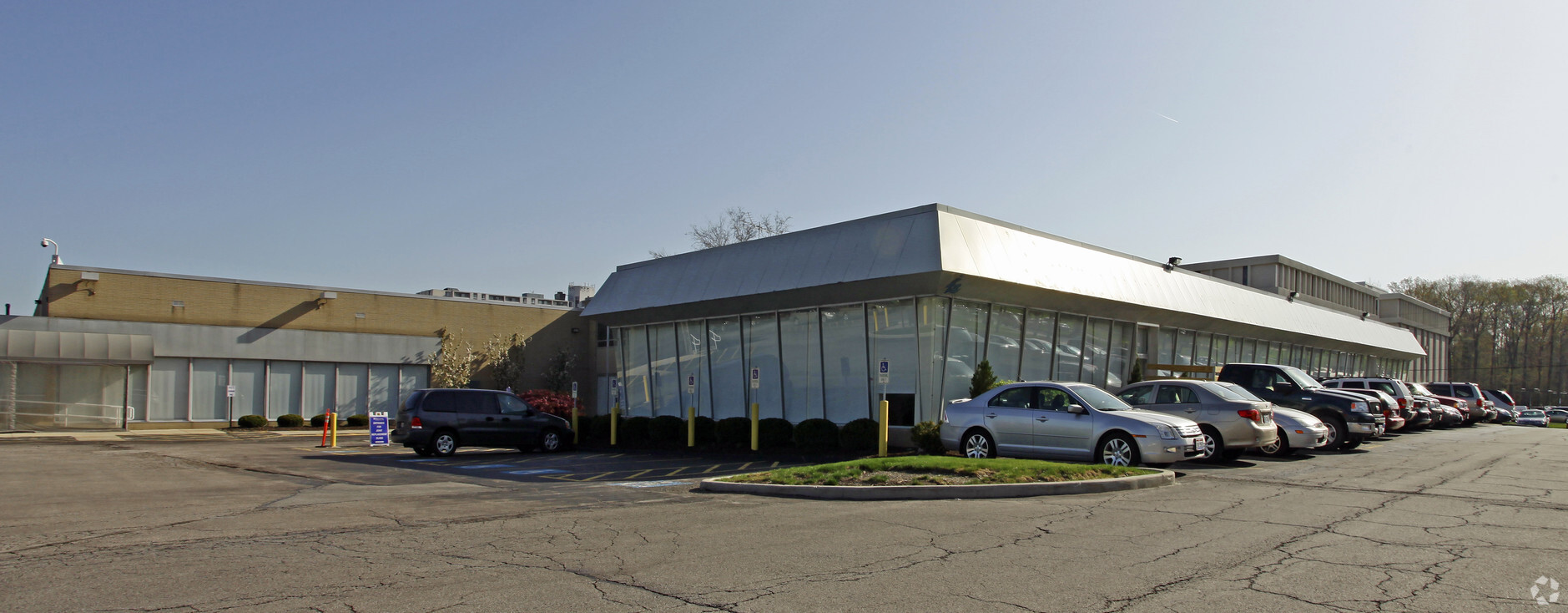
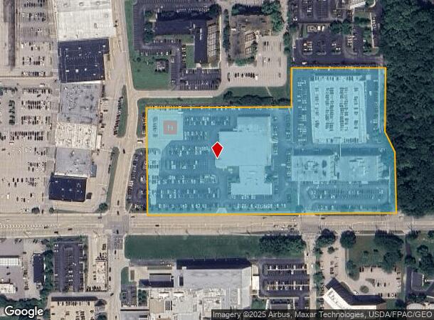
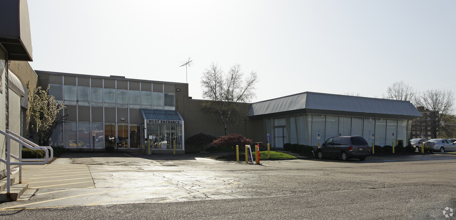
Property Record
6777 Mayfield Rd, Cleveland, OH 44124
NEARBY LISTINGS FOR SALE OR LEASE
Property Detail
6777 Mayfield Rd
Cleveland-Elyria, OH
Mayfield 02
862-29-007
2-15 3-13 EP 1325FT WP
Miscellaneous
Cuyahoga
X
Ohio
39035C0118E
2
0
6.34 AC
2024
Northeast
172105
Cleveland
51,370 SF
DEMOGRAPHICS near 6777 Mayfield Rd
1 Mile
3 Mile
5 Mile
2024 Total Population
10,576
41,331
103,340
2029 Population
10,410
40,363
101,187
Pop Growth 2024-2029
(1.57%)
(2.34%)
(2.08%)
Average Age
44
44
44
2024 Total Households
5,879
18,949
44,669
HH Growth 2024-2029
(1.65%)
(2.42%)
(2.15%)
Median Household Inc
$54,437
$74,699
$79,960
Avg Household Size
1.80
2.10
2.20
2024 Avg HH Vehicles
1.00
2.00
2.00
Median Home Value
$237,365
$214,376
$233,276
Median Year Built
1968
1963
1964
Nearby Places
- Restaurants
- Banks
- Shops
- Fitness
- Groceries
PUBLIC TRANSPORTATION
AIRPORT
Cleveland-Hopkins International
DRIVE
WALK
Distance
Cleveland-Hopkins International
40 min
27.9 mi
Freight Ports
Port of Toledo
DRIVE
WALK
Distance
Port of Toledo
154 min
128.8 mi
Nearby Properties
Address
Land Use
TOTAL SIZE
Lot Size
Zoning
Address
Land Use
TOTAL SIZE
Lot Size
Zoning
1,089,649 SF
12.22 AC
U-8
Address
Land Use
TOTAL SIZE
Lot Size
Zoning
347,464 SF
11.64 AC
U-8
Address
Land Use
TOTAL SIZE
Lot Size
Zoning
592,100 SF
27.58 AC
U-3B
Address
Land Use
TOTAL SIZE
Lot Size
Zoning
157,311 SF
8.95 AC
U-1A
Address
Land Use
TOTAL SIZE
Lot Size
Zoning
262,616 SF
65.48 AC
U-2
Address
Land Use
TOTAL SIZE
Lot Size
Zoning
384,659 SF
20.20 AC
U-4A
Address
Land Use
TOTAL SIZE
Lot Size
Zoning
106,995 SF
9.62 AC
CRG
Address
Land Use
TOTAL SIZE
Lot Size
Zoning
378,218 SF
29.34 AC
Address
Land Use
TOTAL SIZE
Lot Size
Zoning
386,904 SF
8.33 AC
U-3B
Address
Land Use
TOTAL SIZE
Lot Size
Zoning
1,520,349 SF
20.39 AC
IR
Address
Land Use
TOTAL SIZE
Lot Size
Zoning
295,871 SF
108.05 AC
U-1
Address
Land Use
TOTAL SIZE
Lot Size
Zoning
190,745 SF
11.70 AC
U-3C
Address
Land Use
TOTAL SIZE
Lot Size
Zoning
304,615 SF
20.60 AC
U-7
Address
Land Use
TOTAL SIZE
Lot Size
Zoning
1,285 SF
298.69 AC
R5A
Address
Land Use
TOTAL SIZE
Lot Size
Zoning
445,625 SF
35.92 AC
U-7
Address
Land Use
TOTAL SIZE
Lot Size
Zoning
274,614 SF
44.25 AC
U-1
Address
Land Use
TOTAL SIZE
Lot Size
Zoning
12,067 SF
582.06 AC
U-1
Address
Land Use
TOTAL SIZE
Lot Size
Zoning
349,220 SF
20.03 AC
U-7
Address
Land Use
TOTAL SIZE
Lot Size
Zoning
6,754 SF
275.01 AC
U-1
Address
Land Use
TOTAL SIZE
Lot Size
Zoning
484,769 SF
12.21 AC
U-3A
Address
Land Use
TOTAL SIZE
Lot Size
Zoning
224,140 SF
3.09 AC
U-8
Address
Land Use
TOTAL SIZE
Lot Size
Zoning
71,850 SF
2.58 AC
U-8
Address
Land Use
TOTAL SIZE
Lot Size
Zoning
347,392 SF
11.29 AC
U-8
Address
Land Use
TOTAL SIZE
Lot Size
Zoning
65,612 SF
6.01 AC
U-4
Address
Land Use
TOTAL SIZE
Lot Size
Zoning
57,762 SF
10.80 AC
U-1
Address
Land Use
TOTAL SIZE
Lot Size
Zoning
191,805 SF
14 AC
U-3
Address
Land Use
TOTAL SIZE
Lot Size
Zoning
454,412 SF
4.38 AC
U-3B
Address
Land Use
TOTAL SIZE
Lot Size
Zoning
0.23 AC
P-C-M
Address
Land Use
TOTAL SIZE
Lot Size
Zoning
201,168 SF
9.50 AC
U-7
The World's #1 Commercial Real Estate Marketplace
Connect with us
© 2025 CoStar Group
The information above has been obtained from sources believed reliable. While we do not doubt its accuracy we have not verified it and make no guarantee, warranty or representation about it. It is your responsibility to independently confirm its accuracy and completeness. Any projections, opinions, assumptions, or estimates used are for example only and do not represent the current or future performance of the property. The value of this transaction to you depends on tax and other factors which should be evaluated by your tax, financial, and legal advisors. You and your advisors should conduct a careful, independent investigation of the property to determine to your satisfaction the suitability of the property for your needs.