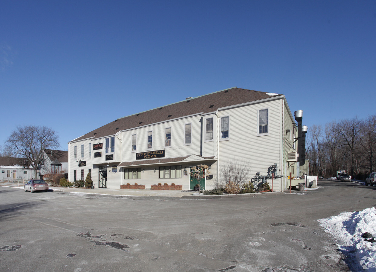
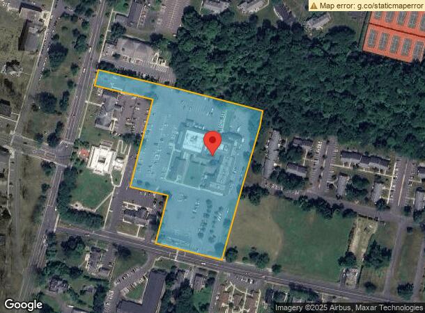
Property Record
68 Bridge St, Suffield, CT 06078
NEARBY LISTINGS FOR SALE OR LEASE
-
-
View all Suffield listings for lease on LoopNet.com
Property Detail
68 Bridge St
SUFF-000043H-000045-000270
Hartford
Storebuilding
Connecticut
X
270
09003C0207F
6.23 AC
2024
Northwest Outlying
2024
Hartford
477103
Hartford-West Hartford-East Hartford, CT
69,919 SF
DEMOGRAPHICS near 68 Bridge St
1 Mile
3 Mile
5 Mile
2024 Total Population
2,957
22,122
59,972
2029 Population
2,959
22,124
59,717
Pop Growth 2024-2029
+ 0.07%
+ 0.01%
(0.43%)
Average Age
45
41
43
2024 Total Households
1,002
8,168
24,132
HH Growth 2024-2029
(0.50%)
(0.23%)
(0.58%)
Median Household Inc
$105,984
$84,217
$85,870
Avg Household Size
2.30
2.30
2.30
2024 Avg HH Vehicles
2.00
2.00
2.00
Median Home Value
$373,241
$327,739
$252,510
Median Year Built
1982
1967
1964
Nearby Places
- Restaurants
- Banks
- Shops
- Fitness
- Groceries
PUBLIC TRANSPORTATION
COMMUTER RAIL
Windsor Locks (Hartford Line - CT Rail (CTRail))
DRIVE
WALK
Distance
Windsor Locks (Hartford Line - CT Rail (CTRail))
14 min
6.8 mi
AIRPORT
Bradley International
DRIVE
WALK
Distance
Bradley International
14 min
4.2 mi
Freight Ports
Port of New Haven
DRIVE
WALK
Distance
Port of New Haven
78 min
56.4 mi
SALE & LEASE HISTORY
LISTING DATE
SALE/LEASE

Sep 25, 2016
For Lease
May 15, 2019
For Lease
Nearby Properties
Address
Land Use
TOTAL SIZE
Lot Size
Zoning
Address
Land Use
TOTAL SIZE
Lot Size
Zoning
179,293 SF
51.07 AC
HR33
Address
Land Use
TOTAL SIZE
Lot Size
Zoning
30.30 AC
R25
Address
Land Use
TOTAL SIZE
Lot Size
Zoning
207,981 SF
60.48 AC
R45
Address
Land Use
TOTAL SIZE
Lot Size
Zoning
64.41 AC
IND3
Address
Land Use
TOTAL SIZE
Lot Size
Zoning
6,000 SF
62.78 AC
IND1
Address
Land Use
TOTAL SIZE
Lot Size
Zoning
32.40 AC
R90
Address
Land Use
TOTAL SIZE
Lot Size
Zoning
24.27 AC
SDD
Address
Land Use
TOTAL SIZE
Lot Size
Zoning
64.46 AC
R25
Address
Land Use
TOTAL SIZE
Lot Size
Zoning
12.14 AC
I
Address
Land Use
TOTAL SIZE
Lot Size
Zoning
135,228 SF
19.50 AC
R45
Address
Land Use
TOTAL SIZE
Lot Size
Zoning
21.50 AC
R25
Address
Land Use
TOTAL SIZE
Lot Size
Zoning
243,624 SF
12.16 AC
I
Address
Land Use
TOTAL SIZE
Lot Size
Zoning
20.54 AC
R33
Address
Land Use
TOTAL SIZE
Lot Size
Zoning
106,851 SF
20.33 AC
R25
Address
Land Use
TOTAL SIZE
Lot Size
Zoning
10 AC
R45
Address
Land Use
TOTAL SIZE
Lot Size
Zoning
18.04 AC
R33
Address
Land Use
TOTAL SIZE
Lot Size
Zoning
35.52 AC
R25
Address
Land Use
TOTAL SIZE
Lot Size
Zoning
67,592 SF
7.70 AC
R25
Address
Land Use
TOTAL SIZE
Lot Size
Zoning
92,900 SF
20.84 AC
PDIP
Address
Land Use
TOTAL SIZE
Lot Size
Zoning
13 AC
I
Address
Land Use
TOTAL SIZE
Lot Size
Zoning
13.85 AC
HR33
Address
Land Use
TOTAL SIZE
Lot Size
Zoning
99.10 AC
R25
Address
Land Use
TOTAL SIZE
Lot Size
Zoning
7.11 AC
R44
Address
Land Use
TOTAL SIZE
Lot Size
Zoning
25.91 AC
R45
Address
Land Use
TOTAL SIZE
Lot Size
Zoning
93,331 SF
2.93 AC
I
Address
Land Use
TOTAL SIZE
Lot Size
Zoning
17,950 SF
1.30 AC
TCV
Address
Land Use
TOTAL SIZE
Lot Size
Zoning
90,925 SF
5.81 AC
PDIP
Address
Land Use
TOTAL SIZE
Lot Size
Zoning
3.13 AC
PDIP
Address
Land Use
TOTAL SIZE
Lot Size
Zoning
1.88 AC
PDIP
Address
Land Use
TOTAL SIZE
Lot Size
Zoning
4,044 SF
17.18 AC
PDIP
The World's #1 Commercial Real Estate Marketplace
Connect with us
© 2025 CoStar Group
The information above has been obtained from sources believed reliable. While we do not doubt its accuracy we have not verified it and make no guarantee, warranty or representation about it. It is your responsibility to independently confirm its accuracy and completeness. Any projections, opinions, assumptions, or estimates used are for example only and do not represent the current or future performance of the property. The value of this transaction to you depends on tax and other factors which should be evaluated by your tax, financial, and legal advisors. You and your advisors should conduct a careful, independent investigation of the property to determine to your satisfaction the suitability of the property for your needs.