Property Record
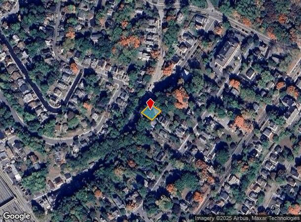
68 Brook St, Croton On Hudson, NY 10520
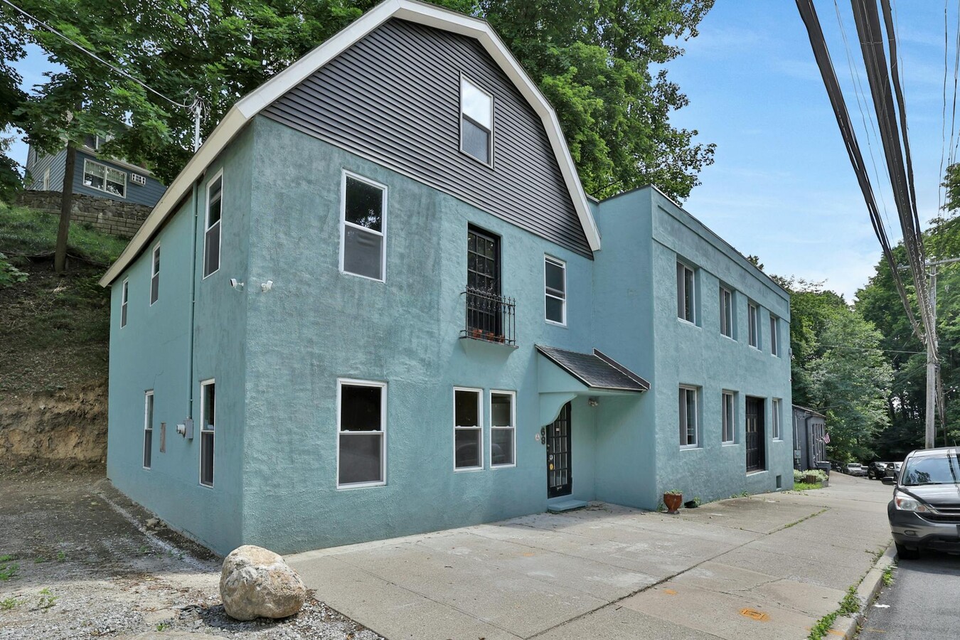
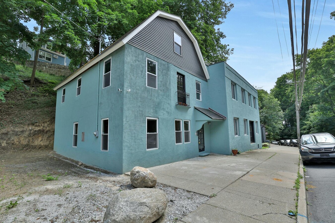
This Property Is For Sale
NEARBY LISTINGS FOR SALE OR LEASE
-
-
View all Croton On Hudson listings for sale on LoopNet.com
Property Detail
68 Brook St
New York-Jersey City-White Plains, NY-NJ
Map Of Property Of Philip G Van Wyck Esq
2203-078-008-00005-000-0018
39.00-211-010
Storesoffices
Westchester
X
New York
36119C0109F
18.000
2024
0.12 AC
2023
Northwest
013900
Westchester/So Connecticut
DEMOGRAPHICS near 68 Brook St
1 Mile
3 Mile
5 Mile
2024 Total Population
6,528
21,675
84,325
2029 Population
6,467
21,373
81,887
Pop Growth 2024-2029
(0.93%)
(1.39%)
(2.89%)
Average Age
43
46
42
2024 Total Households
2,392
8,288
29,835
HH Growth 2024-2029
(1.09%)
(2.10%)
(3.17%)
Median Household Inc
$160,112
$132,493
$112,016
Avg Household Size
2.70
2.40
2.70
2024 Avg HH Vehicles
2.00
2.00
2.00
Median Home Value
$693,437
$629,740
$503,174
Median Year Built
1953
1970
1964
Nearby Places
- Restaurants
- Banks
- Shops
- Fitness
- Groceries
PUBLIC TRANSPORTATION
COMMUTER RAIL
Croton-Harmon Station (Hudson Line - Metro-North Commuter Railroad Company (Metro-North))
DRIVE
WALK
Distance
Croton-Harmon Station (Hudson Line - Metro-North Commuter Railroad Company (Metro-North))
4 min
1.6 mi
Cortlandt Station (Hudson Line - Metro-North Commuter Railroad Company (Metro-North))
DRIVE
WALK
Distance
Cortlandt Station (Hudson Line - Metro-North Commuter Railroad Company (Metro-North))
8 min
4.0 mi
AIRPORT
Westchester County
DRIVE
WALK
Distance
Westchester County
34 min
20.2 mi
New York Stewart International
DRIVE
WALK
Distance
New York Stewart International
52 min
30.7 mi
Laguardia
DRIVE
WALK
Distance
Laguardia
58 min
39.0 mi
Freight Ports
NY - Red Hook Container Terminal
DRIVE
WALK
Distance
NY - Red Hook Container Terminal
71 min
47.1 mi
Nearby Properties
Address
Land Use
TOTAL SIZE
Lot Size
Zoning
Address
Land Use
TOTAL SIZE
Lot Size
Zoning
12.78 AC
Address
Land Use
TOTAL SIZE
Lot Size
Zoning
26.16 AC
Address
Land Use
TOTAL SIZE
Lot Size
Zoning
20.80 AC
Address
Land Use
TOTAL SIZE
Lot Size
Zoning
56.91 AC
Address
Land Use
TOTAL SIZE
Lot Size
Zoning
Address
Land Use
TOTAL SIZE
Lot Size
Zoning
10.33 AC
Address
Land Use
TOTAL SIZE
Lot Size
Zoning
7.81 AC
Address
Land Use
TOTAL SIZE
Lot Size
Zoning
Address
Land Use
TOTAL SIZE
Lot Size
Zoning
3.10 AC
Address
Land Use
TOTAL SIZE
Lot Size
Zoning
6.73 AC
Address
Land Use
TOTAL SIZE
Lot Size
Zoning
Address
Land Use
TOTAL SIZE
Lot Size
Zoning
Address
Land Use
TOTAL SIZE
Lot Size
Zoning
2.16 AC
Address
Land Use
TOTAL SIZE
Lot Size
Zoning
2,816 SF
5.53 AC
Address
Land Use
TOTAL SIZE
Lot Size
Zoning
2.36 AC
Address
Land Use
TOTAL SIZE
Lot Size
Zoning
4.20 AC
Address
Land Use
TOTAL SIZE
Lot Size
Zoning
1.55 AC
Address
Land Use
TOTAL SIZE
Lot Size
Zoning
180 SF
33.28 AC
R-2A
Address
Land Use
TOTAL SIZE
Lot Size
Zoning
25.50 AC
Address
Land Use
TOTAL SIZE
Lot Size
Zoning
0.45 AC
Address
Land Use
TOTAL SIZE
Lot Size
Zoning
0.94 AC
Address
Land Use
TOTAL SIZE
Lot Size
Zoning
Address
Land Use
TOTAL SIZE
Lot Size
Zoning
10.44 AC
Address
Land Use
TOTAL SIZE
Lot Size
Zoning
1.91 AC
Address
Land Use
TOTAL SIZE
Lot Size
Zoning
3.25 AC
Address
Land Use
TOTAL SIZE
Lot Size
Zoning
1.22 AC
Address
Land Use
TOTAL SIZE
Lot Size
Zoning
36.20 AC
Address
Land Use
TOTAL SIZE
Lot Size
Zoning
0.47 AC
Address
Land Use
TOTAL SIZE
Lot Size
Zoning
1.72 AC
Address
Land Use
TOTAL SIZE
Lot Size
Zoning
The World's #1 Commercial Real Estate Marketplace
Connect with us
© 2025 CoStar Group
The information above has been obtained from sources believed reliable. While we do not doubt its accuracy we have not verified it and make no guarantee, warranty or representation about it. It is your responsibility to independently confirm its accuracy and completeness. Any projections, opinions, assumptions, or estimates used are for example only and do not represent the current or future performance of the property. The value of this transaction to you depends on tax and other factors which should be evaluated by your tax, financial, and legal advisors. You and your advisors should conduct a careful, independent investigation of the property to determine to your satisfaction the suitability of the property for your needs.