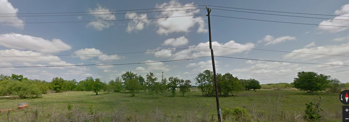
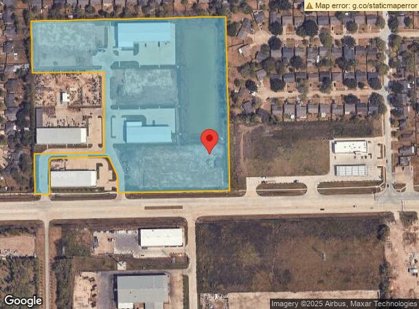
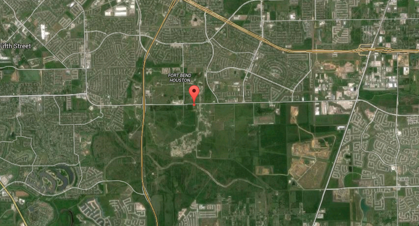
Property Record
6811 Mchard Rd, Houston, TX 77053
NEARBY LISTINGS FOR SALE OR LEASE
Property Detail
6811 Mchard Rd
0513-00-000-0100-907
F Friedenhaus
Commercialnec
0513 F FRIEDENHAUS, BLOCK 1, ACRES 14.364, INDEPENDENCE BUSINESS PARK, UNRESTRICTED RESERVE A, PART
X
Fort Bend
48157C0305M
Texas
2023
14.36 AC
2023
E Fort Bend Co/Sugar Land
670102
Houston
880 SF
Houston-The Woodlands-Sugar Land, TX
DEMOGRAPHICS near 6811 Mchard Rd
1 Mile
3 Mile
5 Mile
2024 Total Population
11,085
75,619
248,635
2029 Population
13,227
86,388
279,569
Pop Growth 2024-2029
+ 19.32%
+ 14.24%
+ 12.44%
Average Age
37
37
37
2024 Total Households
3,415
23,409
80,126
HH Growth 2024-2029
+ 19.91%
+ 14.93%
+ 12.86%
Median Household Inc
$59,054
$66,191
$71,052
Avg Household Size
3.20
3.20
3.00
2024 Avg HH Vehicles
2.00
2.00
2.00
Median Home Value
$115,652
$169,605
$195,622
Median Year Built
1979
1988
1996
Nearby Places
- Restaurants
- Banks
- Shops
- Fitness
- Groceries
PUBLIC TRANSPORTATION
AIRPORT
William P Hobby
DRIVE
WALK
Distance
William P Hobby
28 min
16.1 mi
George Bush Intcntl/Houston
DRIVE
WALK
Distance
George Bush Intcntl/Houston
48 min
34.9 mi
Freight Ports
Port of Houston
DRIVE
WALK
Distance
Port of Houston
34 min
20.4 mi
SALE & LEASE HISTORY
LISTING DATE
SALE/LEASE

Sep 24, 2016
For Sale
Jul 26, 2017
For Sale
Nearby Properties
Address
Land Use
TOTAL SIZE
Lot Size
Zoning
Address
Land Use
TOTAL SIZE
Lot Size
Zoning
1,139,160 SF
75.10 AC
Address
Land Use
TOTAL SIZE
Lot Size
Zoning
542,333 SF
43.95 AC
Address
Land Use
TOTAL SIZE
Lot Size
Zoning
460,711 SF
18.98 AC
Address
Land Use
TOTAL SIZE
Lot Size
Zoning
447,956 SF
18.42 AC
Address
Land Use
TOTAL SIZE
Lot Size
Zoning
429,368 SF
27.94 AC
Address
Land Use
TOTAL SIZE
Lot Size
Zoning
Address
Land Use
TOTAL SIZE
Lot Size
Zoning
306,103 SF
64.07 AC
QY
Address
Land Use
TOTAL SIZE
Lot Size
Zoning
240,000 SF
12.45 AC
Address
Land Use
TOTAL SIZE
Lot Size
Zoning
169,176 SF
24.31 AC
Address
Land Use
TOTAL SIZE
Lot Size
Zoning
209,728 SF
11.93 AC
Address
Land Use
TOTAL SIZE
Lot Size
Zoning
176,000 SF
14.15 AC
Address
Land Use
TOTAL SIZE
Lot Size
Zoning
113,040 SF
8.14 AC
Address
Land Use
TOTAL SIZE
Lot Size
Zoning
85,092 SF
12.95 AC
Address
Land Use
TOTAL SIZE
Lot Size
Zoning
122,188 SF
14.26 AC
Address
Land Use
TOTAL SIZE
Lot Size
Zoning
112,500 SF
7 AC
Address
Land Use
TOTAL SIZE
Lot Size
Zoning
71,596 SF
10.18 AC
Address
Land Use
TOTAL SIZE
Lot Size
Zoning
132,938 SF
29 AC
MZY
Address
Land Use
TOTAL SIZE
Lot Size
Zoning
132,075 SF
3.09 AC
Address
Land Use
TOTAL SIZE
Lot Size
Zoning
163,500 SF
8.97 AC
Address
Land Use
TOTAL SIZE
Lot Size
Zoning
52,464 SF
10.32 AC
Address
Land Use
TOTAL SIZE
Lot Size
Zoning
114,791 SF
4.04 AC
Address
Land Use
TOTAL SIZE
Lot Size
Zoning
5.91 AC
Address
Land Use
TOTAL SIZE
Lot Size
Zoning
32.95 AC
Address
Land Use
TOTAL SIZE
Lot Size
Zoning
82,983 SF
4.46 AC
Address
Land Use
TOTAL SIZE
Lot Size
Zoning
114,705 SF
3.60 AC
Address
Land Use
TOTAL SIZE
Lot Size
Zoning
110,450 SF
7.58 AC
Address
Land Use
TOTAL SIZE
Lot Size
Zoning
84,673 SF
9.57 AC
X
Address
Land Use
TOTAL SIZE
Lot Size
Zoning
88,802 SF
2.35 AC
Address
Land Use
TOTAL SIZE
Lot Size
Zoning
201,890 SF
5.53 AC
Address
Land Use
TOTAL SIZE
Lot Size
Zoning
93,388 SF
5.75 AC
The World's #1 Commercial Real Estate Marketplace
Connect with us
© 2025 CoStar Group
The information above has been obtained from sources believed reliable. While we do not doubt its accuracy we have not verified it and make no guarantee, warranty or representation about it. It is your responsibility to independently confirm its accuracy and completeness. Any projections, opinions, assumptions, or estimates used are for example only and do not represent the current or future performance of the property. The value of this transaction to you depends on tax and other factors which should be evaluated by your tax, financial, and legal advisors. You and your advisors should conduct a careful, independent investigation of the property to determine to your satisfaction the suitability of the property for your needs.