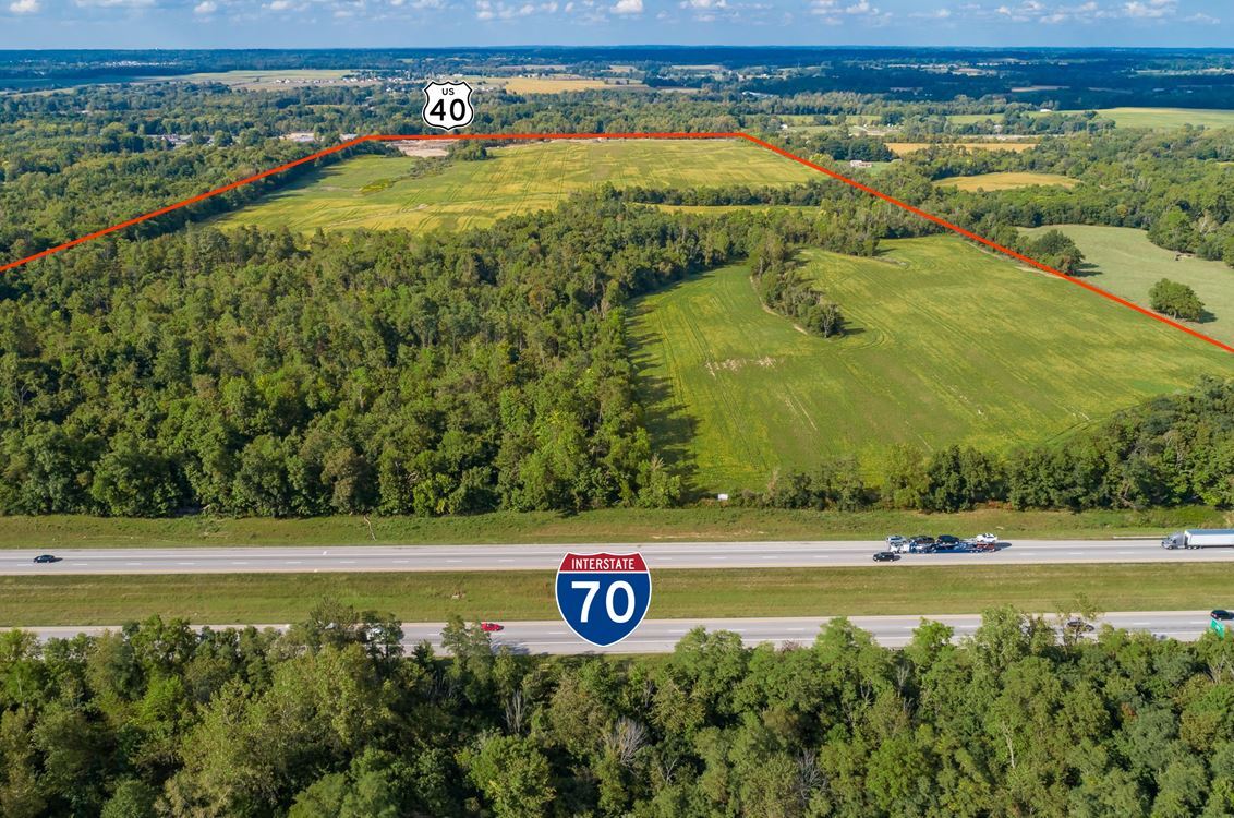
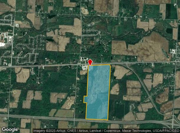
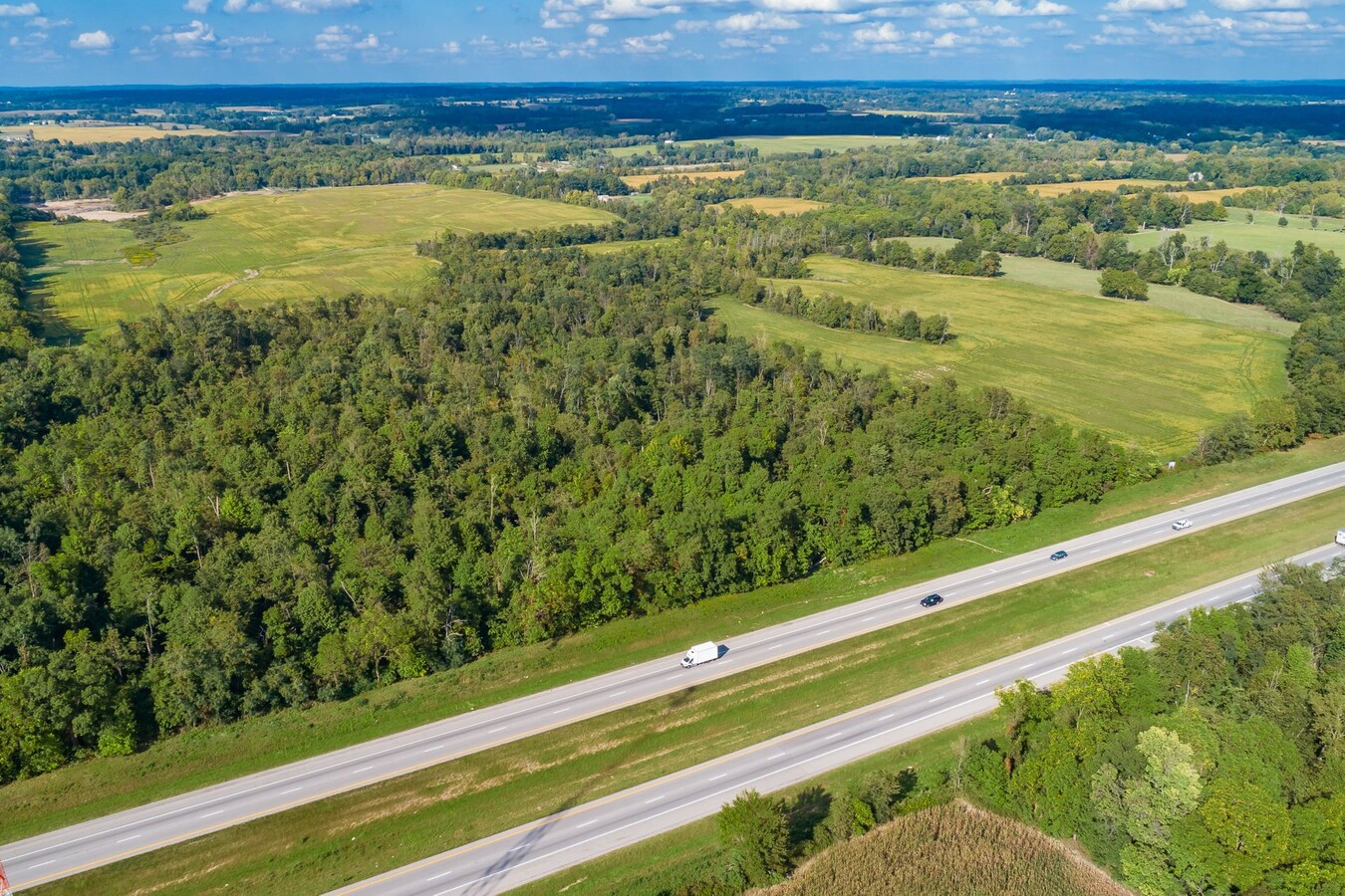
Property Record
6825 National Rd Sw, Pataskala, OH 43062
This Property Is For Sale
NEARBY LISTINGS FOR SALE OR LEASE
Property Detail
6825 National Rd Sw
Columbus, OH
Refugee Lands
010-017952-00.000
184.139 AC SEC 10 R19 T17
Agriculturalland
Licking
X
Ohio
39089C0453J
14
2023
184.13 AC
2023
Licking County
757402
Columbus
DEMOGRAPHICS near 6825 National Rd Sw
1 Mile
3 Mile
5 Mile
2024 Total Population
620
5,080
26,259
2029 Population
640
5,285
27,490
Pop Growth 2024-2029
+ 3.23%
+ 4.04%
+ 4.69%
Average Age
39
40
40
2024 Total Households
208
1,798
9,509
HH Growth 2024-2029
+ 3.37%
+ 4.00%
+ 4.64%
Median Household Inc
$87,076
$92,244
$93,114
Avg Household Size
2.90
2.80
2.70
2024 Avg HH Vehicles
2.00
3.00
2.00
Median Home Value
$216,176
$242,301
$255,536
Median Year Built
1971
1979
1992
Nearby Places
- Restaurants
- Banks
- Shops
- Fitness
- Groceries
PUBLIC TRANSPORTATION
AIRPORT
John Glenn Columbus International
DRIVE
WALK
Distance
John Glenn Columbus International
31 min
21.7 mi
Rickenbacker International
DRIVE
WALK
Distance
Rickenbacker International
33 min
24.0 mi
Freight Ports
Port of Toledo
DRIVE
WALK
Distance
Port of Toledo
201 min
160.3 mi
Nearby Properties
Address
Land Use
TOTAL SIZE
Lot Size
Zoning
Address
Land Use
TOTAL SIZE
Lot Size
Zoning
1,078,218 SF
63.12 AC
Address
Land Use
TOTAL SIZE
Lot Size
Zoning
73,671 SF
80.57 AC
Address
Land Use
TOTAL SIZE
Lot Size
Zoning
21,192 SF
6.37 AC
Address
Land Use
TOTAL SIZE
Lot Size
Zoning
2,421,019 SF
96.80 AC
Address
Land Use
TOTAL SIZE
Lot Size
Zoning
44,823 SF
3 AC
Address
Land Use
TOTAL SIZE
Lot Size
Zoning
18,944 SF
25.67 AC
Address
Land Use
TOTAL SIZE
Lot Size
Zoning
251.36 AC
Address
Land Use
TOTAL SIZE
Lot Size
Zoning
23,167 SF
7.55 AC
Address
Land Use
TOTAL SIZE
Lot Size
Zoning
1,550 SF
24.71 AC
Address
Land Use
TOTAL SIZE
Lot Size
Zoning
17,503 SF
43.90 AC
Address
Land Use
TOTAL SIZE
Lot Size
Zoning
3,900 SF
164.87 AC
Address
Land Use
TOTAL SIZE
Lot Size
Zoning
2,399 SF
168.65 AC
Address
Land Use
TOTAL SIZE
Lot Size
Zoning
14,008 SF
5.01 AC
Address
Land Use
TOTAL SIZE
Lot Size
Zoning
2,336 SF
80.06 AC
Address
Land Use
TOTAL SIZE
Lot Size
Zoning
9,600 SF
5.82 AC
Address
Land Use
TOTAL SIZE
Lot Size
Zoning
73.37 AC
Address
Land Use
TOTAL SIZE
Lot Size
Zoning
27.97 AC
Address
Land Use
TOTAL SIZE
Lot Size
Zoning
2,978 SF
32.83 AC
Address
Land Use
TOTAL SIZE
Lot Size
Zoning
1,934 SF
107.56 AC
Address
Land Use
TOTAL SIZE
Lot Size
Zoning
7,200 SF
15.34 AC
Address
Land Use
TOTAL SIZE
Lot Size
Zoning
9,100 SF
1.62 AC
Address
Land Use
TOTAL SIZE
Lot Size
Zoning
7,110 SF
15.10 AC
Address
Land Use
TOTAL SIZE
Lot Size
Zoning
3,000 SF
100 AC
Address
Land Use
TOTAL SIZE
Lot Size
Zoning
7,574 SF
15.15 AC
Address
Land Use
TOTAL SIZE
Lot Size
Zoning
58.13 AC
Address
Land Use
TOTAL SIZE
Lot Size
Zoning
6,000 SF
90.39 AC
Address
Land Use
TOTAL SIZE
Lot Size
Zoning
2,565 SF
23.73 AC
Address
Land Use
TOTAL SIZE
Lot Size
Zoning
2,045 SF
141.34 AC
Address
Land Use
TOTAL SIZE
Lot Size
Zoning
19,086 SF
18.60 AC
The World's #1 Commercial Real Estate Marketplace
Connect with us
© 2025 CoStar Group
The information above has been obtained from sources believed reliable. While we do not doubt its accuracy we have not verified it and make no guarantee, warranty or representation about it. It is your responsibility to independently confirm its accuracy and completeness. Any projections, opinions, assumptions, or estimates used are for example only and do not represent the current or future performance of the property. The value of this transaction to you depends on tax and other factors which should be evaluated by your tax, financial, and legal advisors. You and your advisors should conduct a careful, independent investigation of the property to determine to your satisfaction the suitability of the property for your needs.