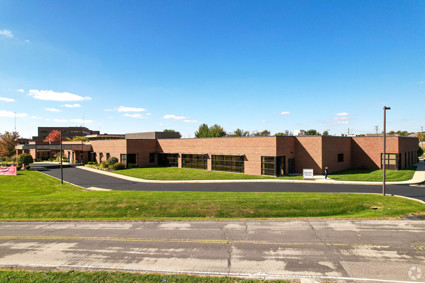
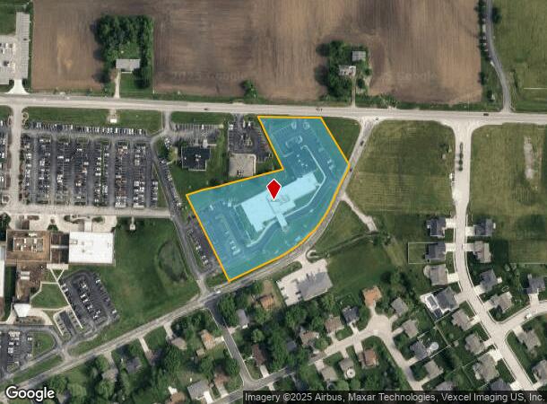
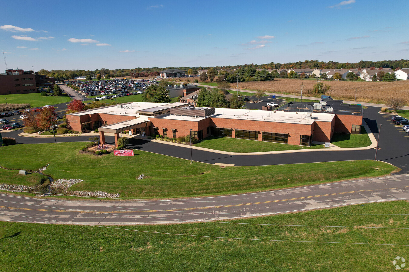
Property Record
6836 State Route 162, Maryville, IL 62062
NEARBY LISTINGS FOR SALE OR LEASE
Property Detail
6836 State Route 162
St. Louis, MO-IL
TR N1/2 SW
13-1-21-01-00-000-011
Madison
Hospitalpublic
Illinois
2018
3 AC
2023
Illinois
4035331031
St. Louis
25,675 SF
DEMOGRAPHICS near 6836 State Route 162
1 Mile
3 Mile
5 Mile
2024 Total Population
3,567
28,041
73,095
2029 Population
3,514
27,632
72,210
Pop Growth 2024-2029
(1.49%)
(1.46%)
(1.21%)
Average Age
44
41
41
2024 Total Households
1,459
11,187
28,976
HH Growth 2024-2029
(1.64%)
(1.56%)
(1.23%)
Median Household Inc
$79,198
$87,818
$84,160
Avg Household Size
2.30
2.40
2.40
2024 Avg HH Vehicles
2.00
2.00
2.00
Median Home Value
$202,778
$223,032
$219,298
Median Year Built
1991
1990
1986
Nearby Places
- Restaurants
- Banks
- Shops
- Fitness
- Groceries
PUBLIC TRANSPORTATION
AIRPORT
Scott AFB/Midamerica St Louis
DRIVE
WALK
Distance
Scott AFB/Midamerica St Louis
40 min
24.0 mi
St Louis Lambert International
DRIVE
WALK
Distance
St Louis Lambert International
36 min
26.0 mi
Freight Ports
Port Milwaukee
DRIVE
WALK
Distance
Port Milwaukee
398 min
352.8 mi
Nearby Properties
Address
Land Use
TOTAL SIZE
Lot Size
Zoning
Address
Land Use
TOTAL SIZE
Lot Size
Zoning
10.83 AC
Address
Land Use
TOTAL SIZE
Lot Size
Zoning
218,837 SF
4.81 AC
Address
Land Use
TOTAL SIZE
Lot Size
Zoning
187,818 SF
12.47 AC
Address
Land Use
TOTAL SIZE
Lot Size
Zoning
22,816 SF
40.45 AC
Address
Land Use
TOTAL SIZE
Lot Size
Zoning
127,592 SF
11.63 AC
Address
Land Use
TOTAL SIZE
Lot Size
Zoning
37,432 SF
2 AC
Address
Land Use
TOTAL SIZE
Lot Size
Zoning
5,280 SF
3.69 AC
Address
Land Use
TOTAL SIZE
Lot Size
Zoning
93,098 SF
15.82 AC
Address
Land Use
TOTAL SIZE
Lot Size
Zoning
72,233 SF
4.94 AC
Address
Land Use
TOTAL SIZE
Lot Size
Zoning
3,000 SF
5.76 AC
Address
Land Use
TOTAL SIZE
Lot Size
Zoning
46,916 SF
2.58 AC
Address
Land Use
TOTAL SIZE
Lot Size
Zoning
35,046 SF
6.82 AC
Address
Land Use
TOTAL SIZE
Lot Size
Zoning
Address
Land Use
TOTAL SIZE
Lot Size
Zoning
3,620 SF
18 AC
Address
Land Use
TOTAL SIZE
Lot Size
Zoning
48,263 SF
6.64 AC
Address
Land Use
TOTAL SIZE
Lot Size
Zoning
26,408 SF
2.94 AC
Address
Land Use
TOTAL SIZE
Lot Size
Zoning
96,702 SF
4.80 AC
Address
Land Use
TOTAL SIZE
Lot Size
Zoning
8,110 SF
13.83 AC
Address
Land Use
TOTAL SIZE
Lot Size
Zoning
5,280 SF
2.72 AC
Address
Land Use
TOTAL SIZE
Lot Size
Zoning
2,360 SF
4.76 AC
Address
Land Use
TOTAL SIZE
Lot Size
Zoning
27,245 SF
4 AC
Address
Land Use
TOTAL SIZE
Lot Size
Zoning
33,476 SF
Address
Land Use
TOTAL SIZE
Lot Size
Zoning
29,342 SF
4.76 AC
Address
Land Use
TOTAL SIZE
Lot Size
Zoning
31,024 SF
11.62 AC
Address
Land Use
TOTAL SIZE
Lot Size
Zoning
12,751 SF
0.68 AC
Address
Land Use
TOTAL SIZE
Lot Size
Zoning
14,825 SF
2.26 AC
Address
Land Use
TOTAL SIZE
Lot Size
Zoning
37,564 SF
1.74 AC
Address
Land Use
TOTAL SIZE
Lot Size
Zoning
11,833 SF
1.80 AC
Address
Land Use
TOTAL SIZE
Lot Size
Zoning
40,500 SF
3.94 AC
The World's #1 Commercial Real Estate Marketplace
Connect with us
© 2025 CoStar Group
The information above has been obtained from sources believed reliable. While we do not doubt its accuracy we have not verified it and make no guarantee, warranty or representation about it. It is your responsibility to independently confirm its accuracy and completeness. Any projections, opinions, assumptions, or estimates used are for example only and do not represent the current or future performance of the property. The value of this transaction to you depends on tax and other factors which should be evaluated by your tax, financial, and legal advisors. You and your advisors should conduct a careful, independent investigation of the property to determine to your satisfaction the suitability of the property for your needs.