Property Record
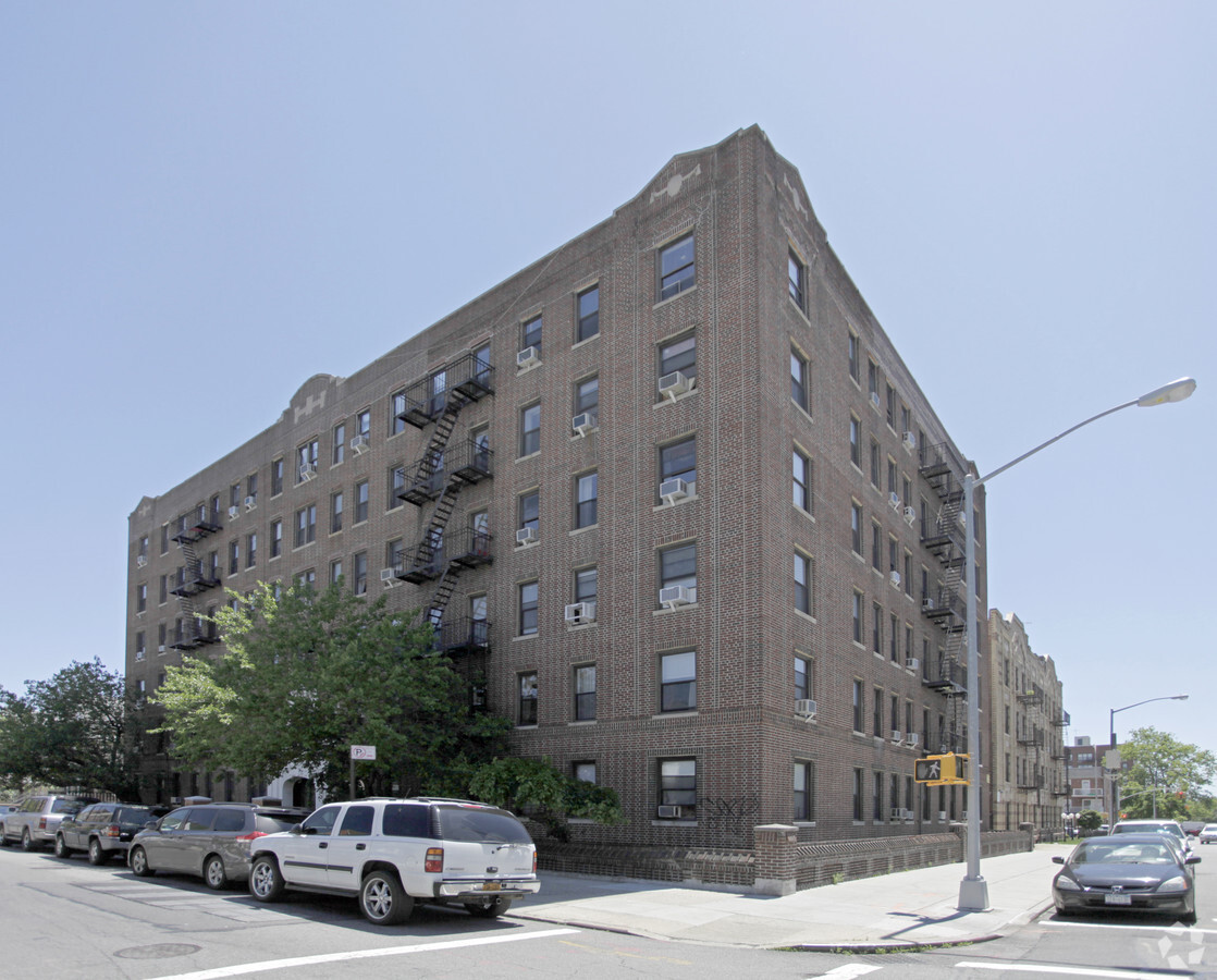
69 Bay 29Th St, Brooklyn, NY 11214

NEARBY LISTINGS FOR SALE OR LEASE
Property Detail
69 Bay 29Th St
New York-Jersey City-White Plains, NY-NJ
Kings
06380-0006
New York
Cooperative
0.31 AC
X
Bath Beach
3604970351F
Long Island (New York)
54,000 SF
DEMOGRAPHICS near 69 Bay 29Th St
1 Mile
3 Mile
5 Mile
2024 Total Population
117,920
780,197
1,361,968
2029 Population
107,930
724,227
1,271,603
Pop Growth 2024-2029
(8.47%)
(7.17%)
(6.63%)
Average Age
41
40
40
2024 Total Households
39,489
266,502
477,618
HH Growth 2024-2029
(9.01%)
(7.47%)
(6.92%)
Median Household Inc
$59,205
$59,282
$67,199
Avg Household Size
2.90
2.80
2.70
2024 Avg HH Vehicles
1.00
1.00
1.00
Median Home Value
$877,850
$842,172
$786,755
Median Year Built
1947
1948
1948
Nearby Places
- Restaurants
- Banks
- Shops
- Fitness
- Groceries
PUBLIC TRANSPORTATION
TRANSIT/SUBWAY
Bay Parkway (D,M Line) (D - New York MTA Subway (The Subway), M - New York MTA Subway (The Subway))
DRIVE
WALK
Distance
Bay Parkway (D,M Line) (D - New York MTA Subway (The Subway), M - New York MTA Subway (The Subway))
0 min
3 min
0.2 mi
20 Avenue (D,M Line) (D - New York MTA Subway (The Subway), M - New York MTA Subway (The Subway))
DRIVE
WALK
Distance
20 Avenue (D,M Line) (D - New York MTA Subway (The Subway), M - New York MTA Subway (The Subway))
1 min
7 min
0.4 mi
25 Avenue (D - New York MTA Subway (The Subway))
DRIVE
WALK
Distance
25 Avenue (D - New York MTA Subway (The Subway))
1 min
12 min
0.6 mi
18 Avenue (D,M Line) (D - New York MTA Subway (The Subway), M - New York MTA Subway (The Subway))
DRIVE
WALK
Distance
18 Avenue (D,M Line) (D - New York MTA Subway (The Subway), M - New York MTA Subway (The Subway))
1 min
13 min
0.7 mi
COMMUTER RAIL
Clifton (Staten Island Railway - New York MTA Subway (The Subway))
DRIVE
WALK
Distance
Clifton (Staten Island Railway - New York MTA Subway (The Subway))
13 min
6.7 mi
Stapleton (Staten Island Railway - New York MTA Subway (The Subway))
DRIVE
WALK
Distance
Stapleton (Staten Island Railway - New York MTA Subway (The Subway))
15 min
7.4 mi
AIRPORT
John F Kennedy International
DRIVE
WALK
Distance
John F Kennedy International
25 min
17.9 mi
Laguardia
DRIVE
WALK
Distance
Laguardia
33 min
18.5 mi
Newark Liberty International
DRIVE
WALK
Distance
Newark Liberty International
34 min
21.3 mi
Freight Ports
NY - Red Hook Container Terminal
DRIVE
WALK
Distance
NY - Red Hook Container Terminal
13 min
7.4 mi
Nearby Properties
Address
Land Use
TOTAL SIZE
Lot Size
Zoning
Address
Land Use
TOTAL SIZE
Lot Size
Zoning
1,545,708 SF
170.96 AC
R4
Address
Land Use
TOTAL SIZE
Lot Size
Zoning
1,066,042 SF
10.45 AC
R4
Address
Land Use
TOTAL SIZE
Lot Size
Zoning
965,600 SF
6.65 AC
R5
Address
Land Use
TOTAL SIZE
Lot Size
Zoning
335,800 SF
1.51 AC
R6
Address
Land Use
TOTAL SIZE
Lot Size
Zoning
54.78 AC
PARK
Address
Land Use
TOTAL SIZE
Lot Size
Zoning
286,000 SF
12.63 AC
PARK
Address
Land Use
TOTAL SIZE
Lot Size
Zoning
226,429 SF
1.52 AC
R5B
Address
Land Use
TOTAL SIZE
Lot Size
Zoning
259,823 SF
11.47 AC
M1-1
Address
Land Use
TOTAL SIZE
Lot Size
Zoning
59,063 SF
21.56 AC
PARK
Address
Land Use
TOTAL SIZE
Lot Size
Zoning
209,346 SF
18.29 AC
PARK
Address
Land Use
TOTAL SIZE
Lot Size
Zoning
702,770 SF
4.47 AC
R6
Address
Land Use
TOTAL SIZE
Lot Size
Zoning
846,056 SF
20.71 AC
R5
Address
Land Use
TOTAL SIZE
Lot Size
Zoning
152,440 SF
23.07 AC
R4B
Address
Land Use
TOTAL SIZE
Lot Size
Zoning
356,000 SF
8.19 AC
R5
Address
Land Use
TOTAL SIZE
Lot Size
Zoning
43,068 SF
216.83 AC
PARK
Address
Land Use
TOTAL SIZE
Lot Size
Zoning
382,162 SF
1.65 AC
R7A
Address
Land Use
TOTAL SIZE
Lot Size
Zoning
221,704 SF
0.82 AC
R5B
Address
Land Use
TOTAL SIZE
Lot Size
Zoning
128,170 SF
0.87 AC
R7A
Address
Land Use
TOTAL SIZE
Lot Size
Zoning
470,000 SF
3.39 AC
R6
Address
Land Use
TOTAL SIZE
Lot Size
Zoning
105,328 SF
0.11 AC
M1-6
Address
Land Use
TOTAL SIZE
Lot Size
Zoning
16,570 SF
240.82 AC
PARK
Address
Land Use
TOTAL SIZE
Lot Size
Zoning
134,650 SF
0.83 AC
R6
Address
Land Use
TOTAL SIZE
Lot Size
Zoning
60,288 SF
0.76 AC
R5
Address
Land Use
TOTAL SIZE
Lot Size
Zoning
305,046 SF
8.76 AC
R6
Address
Land Use
TOTAL SIZE
Lot Size
Zoning
211,552 SF
7.39 AC
R3-2
Address
Land Use
TOTAL SIZE
Lot Size
Zoning
414,400 SF
2.70 AC
R7A
Address
Land Use
TOTAL SIZE
Lot Size
Zoning
206,714 SF
0.67 AC
R6
Address
Land Use
TOTAL SIZE
Lot Size
Zoning
470,000 SF
3.30 AC
R6
Address
Land Use
TOTAL SIZE
Lot Size
Zoning
411,500 SF
3.48 AC
R5B
Address
Land Use
TOTAL SIZE
Lot Size
Zoning
141,830 SF
0.22 AC
C64X
The World's #1 Commercial Real Estate Marketplace
Connect with us
© 2025 CoStar Group
The information above has been obtained from sources believed reliable. While we do not doubt its accuracy we have not verified it and make no guarantee, warranty or representation about it. It is your responsibility to independently confirm its accuracy and completeness. Any projections, opinions, assumptions, or estimates used are for example only and do not represent the current or future performance of the property. The value of this transaction to you depends on tax and other factors which should be evaluated by your tax, financial, and legal advisors. You and your advisors should conduct a careful, independent investigation of the property to determine to your satisfaction the suitability of the property for your needs.