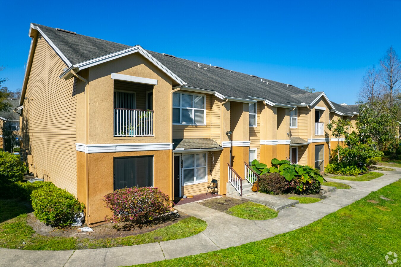
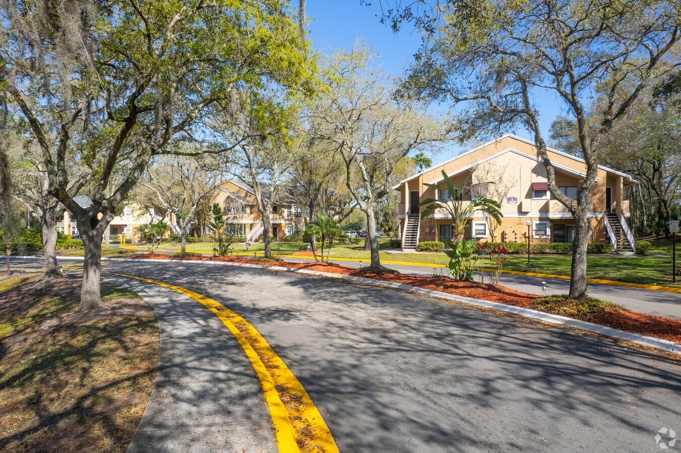
Property Record
6900 Aruba Ave, Tampa, FL 33637

NEARBY LISTINGS FOR SALE OR LEASE
Property Detail
6900 Aruba Ave
Tampa-St. Petersburg-Clearwater, FL
Riverchase Community
T-23-28-19-565-000000-00001.0
RIVERCHASE COMMUNITY LOTS 1 2 AND 3
Multifamilydwelling
Hillsborough
AE
Florida
12057C0219H
1
2023
72.27 AC
2023
Temple Terrace
010401
Tampa/St Petersburg
671,677 SF
DEMOGRAPHICS near 6900 Aruba Ave
1 Mile
3 Mile
5 Mile
2024 Total Population
12,405
81,199
231,050
2029 Population
13,490
88,351
252,426
Pop Growth 2024-2029
+ 8.75%
+ 8.81%
+ 9.25%
Average Age
38
37
36
2024 Total Households
4,758
32,069
89,102
HH Growth 2024-2029
+ 8.87%
+ 8.99%
+ 9.42%
Median Household Inc
$59,130
$46,748
$40,885
Avg Household Size
2.50
2.40
2.40
2024 Avg HH Vehicles
2.00
2.00
1.00
Median Home Value
$250,482
$237,418
$221,147
Median Year Built
1978
1982
1982
Nearby Places
- Restaurants
- Banks
- Shops
- Fitness
- Groceries
PUBLIC TRANSPORTATION
COMMUTER RAIL
Tampa (Silver Star - Amtrak)
DRIVE
WALK
Distance
Tampa (Silver Star - Amtrak)
19 min
9.9 mi
AIRPORT
Tampa International
DRIVE
WALK
Distance
Tampa International
30 min
17.7 mi
St Pete-Clearwater International
DRIVE
WALK
Distance
St Pete-Clearwater International
47 min
27.0 mi
Freight Ports
Port of Tampa Bay
DRIVE
WALK
Distance
Port of Tampa Bay
23 min
11.5 mi
Nearby Properties
Address
Land Use
TOTAL SIZE
Lot Size
Zoning
Address
Land Use
TOTAL SIZE
Lot Size
Zoning
1,236,718 SF
38.67 AC
CI
Address
Land Use
TOTAL SIZE
Lot Size
Zoning
4,011,409 SF
1,561.04 AC
UC
Address
Land Use
TOTAL SIZE
Lot Size
Zoning
2,604,100 SF
85.18 AC
AR
Address
Land Use
TOTAL SIZE
Lot Size
Zoning
606,020 SF
28.56 AC
PD
Address
Land Use
TOTAL SIZE
Lot Size
Zoning
775,847 SF
249.53 AC
PD
Address
Land Use
TOTAL SIZE
Lot Size
Zoning
702,607 SF
63.42 AC
RCP
Address
Land Use
TOTAL SIZE
Lot Size
Zoning
302,910 SF
29.81 AC
PD
Address
Land Use
TOTAL SIZE
Lot Size
Zoning
959,394 SF
97.56 AC
PD
Address
Land Use
TOTAL SIZE
Lot Size
Zoning
665,455 SF
298.65 AC
PD
Address
Land Use
TOTAL SIZE
Lot Size
Zoning
287,530 SF
9.09 AC
PD
Address
Land Use
TOTAL SIZE
Lot Size
Zoning
264,202 SF
12.86 AC
PD
Address
Land Use
TOTAL SIZE
Lot Size
Zoning
374,282 SF
13.50 AC
PD
Address
Land Use
TOTAL SIZE
Lot Size
Zoning
706,512 SF
76.54 AC
PD
Address
Land Use
TOTAL SIZE
Lot Size
Zoning
319,292 SF
31.71 AC
PD
Address
Land Use
TOTAL SIZE
Lot Size
Zoning
598,043 SF
48.18 AC
PD
Address
Land Use
TOTAL SIZE
Lot Size
Zoning
285,330 SF
34.74 AC
RDC-12
Address
Land Use
TOTAL SIZE
Lot Size
Zoning
280,650 SF
11.92 AC
PD
Address
Land Use
TOTAL SIZE
Lot Size
Zoning
250,958 SF
28.28 AC
CI
Address
Land Use
TOTAL SIZE
Lot Size
Zoning
163,045 SF
32.18 AC
PD
Address
Land Use
TOTAL SIZE
Lot Size
Zoning
210,916 SF
16.22 AC
PROF
Address
Land Use
TOTAL SIZE
Lot Size
Zoning
137,721 SF
335.48 AC
IG
Address
Land Use
TOTAL SIZE
Lot Size
Zoning
271,402 SF
15.93 AC
PD
Address
Land Use
TOTAL SIZE
Lot Size
Zoning
232,257 SF
11.64 AC
PD
Address
Land Use
TOTAL SIZE
Lot Size
Zoning
250,816 SF
9.80 AC
PD
Address
Land Use
TOTAL SIZE
Lot Size
Zoning
388,082 SF
30.28 AC
PD
Address
Land Use
TOTAL SIZE
Lot Size
Zoning
303,325 SF
17.01 AC
EI
Address
Land Use
TOTAL SIZE
Lot Size
Zoning
331,265 SF
18.75 AC
RMC-20
Address
Land Use
TOTAL SIZE
Lot Size
Zoning
217,070 SF
20.39 AC
RMFA
Address
Land Use
TOTAL SIZE
Lot Size
Zoning
197,708 SF
9.81 AC
PD
The World's #1 Commercial Real Estate Marketplace
Connect with us
© 2025 CoStar Group
The information above has been obtained from sources believed reliable. While we do not doubt its accuracy we have not verified it and make no guarantee, warranty or representation about it. It is your responsibility to independently confirm its accuracy and completeness. Any projections, opinions, assumptions, or estimates used are for example only and do not represent the current or future performance of the property. The value of this transaction to you depends on tax and other factors which should be evaluated by your tax, financial, and legal advisors. You and your advisors should conduct a careful, independent investigation of the property to determine to your satisfaction the suitability of the property for your needs.