Property Record
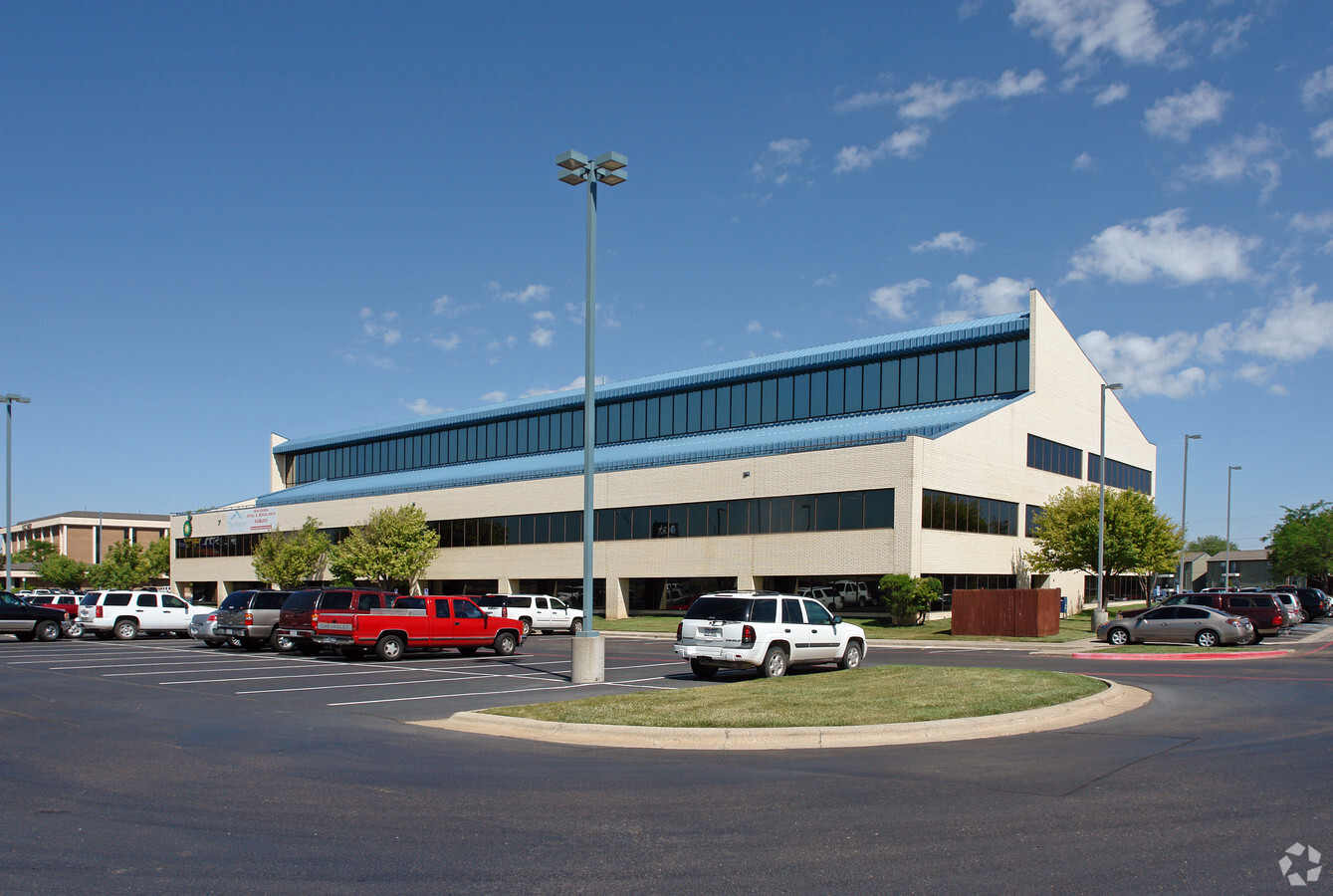
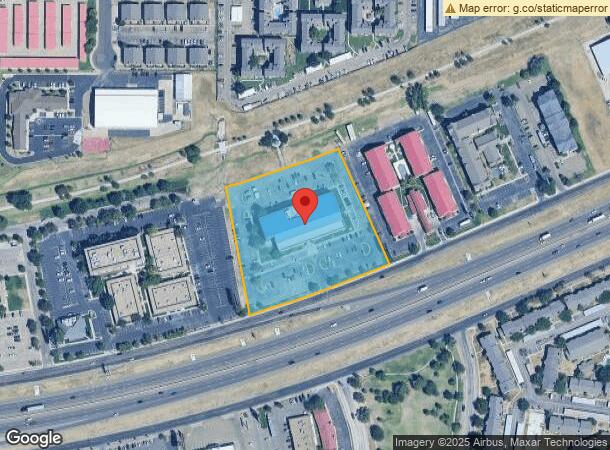
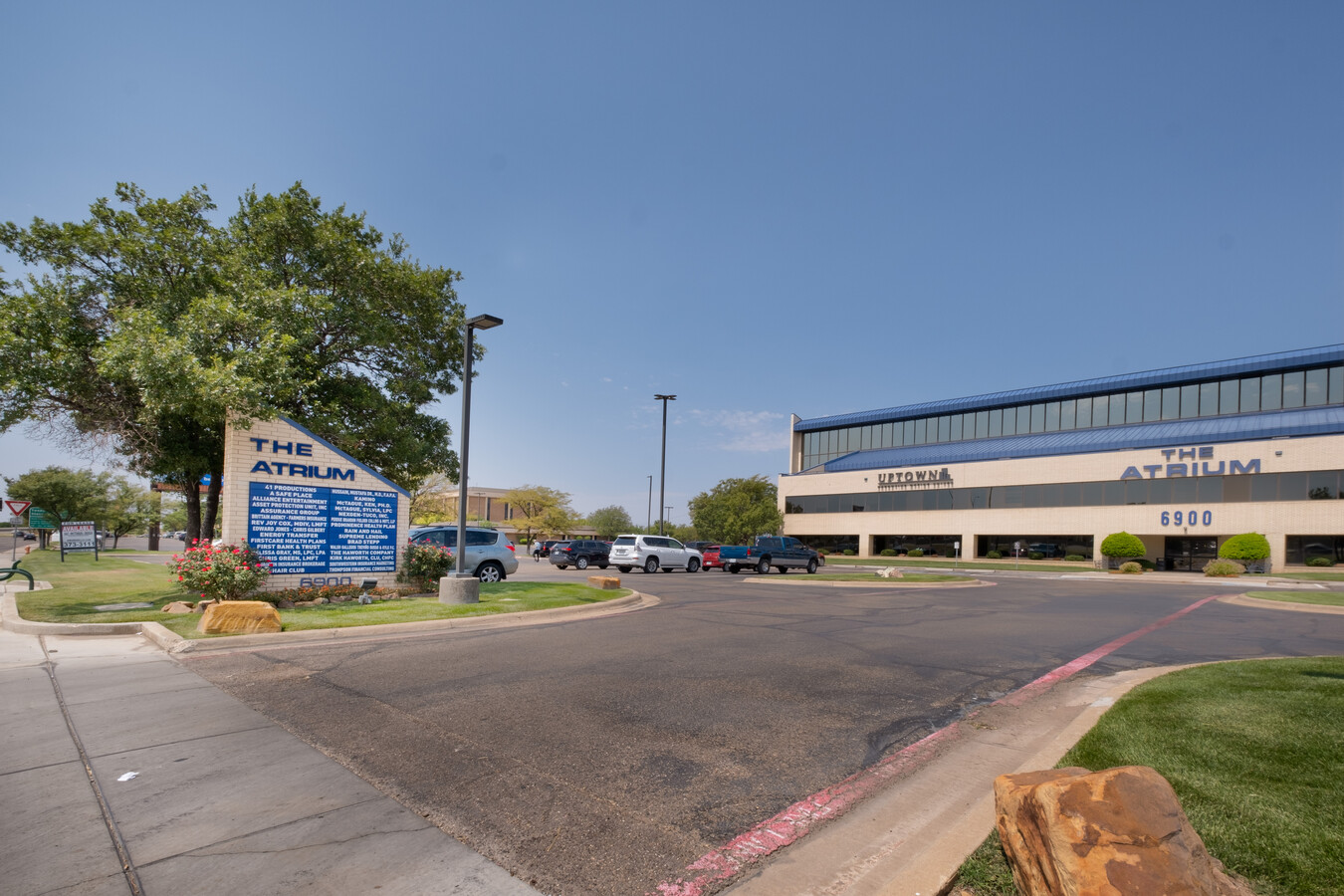
6900 W Interstate 40, Amarillo, TX 79106
NEARBY LISTINGS FOR SALE OR LEASE
Property Detail
6900 W Interstate 40
Amarillo, TX
Belmar # 49
R-001-1800-9290-0
BELMAR # 49, LOT 10A, BLK 0089, 4.0000 ACRES
Officebuilding
Potter
X
Texas
48375C0510C
10a
2023
4 AC
2024
Amarillo
011700
Other Market Areas
70,418 SF
DEMOGRAPHICS near 6900 W Interstate 40
1 Mile
3 Mile
5 Mile
2024 Total Population
10,842
70,983
142,812
2029 Population
10,916
74,507
150,776
Pop Growth 2024-2029
+ 0.68%
+ 4.96%
+ 5.58%
Average Age
39
40
39
2024 Total Households
4,794
30,790
59,617
HH Growth 2024-2029
+ 0.08%
+ 5.09%
+ 5.57%
Median Household Inc
$51,096
$57,035
$60,686
Avg Household Size
2.10
2.20
2.30
2024 Avg HH Vehicles
2.00
2.00
2.00
Median Home Value
$174,376
$180,826
$179,867
Median Year Built
1973
1973
1975
Nearby Places
- Restaurants
- Banks
- Shops
- Fitness
- Groceries
PUBLIC TRANSPORTATION
AIRPORT
Rick Husband Amarillo International
DRIVE
WALK
Distance
Rick Husband Amarillo International
21 min
14.2 mi
Freight Ports
Tulsa Port Of Catoosa
DRIVE
WALK
Distance
Tulsa Port Of Catoosa
403 min
382.2 mi
SALE & LEASE HISTORY
LISTING DATE
SALE/LEASE

Sep 24, 2016
For Lease
Nearby Properties
Address
Land Use
TOTAL SIZE
Lot Size
Zoning
Address
Land Use
TOTAL SIZE
Lot Size
Zoning
180,752 SF
19.99 AC
PD
Address
Land Use
TOTAL SIZE
Lot Size
Zoning
5,948 SF
30.60 AC
Address
Land Use
TOTAL SIZE
Lot Size
Zoning
329,835 SF
16.26 AC
Address
Land Use
TOTAL SIZE
Lot Size
Zoning
202,800 SF
6.57 AC
Address
Land Use
TOTAL SIZE
Lot Size
Zoning
8,733 SF
9.76 AC
PD
Address
Land Use
TOTAL SIZE
Lot Size
Zoning
56,751 SF
34.57 AC
PD
Address
Land Use
TOTAL SIZE
Lot Size
Zoning
5,068 SF
39.36 AC
Address
Land Use
TOTAL SIZE
Lot Size
Zoning
207,120 SF
16.54 AC
GR
Address
Land Use
TOTAL SIZE
Lot Size
Zoning
38,325 SF
23.69 AC
PD
Address
Land Use
TOTAL SIZE
Lot Size
Zoning
1,950 SF
14.20 AC
Address
Land Use
TOTAL SIZE
Lot Size
Zoning
1,987 SF
10.16 AC
Address
Land Use
TOTAL SIZE
Lot Size
Zoning
17,856 SF
12.12 AC
Address
Land Use
TOTAL SIZE
Lot Size
Zoning
116,031 SF
10.25 AC
Address
Land Use
TOTAL SIZE
Lot Size
Zoning
116,031 SF
38.89 AC
Address
Land Use
TOTAL SIZE
Lot Size
Zoning
107,723 SF
7.04 AC
Address
Land Use
TOTAL SIZE
Lot Size
Zoning
23,907 SF
10.85 AC
Address
Land Use
TOTAL SIZE
Lot Size
Zoning
143,608 SF
20.53 AC
Address
Land Use
TOTAL SIZE
Lot Size
Zoning
168,130 SF
16.32 AC
Address
Land Use
TOTAL SIZE
Lot Size
Zoning
145,819 SF
12.89 AC
PD
Address
Land Use
TOTAL SIZE
Lot Size
Zoning
16,541 SF
3.88 AC
R2
Address
Land Use
TOTAL SIZE
Lot Size
Zoning
42,185 SF
5.67 AC
Address
Land Use
TOTAL SIZE
Lot Size
Zoning
95,992 SF
14.98 AC
PD
Address
Land Use
TOTAL SIZE
Lot Size
Zoning
112,005 SF
7.70 AC
GR
Address
Land Use
TOTAL SIZE
Lot Size
Zoning
71,680 SF
32.06 AC
PD
Address
Land Use
TOTAL SIZE
Lot Size
Zoning
49,647 SF
3.67 AC
Address
Land Use
TOTAL SIZE
Lot Size
Zoning
10,832 SF
10.78 AC
GR
Address
Land Use
TOTAL SIZE
Lot Size
Zoning
9,605 SF
16.74 AC
R2
Address
Land Use
TOTAL SIZE
Lot Size
Zoning
13,944 SF
13.20 AC
MF2
Address
Land Use
TOTAL SIZE
Lot Size
Zoning
67,104 SF
3.43 AC
The World's #1 Commercial Real Estate Marketplace
Connect with us
© 2025 CoStar Group
The information above has been obtained from sources believed reliable. While we do not doubt its accuracy we have not verified it and make no guarantee, warranty or representation about it. It is your responsibility to independently confirm its accuracy and completeness. Any projections, opinions, assumptions, or estimates used are for example only and do not represent the current or future performance of the property. The value of this transaction to you depends on tax and other factors which should be evaluated by your tax, financial, and legal advisors. You and your advisors should conduct a careful, independent investigation of the property to determine to your satisfaction the suitability of the property for your needs.