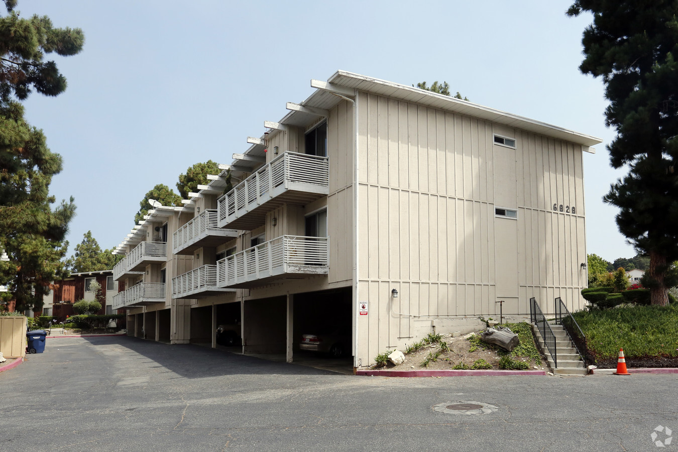
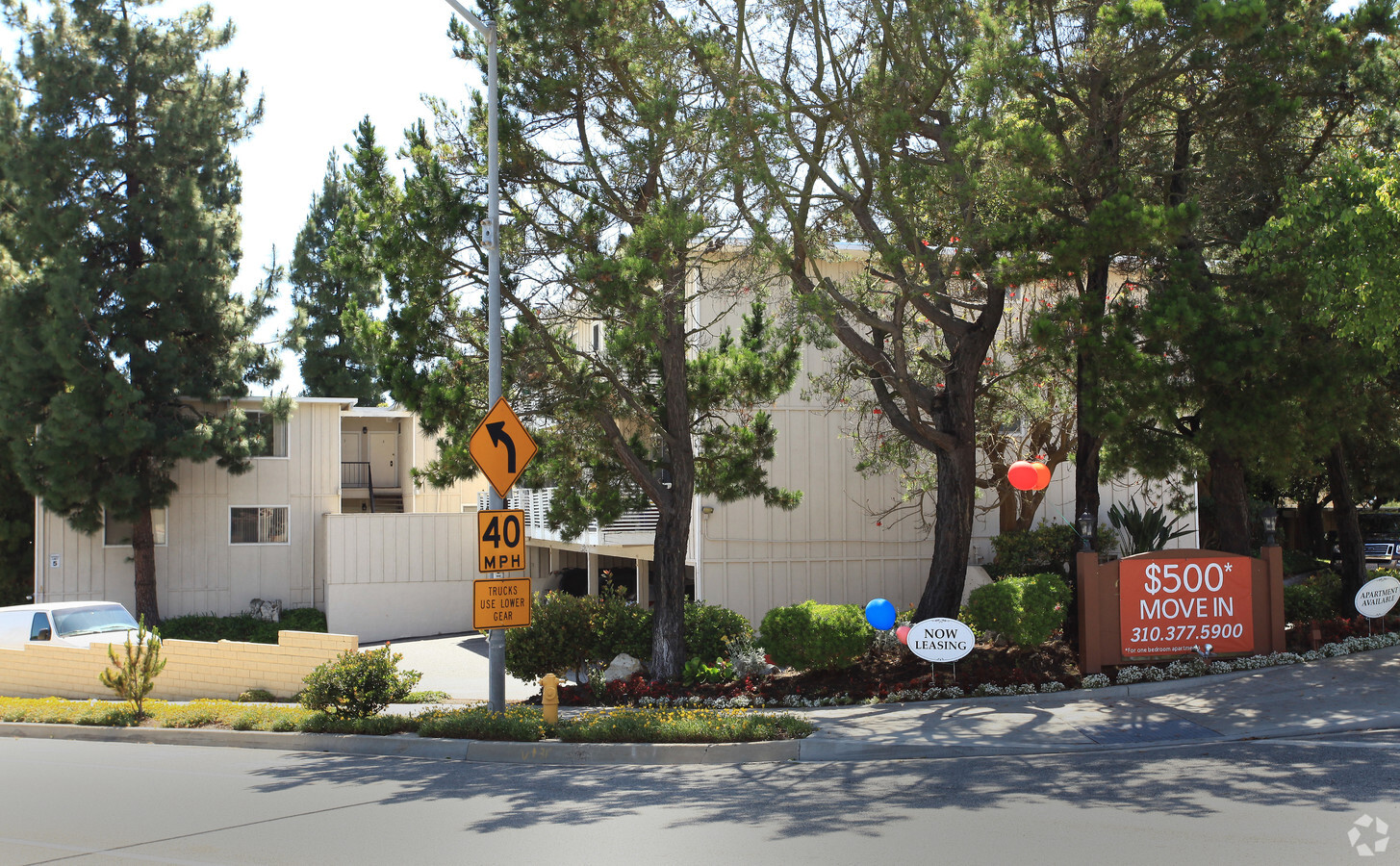
Property Record
6910 Los Verdes Dr, Rancho Palos Verdes, CA 90275
NEARBY LISTINGS FOR SALE OR LEASE
-
-
View all Rancho Palos Verdes listings for sale on LoopNet.com
Property Detail
6910 Los Verdes Dr
Los Angeles-Long Beach-Glendale, CA
32673
7588-018-004
*TR=L A CO ASSESSOR MAP NO 51*LOT COM AT MOST N COR OF LOT 5 TRACT NO 32673 TH N 5 453 W 207.25 FT TH N 74 0635 E 444.82 FT TH NE ON A CURVE CONCAVE TO NW (R=35FT) 23.97 FT TH N 34 5152 E TO LOT/SEC 78
Multifamilydwelling
Los Angeles
X
California
06037C1919H
78
2024
5.19 AC
2024
Rancho Palos Verdes
670416
Los Angeles
149,736 SF
DEMOGRAPHICS near 6910 Los Verdes Dr
1 Mile
3 Mile
5 Mile
2024 Total Population
8,805
41,626
105,935
2029 Population
8,541
40,487
103,016
Pop Growth 2024-2029
(3.00%)
(2.74%)
(2.76%)
Average Age
47
47
46
2024 Total Households
3,338
15,496
41,160
HH Growth 2024-2029
(3.27%)
(3.00%)
(2.97%)
Median Household Inc
$143,576
$167,312
$139,554
Avg Household Size
2.60
2.70
2.50
2024 Avg HH Vehicles
2.00
2.00
2.00
Median Home Value
$1,137,192
$1,128,529
$1,110,759
Median Year Built
1970
1967
1964
Nearby Places
- Restaurants
- Banks
- Shops
- Fitness
- Groceries
PUBLIC TRANSPORTATION
AIRPORT
Long Beach (Daugherty Field)
DRIVE
WALK
Distance
Long Beach (Daugherty Field)
31 min
17.7 mi
Los Angeles International
DRIVE
WALK
Distance
Los Angeles International
31 min
18.7 mi
Freight Ports
Port of Los Angeles
DRIVE
WALK
Distance
Port of Los Angeles
29 min
14.4 mi
Nearby Properties
Address
Land Use
TOTAL SIZE
Lot Size
Zoning
Address
Land Use
TOTAL SIZE
Lot Size
Zoning
459,495 SF
74.14 AC
RPCRSP-OHS
Address
Land Use
TOTAL SIZE
Lot Size
Zoning
67,570 SF
22.16 AC
RECG*
Address
Land Use
TOTAL SIZE
Lot Size
Zoning
116,441 SF
3.20 AC
RPRS1*
Address
Land Use
TOTAL SIZE
Lot Size
Zoning
77,289 SF
1.18 AC
RPRS
Address
Land Use
TOTAL SIZE
Lot Size
Zoning
76,899 SF
1.30 AC
RPRS
Address
Land Use
TOTAL SIZE
Lot Size
Zoning
309,175 SF
5.24 AC
RPI-OH*
Address
Land Use
TOTAL SIZE
Lot Size
Zoning
73,550 SF
0.96 AC
RPRM3600*
Address
Land Use
TOTAL SIZE
Lot Size
Zoning
170,865 SF
39.78 AC
RPI-OH*
Address
Land Use
TOTAL SIZE
Lot Size
Zoning
95,522 SF
4.56 AC
RPI-
Address
Land Use
TOTAL SIZE
Lot Size
Zoning
246,515 SF
5.06 AC
RPRM2000*
Address
Land Use
TOTAL SIZE
Lot Size
Zoning
16,272 SF
44.05 AC
LCRA20000*
Address
Land Use
TOTAL SIZE
Lot Size
Zoning
241,780 SF
3.86 AC
RPCN*
Address
Land Use
TOTAL SIZE
Lot Size
Zoning
148,950 SF
4.90 AC
RPRAIA
Address
Land Use
TOTAL SIZE
Lot Size
Zoning
3.42 AC
RECG
Address
Land Use
TOTAL SIZE
Lot Size
Zoning
133,834 SF
4.69 AC
RPRAIA
Address
Land Use
TOTAL SIZE
Lot Size
Zoning
135,633 SF
1.29 AC
RECG*
Address
Land Use
TOTAL SIZE
Lot Size
Zoning
45,324 SF
0.52 AC
PPRM3600*
Address
Land Use
TOTAL SIZE
Lot Size
Zoning
32,675 SF
0.78 AC
RECG
Address
Land Use
TOTAL SIZE
Lot Size
Zoning
23,361 SF
0.56 AC
PVRM*
Address
Land Use
TOTAL SIZE
Lot Size
Zoning
84,855 SF
1.62 AC
RECG*
Address
Land Use
TOTAL SIZE
Lot Size
Zoning
29,838 SF
0.61 AC
RECG*
Address
Land Use
TOTAL SIZE
Lot Size
Zoning
28,558 SF
2.52 AC
RPCN*
Address
Land Use
TOTAL SIZE
Lot Size
Zoning
10,738 SF
6.93 AC
RPRS1&E*
Address
Land Use
TOTAL SIZE
Lot Size
Zoning
95,995 SF
2.20 AC
RPRM2000*
Address
Land Use
TOTAL SIZE
Lot Size
Zoning
7.02 AC
RHRAS2
Address
Land Use
TOTAL SIZE
Lot Size
Zoning
5,914 SF
0.65 AC
RPCP*
Address
Land Use
TOTAL SIZE
Lot Size
Zoning
53,352 SF
0.87 AC
RPRM2000*
Address
Land Use
TOTAL SIZE
Lot Size
Zoning
51,070 SF
2.18 AC
RECG*
Address
Land Use
TOTAL SIZE
Lot Size
Zoning
100,099 SF
1.30 AC
RPRM2000*
The World's #1 Commercial Real Estate Marketplace
Connect with us
© 2025 CoStar Group
The information above has been obtained from sources believed reliable. While we do not doubt its accuracy we have not verified it and make no guarantee, warranty or representation about it. It is your responsibility to independently confirm its accuracy and completeness. Any projections, opinions, assumptions, or estimates used are for example only and do not represent the current or future performance of the property. The value of this transaction to you depends on tax and other factors which should be evaluated by your tax, financial, and legal advisors. You and your advisors should conduct a careful, independent investigation of the property to determine to your satisfaction the suitability of the property for your needs.