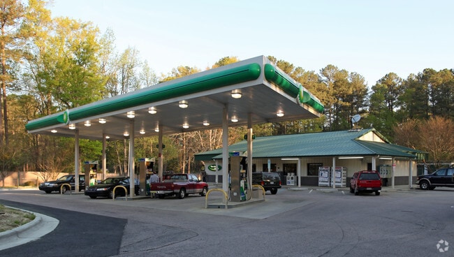
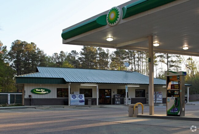
Property Record
6927 Buffaloe Rd, Raleigh, NC 27616

Property Detail
6927 Buffaloe Rd
1746.03-03-4839-000
UPCHURCH
Publicstorage
Wake
IX-3
North Carolina
B and X Area of moderate flood hazard, usually the area between the limits of the 100-year and 500-year floods.
1.85 AC
2025
Northeast Wake County
2025
Raleigh/Durham
054121
Raleigh-Cary, NC
11,750 SF
NEARBY LISTINGS FOR SALE OR LEASE
-
-
View all Raleigh listings for sale on LoopNet.com
DEMOGRAPHICS near 6927 Buffaloe Rd
1 mile
3 mile
5 mile
2025 Total Population
5,252
58,934
158,465
2030 Population
5,740
63,750
170,826
Pop Growth 2025-2030
+ 9.29%
+ 8.17%
+ 7.80%
Average Age
37
38
38
2025 Total Households
1,829
22,272
60,608
HH Growth 2025-2030
+ 9.79%
+ 8.58%
+ 8.24%
Median Household Inc
$97,572
$86,824
$82,245
Avg Household Size
2.80
2.60
2.60
2025 Avg HH Vehicles
2.00
2.00
2.00
Median Home Value
$379,633
$357,700
$356,553
Median Year Built
2008
2001
1999
Nearby Places
Map Layers
Map Styles
 Street
 Aerial
Layers
 Traffic
 Biking
Places
Listings with unknown addresses are not visible on the map
- Restaurants
- Banks
- Shops
- Fitness
- Groceries
PUBLIC TRANSPORTATION
COMMUTER RAIL
Raleigh Union Station (Piedmont - North Carolina by Train (NC Train))
Drive
Walk
Distance
Raleigh Union Station (Piedmont - North Carolina by Train (NC Train))
18 min
9.7 mi
AIRPORT
Raleigh-Durham International
Drive
Walk
Distance
Raleigh-Durham International
25 min
19.6 mi
Nearby Properties
Address
Land Use
TOTAL SIZE
Lot Size
Zoning
Address
Land Use
TOTAL SIZE
Lot Size
Zoning
817,723 SF
64.40 AC
OX-5
Address
Land Use
TOTAL SIZE
Lot Size
Zoning
354,131 SF
15.23 AC
RX-4
Address
Land Use
TOTAL SIZE
Lot Size
Zoning
368,475 SF
12.25 AC
CX-4
Address
Land Use
TOTAL SIZE
Lot Size
Zoning
401,268 SF
23.93 AC
CX-5
Address
Land Use
TOTAL SIZE
Lot Size
Zoning
306,259 SF
13.35 AC
RX-5
Address
Land Use
TOTAL SIZE
Lot Size
Zoning
298,512 SF
20.16 AC
RX-3
Address
Land Use
TOTAL SIZE
Lot Size
Zoning
299,388 SF
13.83 AC
CX-4
Address
Land Use
TOTAL SIZE
Lot Size
Zoning
217,961 SF
11.77 AC
CX-3
Address
Land Use
TOTAL SIZE
Lot Size
Zoning
454,156 SF
42.41 AC
R-10
Address
Land Use
TOTAL SIZE
Lot Size
Zoning
196,198 SF
29.21 AC
PD
Address
Land Use
TOTAL SIZE
Lot Size
Zoning
307,531 SF
16.73 AC
CX-4
Address
Land Use
TOTAL SIZE
Lot Size
Zoning
396,192 SF
38.57 AC
R-10
Address
Land Use
TOTAL SIZE
Lot Size
Zoning
201,826 SF
13.79 AC
CX-4
Address
Land Use
TOTAL SIZE
Lot Size
Zoning
306,561 SF
27.56 AC
CX-4
Address
Land Use
TOTAL SIZE
Lot Size
Zoning
364,094 SF
39.62 AC
R-10
Address
Land Use
TOTAL SIZE
Lot Size
Zoning
211,372 SF
38.26 AC
R-4
Address
Land Use
TOTAL SIZE
Lot Size
Zoning
155,079 SF
5.87 AC
PD
Address
Land Use
TOTAL SIZE
Lot Size
Zoning
208,072 SF
24.35 AC
RX-3
Address
Land Use
TOTAL SIZE
Lot Size
Zoning
179,100 SF
6.80 AC
PD
Address
Land Use
TOTAL SIZE
Lot Size
Zoning
145,944 SF
45.22 AC
OX-5
Address
Land Use
TOTAL SIZE
Lot Size
Zoning
216,103 SF
23.96 AC
R-6
Address
Land Use
TOTAL SIZE
Lot Size
Zoning
133,847 SF
47.62 AC
R-4
Address
Land Use
TOTAL SIZE
Lot Size
Zoning
93,494 SF
10.40 AC
R-10
Address
Land Use
TOTAL SIZE
Lot Size
Zoning
159,432 SF
8.60 AC
OX-3
Address
Land Use
TOTAL SIZE
Lot Size
Zoning
250,120 SF
17.38 AC
MI CD
Address
Land Use
TOTAL SIZE
Lot Size
Zoning
11,577 SF
114.41 AC
R-6
Address
Land Use
TOTAL SIZE
Lot Size
Zoning
157,049 SF
48.75 AC
R-10
Address
Land Use
TOTAL SIZE
Lot Size
Zoning
180,000 SF
24.61 AC
MI CD
Address
Land Use
TOTAL SIZE
Lot Size
Zoning
325,406 SF
18.84 AC
RX-3
Address
Land Use
TOTAL SIZE
Lot Size
Zoning
99,834 SF
21 AC
AP
The World's #1 Commercial Real Estate Marketplace
Connect with us
© 2026 CoStar Group
The information above has been obtained from sources believed reliable. While we do not doubt its accuracy we have not verified it and make no guarantee, warranty or representation about it. It is your responsibility to independently confirm its accuracy and completeness. Any projections, opinions, assumptions, or estimates used are for example only and do not represent the current or future performance of the property. The value of this transaction to you depends on tax and other factors which should be evaluated by your tax, financial, and legal advisors. You and your advisors should conduct a careful, independent investigation of the property to determine to your satisfaction the suitability of the property for your needs.