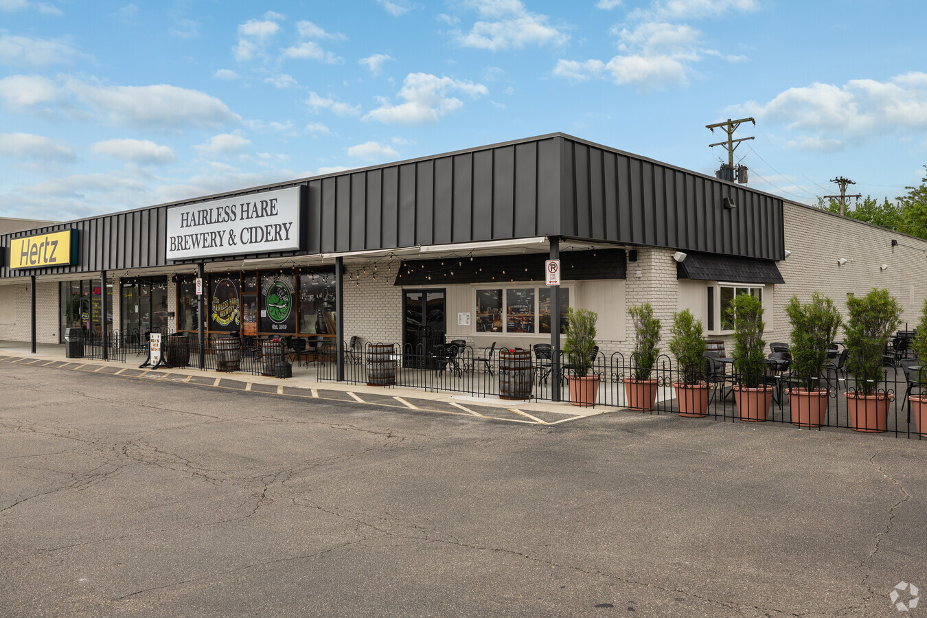
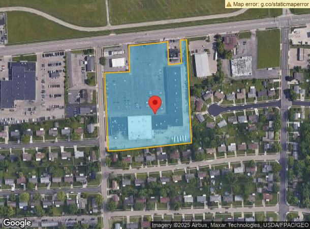
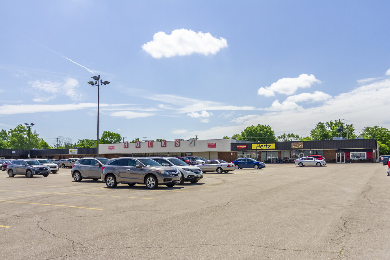
Property Record
694 W National Rd, Vandalia, OH 45377

NEARBY LISTINGS FOR SALE OR LEASE
Property Detail
694 W National Rd
Dayton, OH
Moraine Center Park
B02-00201-0048
6-3-16 2-1-5
Regionalshoppingcenterormallwithanchorstore
Montgomery
X
Ohio
39109C0265E
48
2023
6.42 AC
2024
North Dayton
115011
Cincinnati/Dayton
59,122 SF
DEMOGRAPHICS near 694 W National Rd
1 Mile
3 Mile
5 Mile
2024 Total Population
6,154
18,847
62,786
2029 Population
6,027
18,420
62,190
Pop Growth 2024-2029
(2.06%)
(2.27%)
(0.95%)
Average Age
41
43
42
2024 Total Households
2,878
8,221
26,167
HH Growth 2024-2029
(2.08%)
(2.29%)
(1.10%)
Median Household Inc
$66,061
$76,032
$70,682
Avg Household Size
2.10
2.30
2.30
2024 Avg HH Vehicles
2.00
2.00
2.00
Median Home Value
$157,368
$190,848
$182,759
Median Year Built
1966
1970
1972
Nearby Places
- Restaurants
- Banks
- Shops
- Fitness
- Groceries
PUBLIC TRANSPORTATION
AIRPORT
James M Cox Dayton International
DRIVE
WALK
Distance
James M Cox Dayton International
6 min
2.5 mi
Freight Ports
Port of Toledo
DRIVE
WALK
Distance
Port of Toledo
168 min
145.0 mi
SALE & LEASE HISTORY
LISTING DATE
SALE/LEASE

Sep 25, 2016
For Lease
Sep 23, 2016
For Sale
Sep 07, 2018
For Sale
Jun 16, 2021
For Lease
Jul 24, 2019
For Sale
Jul 17, 2018
For Sale
Jul 14, 2023
For Lease
Apr 07, 2017
For Lease
Nearby Properties
Address
Land Use
TOTAL SIZE
Lot Size
Zoning
Address
Land Use
TOTAL SIZE
Lot Size
Zoning
1,841,033 SF
129.70 AC
Address
Land Use
TOTAL SIZE
Lot Size
Zoning
551,408 SF
71 AC
Address
Land Use
TOTAL SIZE
Lot Size
Zoning
1,059,902 SF
56.13 AC
Address
Land Use
TOTAL SIZE
Lot Size
Zoning
573,962 SF
879.20 AC
Address
Land Use
TOTAL SIZE
Lot Size
Zoning
634,247 SF
86.18 AC
Address
Land Use
TOTAL SIZE
Lot Size
Zoning
834,238 SF
42.04 AC
Address
Land Use
TOTAL SIZE
Lot Size
Zoning
704,988 SF
49.15 AC
Address
Land Use
TOTAL SIZE
Lot Size
Zoning
1,841,033 SF
129.70 AC
Address
Land Use
TOTAL SIZE
Lot Size
Zoning
527,904 SF
75.35 AC
Address
Land Use
TOTAL SIZE
Lot Size
Zoning
37.86 AC
Address
Land Use
TOTAL SIZE
Lot Size
Zoning
597,314 SF
38.27 AC
Address
Land Use
TOTAL SIZE
Lot Size
Zoning
730,000 SF
56.40 AC
Address
Land Use
TOTAL SIZE
Lot Size
Zoning
522,340 SF
36.59 AC
Address
Land Use
TOTAL SIZE
Lot Size
Zoning
45,980 SF
6.04 AC
Address
Land Use
TOTAL SIZE
Lot Size
Zoning
433,792 SF
34.46 AC
Address
Land Use
TOTAL SIZE
Lot Size
Zoning
425,641 SF
33.79 AC
Address
Land Use
TOTAL SIZE
Lot Size
Zoning
730,000 SF
56.40 AC
Address
Land Use
TOTAL SIZE
Lot Size
Zoning
12,660 SF
20.22 AC
Address
Land Use
TOTAL SIZE
Lot Size
Zoning
Address
Land Use
TOTAL SIZE
Lot Size
Zoning
172,753 SF
23.76 AC
Address
Land Use
TOTAL SIZE
Lot Size
Zoning
143,980 SF
35.40 AC
Address
Land Use
TOTAL SIZE
Lot Size
Zoning
222,799 SF
13.74 AC
Address
Land Use
TOTAL SIZE
Lot Size
Zoning
94,671 SF
6.42 AC
Address
Land Use
TOTAL SIZE
Lot Size
Zoning
179,704 SF
18.68 AC
Address
Land Use
TOTAL SIZE
Lot Size
Zoning
76,156 SF
97.13 AC
Address
Land Use
TOTAL SIZE
Lot Size
Zoning
92,985 SF
14.50 AC
Address
Land Use
TOTAL SIZE
Lot Size
Zoning
Address
Land Use
TOTAL SIZE
Lot Size
Zoning
126,038 SF
13.78 AC
Address
Land Use
TOTAL SIZE
Lot Size
Zoning
184,413 SF
9.39 AC
Address
Land Use
TOTAL SIZE
Lot Size
Zoning
165,018 SF
19.77 AC
The World's #1 Commercial Real Estate Marketplace
Connect with us
© 2025 CoStar Group
The information above has been obtained from sources believed reliable. While we do not doubt its accuracy we have not verified it and make no guarantee, warranty or representation about it. It is your responsibility to independently confirm its accuracy and completeness. Any projections, opinions, assumptions, or estimates used are for example only and do not represent the current or future performance of the property. The value of this transaction to you depends on tax and other factors which should be evaluated by your tax, financial, and legal advisors. You and your advisors should conduct a careful, independent investigation of the property to determine to your satisfaction the suitability of the property for your needs.