Property Record
6945 Indiana Ct, Arvada, CO 80007
NEARBY LISTINGS FOR SALE OR LEASE
Property Detail
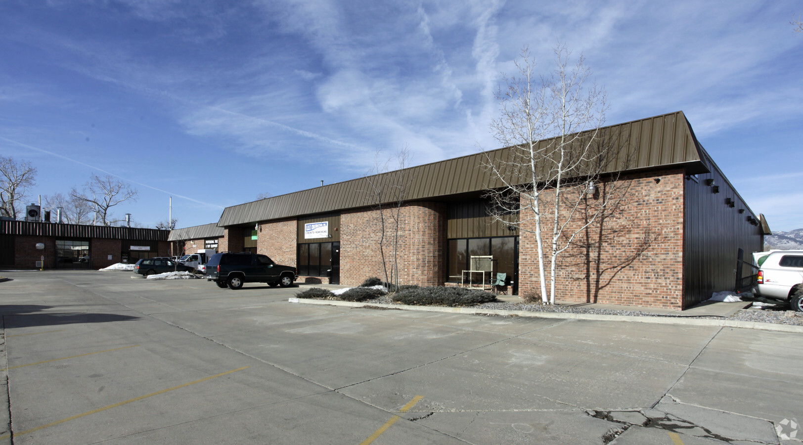
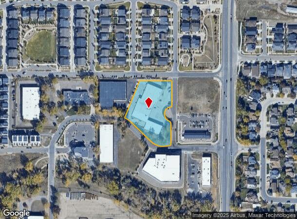
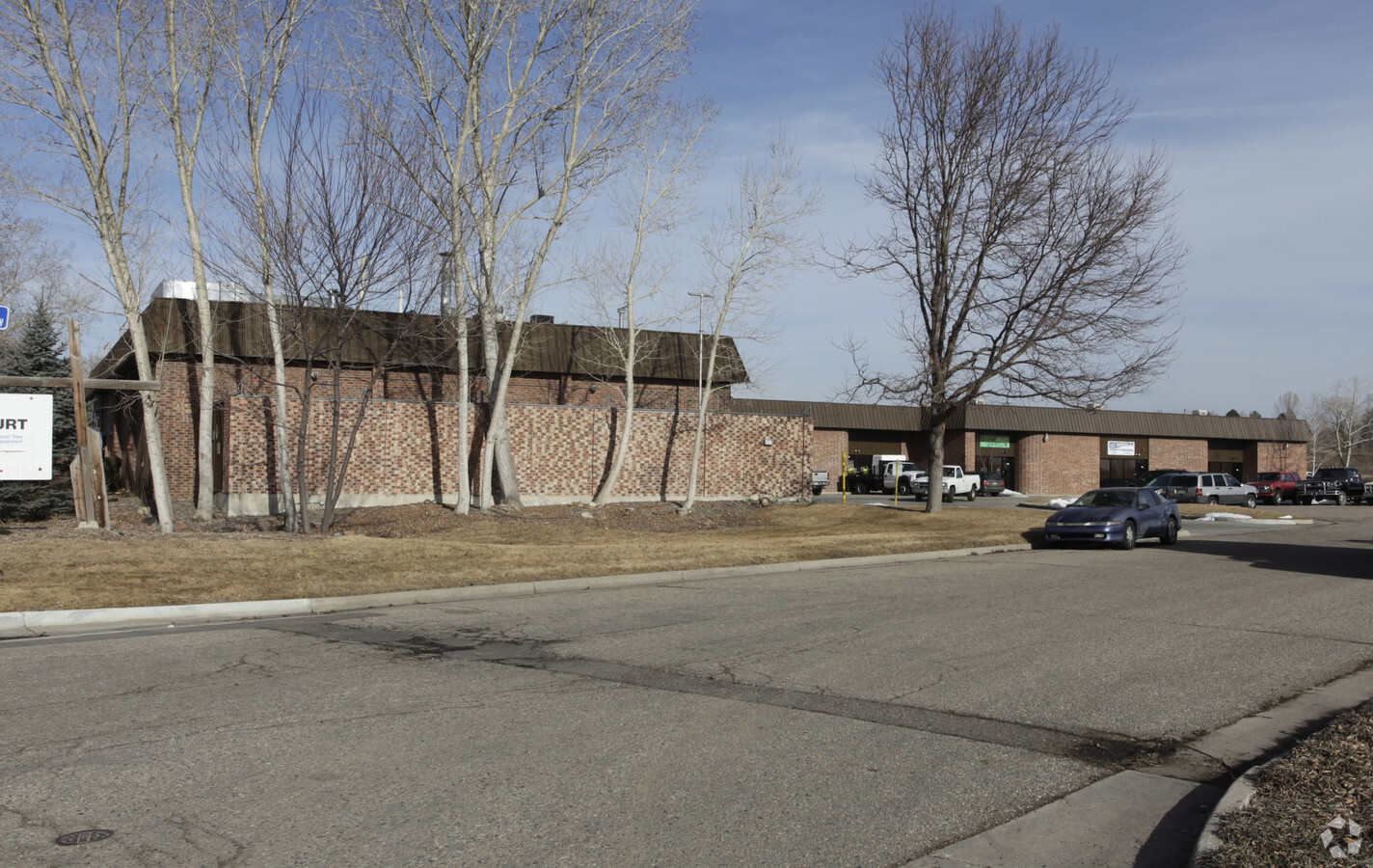
6945 Indiana Ct
Denver-Aurora-Lakewood, CO
Cottonwood Park In Ralston Valley
30-011-01-003
SECTION 01 TOWNSHIP 03 RANGE 70 QTR NE SUBDIVISIONCD 168200 SUBDIVISIONNAME COTTONWOOD PARK IN RALSTON VALLEY BLOCK LOT 0003 SIZE: 83504 TRACT VALUE: 1.917
Industrialgeneral
Jefferson
AE
Colorado
08059C0183G
3
2023
1.92 AC
2024
West Denver
009838
Denver
28,755 SF
DEMOGRAPHICS near 6945 Indiana Ct
1 Mile
3 Mile
5 Mile
2024 Total Population
8,474
58,916
142,342
2029 Population
8,331
58,041
140,833
Pop Growth 2024-2029
(1.69%)
(1.49%)
(1.06%)
Average Age
43
43
42
2024 Total Households
3,192
22,319
56,997
HH Growth 2024-2029
(1.88%)
(1.57%)
(1.14%)
Median Household Inc
$123,466
$125,599
$106,036
Avg Household Size
2.60
2.60
2.40
2024 Avg HH Vehicles
2.00
2.00
2.00
Median Home Value
$652,343
$680,344
$613,852
Median Year Built
1992
1990
1980
Nearby Places
- Restaurants
- Banks
- Shops
- Fitness
- Groceries
PUBLIC TRANSPORTATION
COMMUTER RAIL
Wheat Ridge - Ward Station Track 1 (Union Station to Wheat Ridge Ward Station - Regional Transportation District)
DRIVE
WALK
Distance
Wheat Ridge - Ward Station Track 1 (Union Station to Wheat Ridge Ward Station - Regional Transportation District)
8 min
4.2 mi
Arvada Ridge Station Track 1 (Union Station to Wheat Ridge Ward Station - Regional Transportation District)
DRIVE
WALK
Distance
Arvada Ridge Station Track 1 (Union Station to Wheat Ridge Ward Station - Regional Transportation District)
8 min
5.0 mi
AIRPORT
Denver International
DRIVE
WALK
Distance
Denver International
45 min
34.4 mi
Freight Ports
Tulsa Port Of Catoosa
DRIVE
WALK
Distance
Tulsa Port Of Catoosa
742 min
719.9 mi
Nearby Properties
Address
Land Use
TOTAL SIZE
Lot Size
Zoning
Address
Land Use
TOTAL SIZE
Lot Size
Zoning
269,013 SF
31.89 AC
Address
Land Use
TOTAL SIZE
Lot Size
Zoning
253,643 SF
50.87 AC
A2
Address
Land Use
TOTAL SIZE
Lot Size
Zoning
227,132 SF
11.95 AC
Address
Land Use
TOTAL SIZE
Lot Size
Zoning
215,878 SF
11.82 AC
A2
Address
Land Use
TOTAL SIZE
Lot Size
Zoning
131,135 SF
2.83 AC
Address
Land Use
TOTAL SIZE
Lot Size
Zoning
363,989 SF
30.10 AC
Address
Land Use
TOTAL SIZE
Lot Size
Zoning
101,761 SF
4.34 AC
Address
Land Use
TOTAL SIZE
Lot Size
Zoning
64,883 SF
4.74 AC
Address
Land Use
TOTAL SIZE
Lot Size
Zoning
82,055 SF
19.39 AC
Address
Land Use
TOTAL SIZE
Lot Size
Zoning
68,300 SF
6 AC
Address
Land Use
TOTAL SIZE
Lot Size
Zoning
67,520 SF
6.46 AC
Address
Land Use
TOTAL SIZE
Lot Size
Zoning
51,987 SF
15.23 AC
PD
Address
Land Use
TOTAL SIZE
Lot Size
Zoning
83,684 SF
8.15 AC
Address
Land Use
TOTAL SIZE
Lot Size
Zoning
50,852 SF
3.94 AC
Address
Land Use
TOTAL SIZE
Lot Size
Zoning
201,582 SF
5.78 AC
Address
Land Use
TOTAL SIZE
Lot Size
Zoning
123,448 SF
7.80 AC
Address
Land Use
TOTAL SIZE
Lot Size
Zoning
67,879 SF
9.91 AC
A2
Address
Land Use
TOTAL SIZE
Lot Size
Zoning
68,500 SF
5.84 AC
Address
Land Use
TOTAL SIZE
Lot Size
Zoning
113,455 SF
7.98 AC
Address
Land Use
TOTAL SIZE
Lot Size
Zoning
175,599 SF
17.23 AC
Address
Land Use
TOTAL SIZE
Lot Size
Zoning
110,235 SF
2.32 AC
Address
Land Use
TOTAL SIZE
Lot Size
Zoning
62,604 SF
75.98 AC
Address
Land Use
TOTAL SIZE
Lot Size
Zoning
188,494 SF
15.14 AC
Address
Land Use
TOTAL SIZE
Lot Size
Zoning
68,060 SF
12 AC
A2
Address
Land Use
TOTAL SIZE
Lot Size
Zoning
83,450 SF
7.22 AC
Address
Land Use
TOTAL SIZE
Lot Size
Zoning
64,050 SF
6.07 AC
Address
Land Use
TOTAL SIZE
Lot Size
Zoning
121,192 SF
12.43 AC
Address
Land Use
TOTAL SIZE
Lot Size
Zoning
44,797 SF
4.35 AC
Address
Land Use
TOTAL SIZE
Lot Size
Zoning
52,730 SF
4.53 AC
Address
Land Use
TOTAL SIZE
Lot Size
Zoning
101,250 SF
8.90 AC
The World's #1 Commercial Real Estate Marketplace
Connect with us
© 2025 CoStar Group
The information above has been obtained from sources believed reliable. While we do not doubt its accuracy we have not verified it and make no guarantee, warranty or representation about it. It is your responsibility to independently confirm its accuracy and completeness. Any projections, opinions, assumptions, or estimates used are for example only and do not represent the current or future performance of the property. The value of this transaction to you depends on tax and other factors which should be evaluated by your tax, financial, and legal advisors. You and your advisors should conduct a careful, independent investigation of the property to determine to your satisfaction the suitability of the property for your needs.