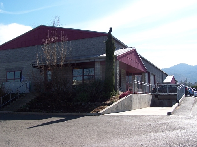
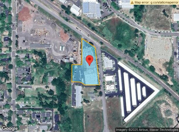
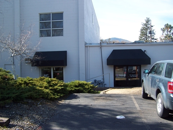
Property Record
695 Mistletoe Rd, Ashland, OR 97520

NEARBY LISTINGS FOR SALE OR LEASE
Property Detail
695 Mistletoe Rd
10080710
Partition Plat No P-10-1012
Commercialbuilding
Jackson
A
Oregon
41029C2216G
1.80 AC
2023
Medford/Grants Pass
2024
Other Market Areas
001801
Medford, OR
40,260 SF
DEMOGRAPHICS near 695 Mistletoe Rd
1 Mile
3 Mile
5 Mile
2024 Total Population
7,903
22,901
27,507
2029 Population
8,175
23,513
28,133
Pop Growth 2024-2029
+ 3.44%
+ 2.67%
+ 2.28%
Average Age
45
44
44
2024 Total Households
3,843
10,553
12,647
HH Growth 2024-2029
+ 3.41%
+ 2.88%
+ 2.44%
Median Household Inc
$64,515
$60,958
$64,978
Avg Household Size
2.00
2.00
2.00
2024 Avg HH Vehicles
2.00
2.00
2.00
Median Home Value
$482,600
$544,159
$557,537
Median Year Built
1990
1986
1984
Nearby Places
- Restaurants
- Banks
- Shops
- Fitness
- Groceries
PUBLIC TRANSPORTATION
AIRPORT
Rogue Valley International - Medford
DRIVE
WALK
Distance
Rogue Valley International - Medford
26 min
18.7 mi
Freight Ports
Port of Coos Bay, OR
DRIVE
WALK
Distance
Port of Coos Bay, OR
235 min
180.0 mi
SALE & LEASE HISTORY
LISTING DATE
SALE/LEASE

Apr 04, 2018
For Sale
Nearby Properties
Address
Land Use
TOTAL SIZE
Lot Size
Zoning
Address
Land Use
TOTAL SIZE
Lot Size
Zoning
17.46 AC
SO
Address
Land Use
TOTAL SIZE
Lot Size
Zoning
78,000 SF
15.17 AC
SO
Address
Land Use
TOTAL SIZE
Lot Size
Zoning
25,300 SF
14.69 AC
SO
Address
Land Use
TOTAL SIZE
Lot Size
Zoning
21.36 AC
SO
Address
Land Use
TOTAL SIZE
Lot Size
Zoning
25.14 AC
R-1-5
Address
Land Use
TOTAL SIZE
Lot Size
Zoning
9.73 AC
R-1-5
Address
Land Use
TOTAL SIZE
Lot Size
Zoning
11.04 AC
SO
Address
Land Use
TOTAL SIZE
Lot Size
Zoning
80 AC
WR-20
Address
Land Use
TOTAL SIZE
Lot Size
Zoning
12.05 AC
R-2
Address
Land Use
TOTAL SIZE
Lot Size
Zoning
29.34 AC
SO
Address
Land Use
TOTAL SIZE
Lot Size
Zoning
123,060 SF
7.22 AC
SO
Address
Land Use
TOTAL SIZE
Lot Size
Zoning
3.46 AC
R-2
Address
Land Use
TOTAL SIZE
Lot Size
Zoning
196,614 SF
10.05 AC
C-1
Address
Land Use
TOTAL SIZE
Lot Size
Zoning
43,034 SF
0.96 AC
C-1-D
Address
Land Use
TOTAL SIZE
Lot Size
Zoning
26,208 SF
2.85 AC
HC
Address
Land Use
TOTAL SIZE
Lot Size
Zoning
320,862 SF
5.91 AC
C-1
Address
Land Use
TOTAL SIZE
Lot Size
Zoning
21,098 SF
56.38 AC
EFU
Address
Land Use
TOTAL SIZE
Lot Size
Zoning
6,633 SF
1.70 AC
C-1
Address
Land Use
TOTAL SIZE
Lot Size
Zoning
5.71 AC
FR
Address
Land Use
TOTAL SIZE
Lot Size
Zoning
20.03 AC
WR-20
Address
Land Use
TOTAL SIZE
Lot Size
Zoning
0.37 AC
C-1-D
Address
Land Use
TOTAL SIZE
Lot Size
Zoning
18.84 AC
WR-20
Address
Land Use
TOTAL SIZE
Lot Size
Zoning
56,386 SF
2.98 AC
C-1
Address
Land Use
TOTAL SIZE
Lot Size
Zoning
40,673 SF
2.72 AC
C-1
Address
Land Use
TOTAL SIZE
Lot Size
Zoning
26,966 SF
3.42 AC
E-1
Address
Land Use
TOTAL SIZE
Lot Size
Zoning
65,160 SF
4.82 AC
E-1
Address
Land Use
TOTAL SIZE
Lot Size
Zoning
42,033 SF
8.48 AC
E-1
Address
Land Use
TOTAL SIZE
Lot Size
Zoning
104,679 SF
3.59 AC
R-3
Address
Land Use
TOTAL SIZE
Lot Size
Zoning
0.53 AC
RR-5
Address
Land Use
TOTAL SIZE
Lot Size
Zoning
45,096 SF
2.57 AC
R-2
The World's #1 Commercial Real Estate Marketplace
Connect with us
© 2025 CoStar Group
The information above has been obtained from sources believed reliable. While we do not doubt its accuracy we have not verified it and make no guarantee, warranty or representation about it. It is your responsibility to independently confirm its accuracy and completeness. Any projections, opinions, assumptions, or estimates used are for example only and do not represent the current or future performance of the property. The value of this transaction to you depends on tax and other factors which should be evaluated by your tax, financial, and legal advisors. You and your advisors should conduct a careful, independent investigation of the property to determine to your satisfaction the suitability of the property for your needs.