Property Record
6952 John R Rd, Troy, MI 48085


NEARBY LISTINGS FOR SALE OR LEASE
Property Detail
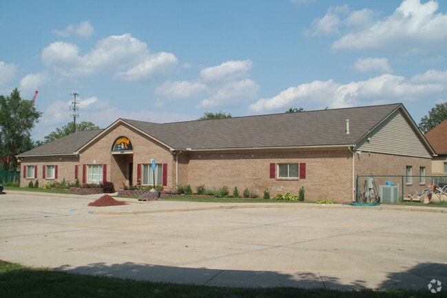
6952 John R Rd
Detroit-Warren-Dearborn, MI
Supervisors Plat Of John Arbor
20-01-101-041
T2N, R11E, SEC 1 SUPERVISOR'S PLAT OF JOHN ARBOR SUB LOTS 384 TO 394 INCL11-30-93 FR 029, 030 & 031
Commercialnec
Oakland
X
Michigan
26125C0551F
384-394
2024
0.87 AC
2022
Troy North
196000
Detroit
5,263 SF
DEMOGRAPHICS near 6952 John R Rd
1 Mile
3 Mile
5 Mile
2024 Total Population
6,903
77,817
211,292
2029 Population
6,799
76,988
209,051
Pop Growth 2024-2029
(1.51%)
(1.07%)
(1.06%)
Average Age
40
41
42
2024 Total Households
2,622
30,004
81,720
HH Growth 2024-2029
(1.49%)
(1.09%)
(1.07%)
Median Household Inc
$109,535
$98,534
$91,759
Avg Household Size
2.60
2.50
2.50
2024 Avg HH Vehicles
2.00
2.00
2.00
Median Home Value
$353,452
$324,039
$310,280
Median Year Built
1984
1985
1979
Nearby Places
Map Layers
Map Styles
 Street
 Aerial
- Restaurants
- Banks
- Shops
- Fitness
- Groceries
PUBLIC TRANSPORTATION
COMMUTER RAIL
DRIVE
WALK
Distance
19 min
9.8 mi
AIRPORT
Windsor International
DRIVE
WALK
Distance
Windsor International
54 min
31.3 mi
Detroit Metro Wayne County
DRIVE
WALK
Distance
Detroit Metro Wayne County
58 min
40.9 mi
Bishop International
DRIVE
WALK
Distance
Bishop International
65 min
48.2 mi
SALE & LEASE HISTORY
LISTING DATE
SALE/LEASE

Sep 15, 2021
For Sale
Nearby Properties
Address
Land Use
TOTAL SIZE
Lot Size
Zoning
Address
Land Use
TOTAL SIZE
Lot Size
Zoning
12.38 AC
R-10
Address
Land Use
TOTAL SIZE
Lot Size
Zoning
46.56 AC
CK MAP
Address
Land Use
TOTAL SIZE
Lot Size
Zoning
144,450 SF
11.22 AC
OSC
Address
Land Use
TOTAL SIZE
Lot Size
Zoning
144,450 SF
11.22 AC
Address
Land Use
TOTAL SIZE
Lot Size
Zoning
136,962 SF
43.80 AC
OSC
Address
Land Use
TOTAL SIZE
Lot Size
Zoning
1,150 SF
25.68 AC
CK MAP
Address
Land Use
TOTAL SIZE
Lot Size
Zoning
242,857 SF
9.61 AC
RM-3
Address
Land Use
TOTAL SIZE
Lot Size
Zoning
34.43 AC
CK MAP
Address
Land Use
TOTAL SIZE
Lot Size
Zoning
41.09 AC
R-7
Address
Land Use
TOTAL SIZE
Lot Size
Zoning
27.89 AC
CK MAP
Address
Land Use
TOTAL SIZE
Lot Size
Zoning
28.58 AC
AI
Address
Land Use
TOTAL SIZE
Lot Size
Zoning
203,282 SF
17.13 AC
C-2
Address
Land Use
TOTAL SIZE
Lot Size
Zoning
336,720 SF
63.11 AC
CR1
Address
Land Use
TOTAL SIZE
Lot Size
Zoning
255,070 SF
20.33 AC
RM-2
Address
Land Use
TOTAL SIZE
Lot Size
Zoning
22.09 AC
AI
Address
Land Use
TOTAL SIZE
Lot Size
Zoning
19.47 AC
R-8
Address
Land Use
TOTAL SIZE
Lot Size
Zoning
43.80 AC
Address
Land Use
TOTAL SIZE
Lot Size
Zoning
29.39 AC
CK MAP
Address
Land Use
TOTAL SIZE
Lot Size
Zoning
1,350 SF
21.90 AC
CK MAP
Address
Land Use
TOTAL SIZE
Lot Size
Zoning
106,130 SF
5.37 AC
O-2
Address
Land Use
TOTAL SIZE
Lot Size
Zoning
21.52 AC
AI
Address
Land Use
TOTAL SIZE
Lot Size
Zoning
19.30 AC
CK MAP
Address
Land Use
TOTAL SIZE
Lot Size
Zoning
128,364 SF
40.11 AC
C-4
Address
Land Use
TOTAL SIZE
Lot Size
Zoning
51.98 AC
MHP
Address
Land Use
TOTAL SIZE
Lot Size
Zoning
12.22 AC
RM-2
Address
Land Use
TOTAL SIZE
Lot Size
Zoning
11.98 AC
RI
Address
Land Use
TOTAL SIZE
Lot Size
Zoning
89,460 SF
7.31 AC
BI
Address
Land Use
TOTAL SIZE
Lot Size
Zoning
Address
Land Use
TOTAL SIZE
Lot Size
Zoning
101,749 SF
11.15 AC
C-2
The World's #1 Commercial Real Estate Marketplace
Connect with us
© 2025 CoStar Group
The information above has been obtained from sources believed reliable. While we do not doubt its accuracy we have not verified it and make no guarantee, warranty or representation about it. It is your responsibility to independently confirm its accuracy and completeness. Any projections, opinions, assumptions, or estimates used are for example only and do not represent the current or future performance of the property. The value of this transaction to you depends on tax and other factors which should be evaluated by your tax, financial, and legal advisors. You and your advisors should conduct a careful, independent investigation of the property to determine to your satisfaction the suitability of the property for your needs.