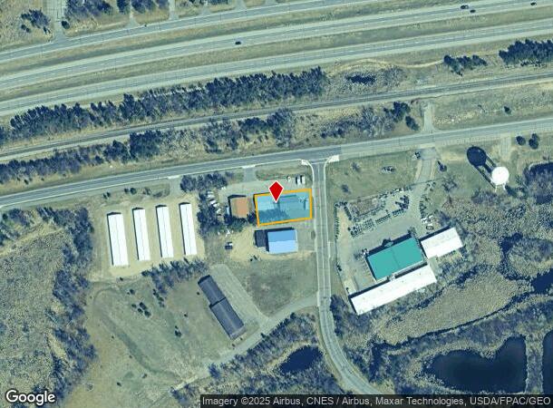
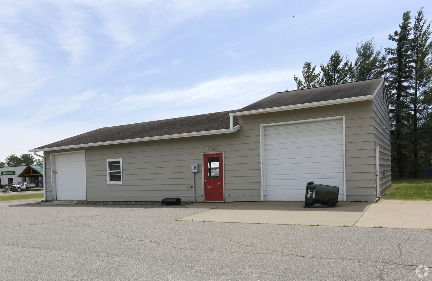
Property Record
6961 Foley Rd, Baxter, MN 56425

NEARBY LISTINGS FOR SALE OR LEASE
Property Detail
6961 Foley Rd
010072400EB0009
PT OF SE1/4 OF NW1/4 OF SEC 7 DESC AS FOL: COMM AT THE SE COR OF SD NW1/4 SD SE COR BEING N 1D 12'47
Lightindustrial
Crow Wing
X
Minnesota
27035C0510C
0.32 AC
2024
Minnesota Central Area
2024
Other Market Areas
951304
Brainerd, MN
1,680 SF
DEMOGRAPHICS near 6961 Foley Rd
1 Mile
3 Mile
5 Mile
2024 Total Population
2,230
14,834
25,597
2029 Population
2,333
15,479
26,704
Pop Growth 2024-2029
+ 4.62%
+ 4.35%
+ 4.32%
Average Age
40
40
40
2024 Total Households
890
6,078
10,286
HH Growth 2024-2029
+ 4.27%
+ 4.00%
+ 4.00%
Median Household Inc
$54,271
$58,435
$57,886
Avg Household Size
2.40
2.30
2.30
2024 Avg HH Vehicles
2.00
2.00
2.00
Median Home Value
$207,975
$197,699
$193,537
Median Year Built
2001
1986
1984
Nearby Places
- Restaurants
- Banks
- Shops
- Fitness
- Groceries
SALE & LEASE HISTORY
LISTING DATE
SALE/LEASE

Jun 29, 2017
For Lease
Nearby Properties
Address
Land Use
TOTAL SIZE
Lot Size
Zoning
Address
Land Use
TOTAL SIZE
Lot Size
Zoning
320,708 SF
35.89 AC
Address
Land Use
TOTAL SIZE
Lot Size
Zoning
3,829 SF
1.04 AC
Address
Land Use
TOTAL SIZE
Lot Size
Zoning
344,274 SF
163.56 AC
Address
Land Use
TOTAL SIZE
Lot Size
Zoning
186,000 SF
8.71 AC
Address
Land Use
TOTAL SIZE
Lot Size
Zoning
229,123 SF
11.84 AC
Address
Land Use
TOTAL SIZE
Lot Size
Zoning
128,295 SF
2.08 AC
Address
Land Use
TOTAL SIZE
Lot Size
Zoning
110,624 SF
5.62 AC
Address
Land Use
TOTAL SIZE
Lot Size
Zoning
33,460 SF
94.30 AC
Address
Land Use
TOTAL SIZE
Lot Size
Zoning
91,464 SF
4.83 AC
Address
Land Use
TOTAL SIZE
Lot Size
Zoning
63,251 SF
8.27 AC
Address
Land Use
TOTAL SIZE
Lot Size
Zoning
50,741 SF
8.09 AC
Address
Land Use
TOTAL SIZE
Lot Size
Zoning
83,078 SF
9.71 AC
Address
Land Use
TOTAL SIZE
Lot Size
Zoning
2.96 AC
Address
Land Use
TOTAL SIZE
Lot Size
Zoning
55,953 SF
14.52 AC
Address
Land Use
TOTAL SIZE
Lot Size
Zoning
90,147 SF
12.93 AC
Address
Land Use
TOTAL SIZE
Lot Size
Zoning
57,426 SF
2.61 AC
Address
Land Use
TOTAL SIZE
Lot Size
Zoning
79,048 SF
5.33 AC
Address
Land Use
TOTAL SIZE
Lot Size
Zoning
147,014 SF
15.71 AC
Address
Land Use
TOTAL SIZE
Lot Size
Zoning
69,515 SF
2.14 AC
Address
Land Use
TOTAL SIZE
Lot Size
Zoning
66,967 SF
2.95 AC
Address
Land Use
TOTAL SIZE
Lot Size
Zoning
68,643 SF
2.34 AC
Address
Land Use
TOTAL SIZE
Lot Size
Zoning
64,187 SF
3.47 AC
Address
Land Use
TOTAL SIZE
Lot Size
Zoning
87,007 SF
4.97 AC
Address
Land Use
TOTAL SIZE
Lot Size
Zoning
270,176 SF
17.13 AC
Address
Land Use
TOTAL SIZE
Lot Size
Zoning
209,815 SF
22.30 AC
Address
Land Use
TOTAL SIZE
Lot Size
Zoning
30,819 SF
9.36 AC
Address
Land Use
TOTAL SIZE
Lot Size
Zoning
50,344 SF
12.62 AC
Address
Land Use
TOTAL SIZE
Lot Size
Zoning
68,564 SF
3.41 AC
Address
Land Use
TOTAL SIZE
Lot Size
Zoning
38,487 SF
2.78 AC
Address
Land Use
TOTAL SIZE
Lot Size
Zoning
64,719 SF
2.06 AC
The World's #1 Commercial Real Estate Marketplace
Connect with us
© 2025 CoStar Group
The information above has been obtained from sources believed reliable. While we do not doubt its accuracy we have not verified it and make no guarantee, warranty or representation about it. It is your responsibility to independently confirm its accuracy and completeness. Any projections, opinions, assumptions, or estimates used are for example only and do not represent the current or future performance of the property. The value of this transaction to you depends on tax and other factors which should be evaluated by your tax, financial, and legal advisors. You and your advisors should conduct a careful, independent investigation of the property to determine to your satisfaction the suitability of the property for your needs.