Property Record
7 Main St, Livonia, NY 14487


NEARBY LISTINGS FOR SALE OR LEASE
-
-
View all Livonia listings for sale on LoopNet.com
Property Detail
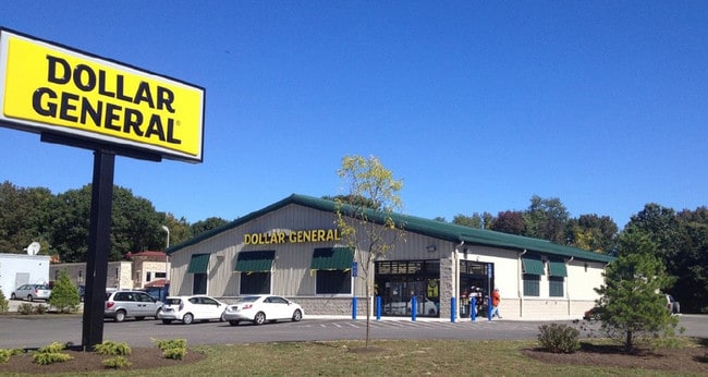
7 Main St
Rochester, NY
Livingston
243401-075-005-0001-011-011-0000
New York
Storesoffices
11.011
2025
1 AC
2024
Livingston County
030702
Rochester
9,600 SF
DEMOGRAPHICS near 7 Main St
1 Mile
3 Mile
5 Mile
2024 Total Population
1,972
6,310
10,619
2029 Population
1,951
6,269
10,576
Pop Growth 2024-2029
(1.06%)
(0.65%)
(0.40%)
Average Age
42
44
44
2024 Total Households
791
2,666
4,463
HH Growth 2024-2029
(1.14%)
(0.60%)
(0.34%)
Median Household Inc
$74,914
$79,874
$78,061
Avg Household Size
2.40
2.30
2.30
2024 Avg HH Vehicles
2.00
2.00
2.00
Median Home Value
$170,494
$181,147
$184,996
Median Year Built
1978
1979
1978
Nearby Places
Map Layers
Map Styles
 Street
 Aerial
- Restaurants
- Banks
- Shops
- Fitness
- Groceries
PUBLIC TRANSPORTATION
AIRPORT
Frederick Douglass/Greater Rochester International
DRIVE
WALK
Distance
Frederick Douglass/Greater Rochester International
35 min
25.2 mi
Freight Ports
Albany, NY Port
DRIVE
WALK
Distance
Albany, NY Port
284 min
233.9 mi
SALE & LEASE HISTORY
LISTING DATE
SALE/LEASE

Sep 17, 2020
For Sale
Oct 30, 2018
For Sale
Jul 11, 2019
For Sale
Jul 07, 2017
For Sale
Nearby Properties
Address
Land Use
TOTAL SIZE
Lot Size
Zoning
Address
Land Use
TOTAL SIZE
Lot Size
Zoning
62,984 SF
42 AC
01 - NOT Z
Address
Land Use
TOTAL SIZE
Lot Size
Zoning
31,698 SF
12 AC
02 - SINGL
Address
Land Use
TOTAL SIZE
Lot Size
Zoning
64,319 SF
15.50 AC
05 - COMME
Address
Land Use
TOTAL SIZE
Lot Size
Zoning
39.90 AC
Address
Land Use
TOTAL SIZE
Lot Size
Zoning
63.60 AC
Address
Land Use
TOTAL SIZE
Lot Size
Zoning
Address
Land Use
TOTAL SIZE
Lot Size
Zoning
8,000 SF
6.34 AC
02 - SINGL
Address
Land Use
TOTAL SIZE
Lot Size
Zoning
7,923 SF
31.20 AC
02 - SINGL
Address
Land Use
TOTAL SIZE
Lot Size
Zoning
11,272 SF
20 AC
01 - NOT Z
Address
Land Use
TOTAL SIZE
Lot Size
Zoning
14,000 SF
4.18 AC
05 - COMME
Address
Land Use
TOTAL SIZE
Lot Size
Zoning
6,800 SF
5 AC
05 - COMME
Address
Land Use
TOTAL SIZE
Lot Size
Zoning
165.60 AC
05 - COMME
Address
Land Use
TOTAL SIZE
Lot Size
Zoning
5.60 AC
05 - COMME
Address
Land Use
TOTAL SIZE
Lot Size
Zoning
7,600 SF
2.29 AC
05 - COMME
Address
Land Use
TOTAL SIZE
Lot Size
Zoning
Address
Land Use
TOTAL SIZE
Lot Size
Zoning
6,480 SF
4.30 AC
05 - COMME
Address
Land Use
TOTAL SIZE
Lot Size
Zoning
40.23 AC
02 - SINGL
Address
Land Use
TOTAL SIZE
Lot Size
Zoning
12,866 SF
2.14 AC
05 - COMME
Address
Land Use
TOTAL SIZE
Lot Size
Zoning
1.74 AC
02 - SINGL
Address
Land Use
TOTAL SIZE
Lot Size
Zoning
1,056 SF
3.50 AC
05 - COMME
Address
Land Use
TOTAL SIZE
Lot Size
Zoning
1,790 SF
0.56 AC
02 - SINGL
Address
Land Use
TOTAL SIZE
Lot Size
Zoning
15,006 SF
2.26 AC
02 - SINGL
Address
Land Use
TOTAL SIZE
Lot Size
Zoning
7,941 SF
9.30 AC
HR
Address
Land Use
TOTAL SIZE
Lot Size
Zoning
6.70 AC
CB
Address
Land Use
TOTAL SIZE
Lot Size
Zoning
8,672 SF
2.40 AC
03 - MULTI
Address
Land Use
TOTAL SIZE
Lot Size
Zoning
9,702 SF
7.70 AC
05 - COMME
Address
Land Use
TOTAL SIZE
Lot Size
Zoning
21,470 SF
2.20 AC
05 - COMME
Address
Land Use
TOTAL SIZE
Lot Size
Zoning
2,630 SF
0.16 AC
02 - SINGL
Address
Land Use
TOTAL SIZE
Lot Size
Zoning
4,843 SF
16.62 AC
02 - SINGL
Address
Land Use
TOTAL SIZE
Lot Size
Zoning
20,000 SF
5 AC
05 - COMME
The World's #1 Commercial Real Estate Marketplace
Connect with us
© 2026 CoStar Group
The information above has been obtained from sources believed reliable. While we do not doubt its accuracy we have not verified it and make no guarantee, warranty or representation about it. It is your responsibility to independently confirm its accuracy and completeness. Any projections, opinions, assumptions, or estimates used are for example only and do not represent the current or future performance of the property. The value of this transaction to you depends on tax and other factors which should be evaluated by your tax, financial, and legal advisors. You and your advisors should conduct a careful, independent investigation of the property to determine to your satisfaction the suitability of the property for your needs.