Property Record
7 Tremont Ave, Binghamton, NY 13903
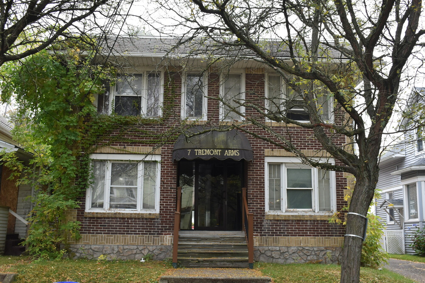
This Property Is For Sale
NEARBY LISTINGS FOR SALE OR LEASE
Property Detail
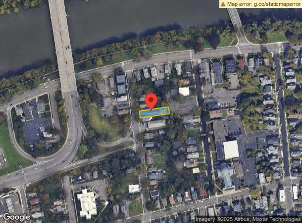
7 Tremont Ave
Binghamton, NY
Broome
030200-160-065-0002-032-000-0000
New York
Apartment
32.000
2024
0.16 AC
2023
Southside East Binghamton
001700
Syracuse
5,712 SF
DEMOGRAPHICS near 7 Tremont Ave
1 Mile
3 Mile
5 Mile
2024 Total Population
17,442
68,055
97,250
2029 Population
17,141
66,688
95,617
Pop Growth 2024-2029
(1.73%)
(2.01%)
(1.68%)
Average Age
39
39
39
2024 Total Households
8,113
28,009
38,842
HH Growth 2024-2029
(1.77%)
(2.28%)
(1.97%)
Median Household Inc
$34,240
$43,170
$47,720
Avg Household Size
2.00
2.10
2.10
2024 Avg HH Vehicles
1.00
1.00
1.00
Median Home Value
$121,402
$122,544
$132,211
Median Year Built
1954
1950
1954
Nearby Places
- Restaurants
- Banks
- Shops
- Fitness
- Groceries
Nearby Properties
Address
Land Use
TOTAL SIZE
Lot Size
Zoning
Address
Land Use
TOTAL SIZE
Lot Size
Zoning
9,790 SF
11.23 AC
ID
Address
Land Use
TOTAL SIZE
Lot Size
Zoning
418,288 SF
33.64 AC
Address
Land Use
TOTAL SIZE
Lot Size
Zoning
88,796 SF
20.04 AC
Address
Land Use
TOTAL SIZE
Lot Size
Zoning
30,334 SF
238.95 AC
Address
Land Use
TOTAL SIZE
Lot Size
Zoning
470,272 SF
5.30 AC
Address
Land Use
TOTAL SIZE
Lot Size
Zoning
283,373 SF
1.47 AC
Address
Land Use
TOTAL SIZE
Lot Size
Zoning
20,411 SF
0.66 AC
Address
Land Use
TOTAL SIZE
Lot Size
Zoning
2,877 SF
264 AC
Address
Land Use
TOTAL SIZE
Lot Size
Zoning
68,845 SF
4.74 AC
C-2
Address
Land Use
TOTAL SIZE
Lot Size
Zoning
153,616 SF
2.73 AC
Address
Land Use
TOTAL SIZE
Lot Size
Zoning
143,718 SF
1.37 AC
Address
Land Use
TOTAL SIZE
Lot Size
Zoning
41,535 SF
4.16 AC
Address
Land Use
TOTAL SIZE
Lot Size
Zoning
203,296 SF
3.73 AC
Address
Land Use
TOTAL SIZE
Lot Size
Zoning
313,570 SF
4.88 AC
Address
Land Use
TOTAL SIZE
Lot Size
Zoning
88,625 SF
2.33 AC
Address
Land Use
TOTAL SIZE
Lot Size
Zoning
97,204 SF
1.45 AC
C-1
Address
Land Use
TOTAL SIZE
Lot Size
Zoning
34,606 SF
4.10 AC
Address
Land Use
TOTAL SIZE
Lot Size
Zoning
97,087 SF
1.66 AC
C-2
Address
Land Use
TOTAL SIZE
Lot Size
Zoning
95,892 SF
1.18 AC
CD
Address
Land Use
TOTAL SIZE
Lot Size
Zoning
69,983 SF
10.29 AC
C-2
Address
Land Use
TOTAL SIZE
Lot Size
Zoning
52,295 SF
12.30 AC
Address
Land Use
TOTAL SIZE
Lot Size
Zoning
63,930 SF
0.83 AC
Address
Land Use
TOTAL SIZE
Lot Size
Zoning
190,606 SF
13.10 AC
Address
Land Use
TOTAL SIZE
Lot Size
Zoning
24,000 SF
12.77 AC
C-2
Address
Land Use
TOTAL SIZE
Lot Size
Zoning
194,040 SF
0.90 AC
Address
Land Use
TOTAL SIZE
Lot Size
Zoning
95,842 SF
16.33 AC
I
Address
Land Use
TOTAL SIZE
Lot Size
Zoning
171,778 SF
2.93 AC
Address
Land Use
TOTAL SIZE
Lot Size
Zoning
173,448 SF
1.42 AC
Address
Land Use
TOTAL SIZE
Lot Size
Zoning
8,250 SF
5.32 AC
CR
Address
Land Use
TOTAL SIZE
Lot Size
Zoning
31.90 AC
The World's #1 Commercial Real Estate Marketplace
Connect with us
© 2025 CoStar Group
The information above has been obtained from sources believed reliable. While we do not doubt its accuracy we have not verified it and make no guarantee, warranty or representation about it. It is your responsibility to independently confirm its accuracy and completeness. Any projections, opinions, assumptions, or estimates used are for example only and do not represent the current or future performance of the property. The value of this transaction to you depends on tax and other factors which should be evaluated by your tax, financial, and legal advisors. You and your advisors should conduct a careful, independent investigation of the property to determine to your satisfaction the suitability of the property for your needs.