Property Record
70 N Lester St, White Cloud, MI 49349
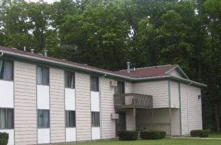
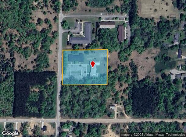
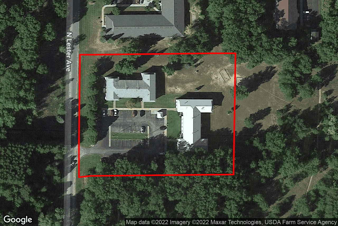
This Property Is For Sale
NEARBY LISTINGS FOR SALE OR LEASE
-
-
View all White Cloud listings for sale on LoopNet.com
Property Detail
70 N Lester St
Multifamilydwelling
PT SW1/4 COM N 0 DEG 34 MIN 17 SEC E 341.28 FT FROM SW SEC COR TH N 0 DEG 34 MIN 17 SEC E 327.1 FT TH N 89 DEG 33 MIN 6 S
X
Newaygo
26123C0317D
Michigan
2023
3 AC
2024
Newaygo County
970700
West Michigan
29,832 SF
11-32-300-039
DEMOGRAPHICS near 70 N Lester St
1 Mile
3 Mile
5 Mile
2024 Total Population
1,551
2,842
5,549
2029 Population
1,638
3,005
5,880
Pop Growth 2024-2029
+ 5.61%
+ 5.74%
+ 5.97%
Average Age
39
40
42
2024 Total Households
489
975
2,058
HH Growth 2024-2029
+ 5.52%
+ 5.74%
+ 5.88%
Median Household Inc
$46,000
$46,704
$47,999
Avg Household Size
2.60
2.60
2.50
2024 Avg HH Vehicles
2.00
2.00
2.00
Median Home Value
$95,222
$115,284
$133,829
Median Year Built
1974
1976
1977
Nearby Places
- Restaurants
- Banks
- Shops
- Fitness
- Groceries
Nearby Properties
Address
Land Use
TOTAL SIZE
Lot Size
Zoning
Address
Land Use
TOTAL SIZE
Lot Size
Zoning
114,073 SF
30.75 AC
LOCAL ZONE
Address
Land Use
TOTAL SIZE
Lot Size
Zoning
Address
Land Use
TOTAL SIZE
Lot Size
Zoning
22,400 SF
2.15 AC
LOCAL ZONE
Address
Land Use
TOTAL SIZE
Lot Size
Zoning
19,212 SF
2.31 AC
LOCAL ZONE
Address
Land Use
TOTAL SIZE
Lot Size
Zoning
5,440 SF
1.12 AC
LOCAL ZONE
Address
Land Use
TOTAL SIZE
Lot Size
Zoning
27,788 SF
1.51 AC
LOCAL ZONE
Address
Land Use
TOTAL SIZE
Lot Size
Zoning
20,520 SF
2.05 AC
LOCAL ZONE
Address
Land Use
TOTAL SIZE
Lot Size
Zoning
6.71 AC
LOCAL ZONE
Address
Land Use
TOTAL SIZE
Lot Size
Zoning
11,412 SF
2.55 AC
LOCAL ZONE
Address
Land Use
TOTAL SIZE
Lot Size
Zoning
19,610 SF
0.88 AC
LOCAL ZONE
Address
Land Use
TOTAL SIZE
Lot Size
Zoning
22,040 SF
6.90 AC
LOCAL ZONE
Address
Land Use
TOTAL SIZE
Lot Size
Zoning
15,072 SF
3.35 AC
LOCAL ZONE
Address
Land Use
TOTAL SIZE
Lot Size
Zoning
3,326 SF
0.56 AC
LOCAL ZONE
Address
Land Use
TOTAL SIZE
Lot Size
Zoning
9,020 SF
1.02 AC
LOCAL ZONE
Address
Land Use
TOTAL SIZE
Lot Size
Zoning
89,741 SF
6.12 AC
LOCAL ZONE
Address
Land Use
TOTAL SIZE
Lot Size
Zoning
2.63 AC
LOCAL ZONE
Address
Land Use
TOTAL SIZE
Lot Size
Zoning
16,584 SF
2.49 AC
LOCAL ZONE
Address
Land Use
TOTAL SIZE
Lot Size
Zoning
7,734 SF
0.48 AC
LOCAL ZONE
Address
Land Use
TOTAL SIZE
Lot Size
Zoning
3,076 SF
2.30 AC
LOCAL ZONE
Address
Land Use
TOTAL SIZE
Lot Size
Zoning
4.21 AC
LOCAL ZONE
Address
Land Use
TOTAL SIZE
Lot Size
Zoning
5,040 SF
3.29 AC
LOCAL ZONE
Address
Land Use
TOTAL SIZE
Lot Size
Zoning
1.31 AC
LOCAL ZONE
Address
Land Use
TOTAL SIZE
Lot Size
Zoning
5,332 SF
0.35 AC
LOCAL ZONE
Address
Land Use
TOTAL SIZE
Lot Size
Zoning
5,187 SF
0.54 AC
LOCAL ZONE
Address
Land Use
TOTAL SIZE
Lot Size
Zoning
4.03 AC
LOCAL ZONE
Address
Land Use
TOTAL SIZE
Lot Size
Zoning
6,360 SF
0.68 AC
LOCAL ZONE
Address
Land Use
TOTAL SIZE
Lot Size
Zoning
5,558 SF
0.60 AC
LOCAL ZONE
Address
Land Use
TOTAL SIZE
Lot Size
Zoning
74.65 AC
LOCAL ZONE
Address
Land Use
TOTAL SIZE
Lot Size
Zoning
155.63 AC
LOCAL ZONE
The World's #1 Commercial Real Estate Marketplace
Connect with us
© 2025 CoStar Group
The information above has been obtained from sources believed reliable. While we do not doubt its accuracy we have not verified it and make no guarantee, warranty or representation about it. It is your responsibility to independently confirm its accuracy and completeness. Any projections, opinions, assumptions, or estimates used are for example only and do not represent the current or future performance of the property. The value of this transaction to you depends on tax and other factors which should be evaluated by your tax, financial, and legal advisors. You and your advisors should conduct a careful, independent investigation of the property to determine to your satisfaction the suitability of the property for your needs.