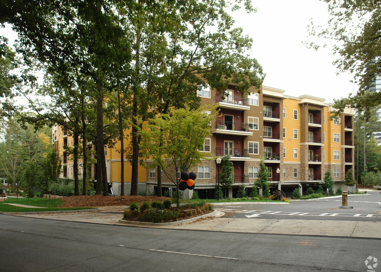
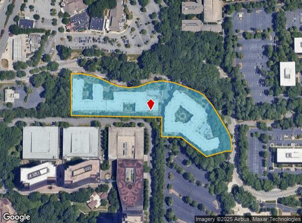
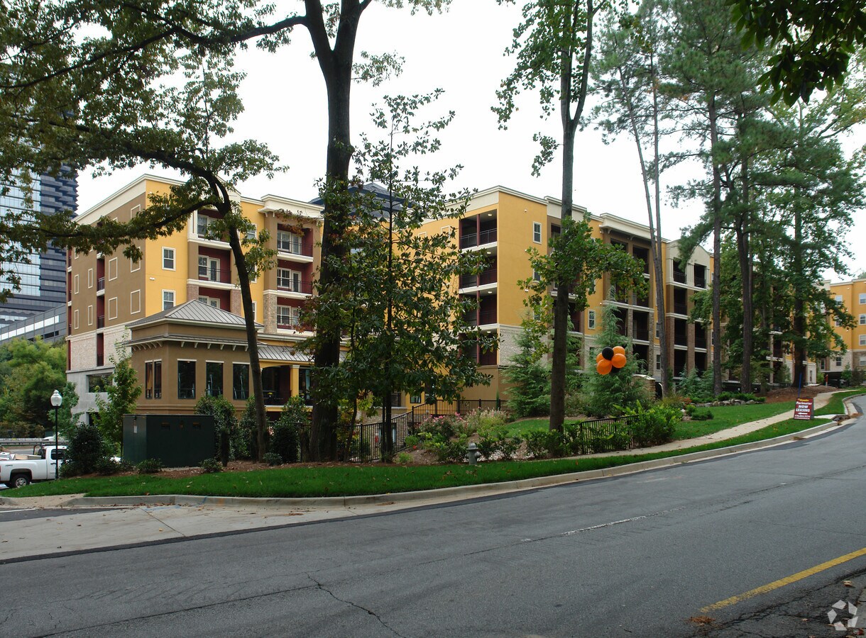
Property Record
70 Perimeter Ctr E, Atlanta, GA 30346

NEARBY LISTINGS FOR SALE OR LEASE
Property Detail
70 Perimeter Ctr E
18-347-01-014
DeKalb
Apartment
Georgia
X
14
13089C0012K
6.50 AC
2023
Central Perimeter
2023
Atlanta
021226
Atlanta-Sandy Springs-Roswell, GA
519,706 SF
DEMOGRAPHICS near 70 Perimeter Ctr E
1 Mile
3 Mile
5 Mile
2024 Total Population
14,829
110,193
253,298
2029 Population
14,814
111,012
255,368
Pop Growth 2024-2029
(0.10%)
+ 0.74%
+ 0.82%
Average Age
36
39
38
2024 Total Households
7,162
49,974
108,057
HH Growth 2024-2029
+ 0.14%
+ 1.01%
+ 0.94%
Median Household Inc
$96,569
$100,462
$97,122
Avg Household Size
2.10
2.20
2.30
2024 Avg HH Vehicles
1.00
2.00
2.00
Median Home Value
$600,536
$521,936
$567,246
Median Year Built
1996
1989
1986
Nearby Places
- Restaurants
- Banks
- Shops
- Fitness
- Groceries
PUBLIC TRANSPORTATION
TRANSIT/SUBWAY
Dunwoody (Red Line - Metropolitan Atlanta Rapid Transit Authority (MARTA))
DRIVE
WALK
Distance
Dunwoody (Red Line - Metropolitan Atlanta Rapid Transit Authority (MARTA))
1 min
14 min
0.7 mi
AIRPORT
Hartsfield - Jackson Atlanta International
DRIVE
WALK
Distance
Hartsfield - Jackson Atlanta International
35 min
23.8 mi
Freight Ports
Georgia Ports - Savannah
DRIVE
WALK
Distance
Georgia Ports - Savannah
297 min
264.2 mi
Nearby Properties
Address
Land Use
TOTAL SIZE
Lot Size
Zoning
Address
Land Use
TOTAL SIZE
Lot Size
Zoning
1,123,714 SF
47.33 AC
C1
Address
Land Use
TOTAL SIZE
Lot Size
Zoning
854,744 SF
1.95 AC
OI
Address
Land Use
TOTAL SIZE
Lot Size
Zoning
374,311 SF
0.19 AC
X
Address
Land Use
TOTAL SIZE
Lot Size
Zoning
216,464 SF
X
Address
Land Use
TOTAL SIZE
Lot Size
Zoning
104,625 SF
0.99 AC
X
Address
Land Use
TOTAL SIZE
Lot Size
Zoning
376,010 SF
3.80 AC
OI
Address
Land Use
TOTAL SIZE
Lot Size
Zoning
432,424 SF
3.90 AC
MC
Address
Land Use
TOTAL SIZE
Lot Size
Zoning
1,088,359 SF
7.07 AC
OIC
Address
Land Use
TOTAL SIZE
Lot Size
Zoning
699,202 SF
13.90 AC
OIC
Address
Land Use
TOTAL SIZE
Lot Size
Zoning
316,391 SF
11.50 AC
OCR
Address
Land Use
TOTAL SIZE
Lot Size
Zoning
1,119,177 SF
5.21 AC
OIC
Address
Land Use
TOTAL SIZE
Lot Size
Zoning
907,800 SF
2.65 AC
Address
Land Use
TOTAL SIZE
Lot Size
Zoning
406,188 SF
4.43 AC
X
Address
Land Use
TOTAL SIZE
Lot Size
Zoning
258,909 SF
19.20 AC
X
Address
Land Use
TOTAL SIZE
Lot Size
Zoning
1,067,348 SF
6.41 AC
OIC
Address
Land Use
TOTAL SIZE
Lot Size
Zoning
366,276 SF
11.50 AC
RM-HD
Address
Land Use
TOTAL SIZE
Lot Size
Zoning
664,199 SF
2.84 AC
Address
Land Use
TOTAL SIZE
Lot Size
Zoning
478,332 SF
4.07 AC
Address
Land Use
TOTAL SIZE
Lot Size
Zoning
588,846 SF
3.80 AC
Address
Land Use
TOTAL SIZE
Lot Size
Zoning
409,493 SF
9.90 AC
OI
Address
Land Use
TOTAL SIZE
Lot Size
Zoning
912,649 SF
5.21 AC
OIC
Address
Land Use
TOTAL SIZE
Lot Size
Zoning
543,420 SF
4.15 AC
Address
Land Use
TOTAL SIZE
Lot Size
Zoning
395,191 SF
2.78 AC
OIC
Address
Land Use
TOTAL SIZE
Lot Size
Zoning
892,367 SF
3.37 AC
OIC
Address
Land Use
TOTAL SIZE
Lot Size
Zoning
1,430,700 SF
5.77 AC
OIC
Address
Land Use
TOTAL SIZE
Lot Size
Zoning
480,790 SF
5.93 AC
Address
Land Use
TOTAL SIZE
Lot Size
Zoning
296,627 SF
9.10 AC
X
Address
Land Use
TOTAL SIZE
Lot Size
Zoning
326,734 SF
13.15 AC
OIC
Address
Land Use
TOTAL SIZE
Lot Size
Zoning
572,181 SF
3.76 AC
C1
The World's #1 Commercial Real Estate Marketplace
Connect with us
© 2025 CoStar Group
The information above has been obtained from sources believed reliable. While we do not doubt its accuracy we have not verified it and make no guarantee, warranty or representation about it. It is your responsibility to independently confirm its accuracy and completeness. Any projections, opinions, assumptions, or estimates used are for example only and do not represent the current or future performance of the property. The value of this transaction to you depends on tax and other factors which should be evaluated by your tax, financial, and legal advisors. You and your advisors should conduct a careful, independent investigation of the property to determine to your satisfaction the suitability of the property for your needs.