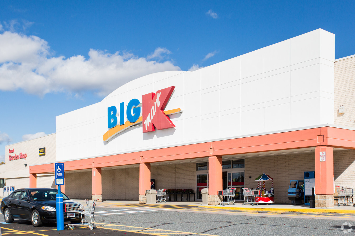
Property Record
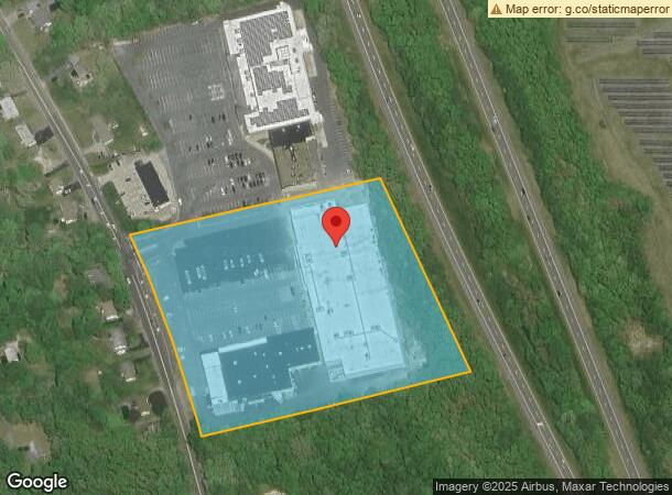
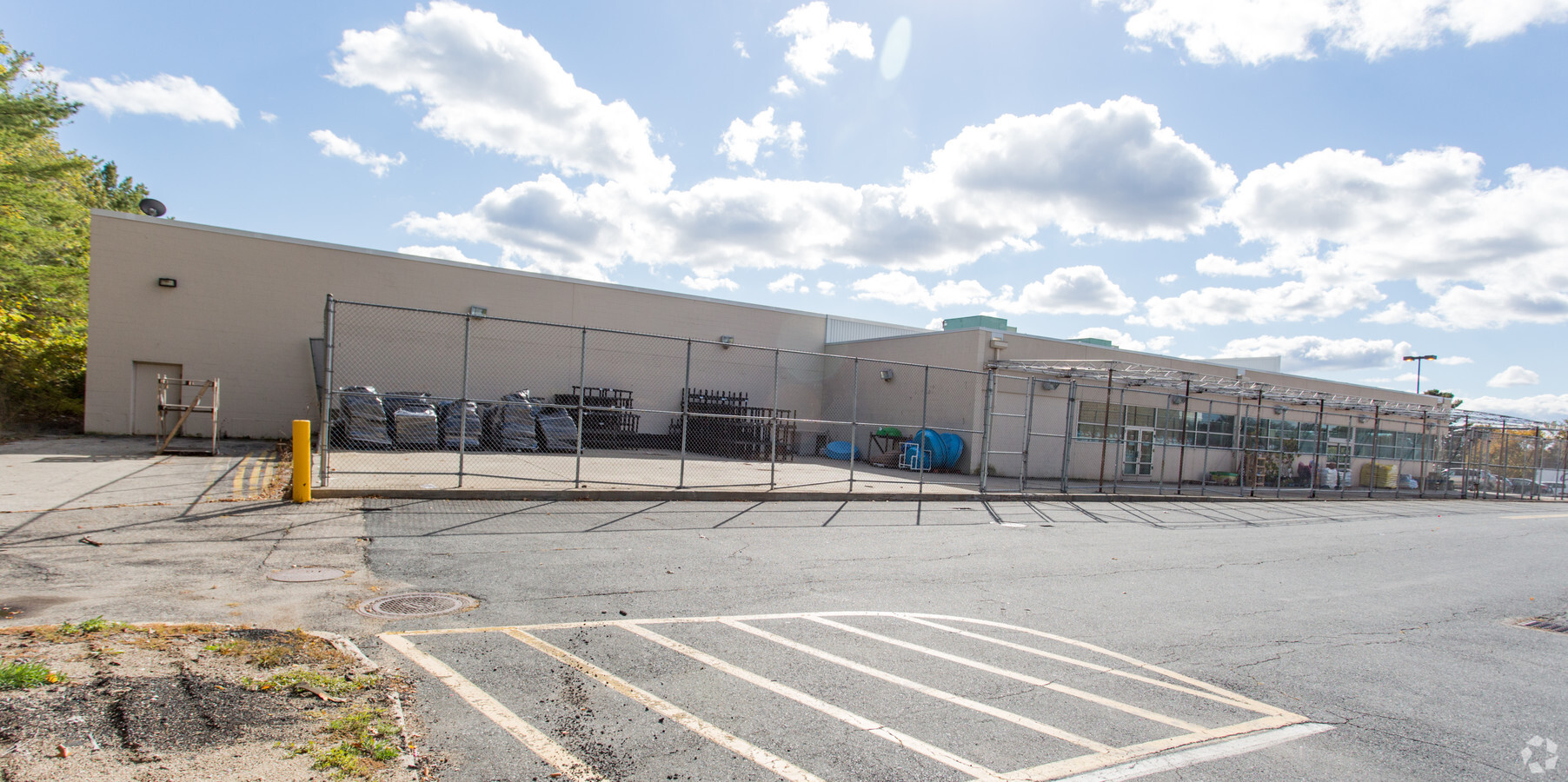
70 Worcester Rd, Webster, MA 01570
NEARBY LISTINGS FOR SALE OR LEASE
Property Detail
70 Worcester Rd
WEBS-000088-B000000-000042-000041
Worcester
Commercialnec
Massachusetts
X
8.96 AC
25027C0978F
Outlying Worcester
2024
Boston
2024
Worcester, MA-CT
754100
DEMOGRAPHICS near 70 Worcester Rd
1 Mile
3 Mile
5 Mile
2024 Total Population
3,126
26,910
43,642
2029 Population
3,118
26,745
43,438
Pop Growth 2024-2029
(0.26%)
(0.61%)
(0.47%)
Average Age
44
42
42
2024 Total Households
1,379
11,355
17,541
HH Growth 2024-2029
(0.29%)
(0.66%)
(0.51%)
Median Household Inc
$65,548
$73,864
$86,920
Avg Household Size
2.20
2.30
2.40
2024 Avg HH Vehicles
2.00
2.00
2.00
Median Home Value
$333,955
$309,638
$329,685
Median Year Built
1968
1961
1968
Nearby Places
- Restaurants
- Banks
- Shops
- Fitness
- Groceries
PUBLIC TRANSPORTATION
AIRPORT
Worcester Regional
DRIVE
WALK
Distance
Worcester Regional
29 min
16.8 mi
Freight Ports
Port of Davisville, RI
DRIVE
WALK
Distance
Port of Davisville, RI
77 min
61.3 mi
Nearby Properties
Address
Land Use
TOTAL SIZE
Lot Size
Zoning
Address
Land Use
TOTAL SIZE
Lot Size
Zoning
60.14 AC
Address
Land Use
TOTAL SIZE
Lot Size
Zoning
95,274 SF
10.18 AC
Address
Land Use
TOTAL SIZE
Lot Size
Zoning
34 AC
LI
Address
Land Use
TOTAL SIZE
Lot Size
Zoning
9.05 AC
INDUST
Address
Land Use
TOTAL SIZE
Lot Size
Zoning
131,686 SF
14.60 AC
INDUST
Address
Land Use
TOTAL SIZE
Lot Size
Zoning
175,000 SF
10.01 AC
LI
Address
Land Use
TOTAL SIZE
Lot Size
Zoning
199,444 SF
179.03 AC
R1
Address
Land Use
TOTAL SIZE
Lot Size
Zoning
4.87 AC
INDUST
Address
Land Use
TOTAL SIZE
Lot Size
Zoning
105,657 SF
12.65 AC
HI
Address
Land Use
TOTAL SIZE
Lot Size
Zoning
13.22 AC
INDUST
Address
Land Use
TOTAL SIZE
Lot Size
Zoning
20.31 AC
INDUST
Address
Land Use
TOTAL SIZE
Lot Size
Zoning
10.09 AC
Address
Land Use
TOTAL SIZE
Lot Size
Zoning
2.15 AC
GB-4 W
Address
Land Use
TOTAL SIZE
Lot Size
Zoning
102,704 SF
31 AC
GB-4 W
Address
Land Use
TOTAL SIZE
Lot Size
Zoning
123,592 SF
10 AC
INDUST
Address
Land Use
TOTAL SIZE
Lot Size
Zoning
164,960 SF
15.40 AC
INDUST
Address
Land Use
TOTAL SIZE
Lot Size
Zoning
Address
Land Use
TOTAL SIZE
Lot Size
Zoning
52,677 SF
15.17 AC
Address
Land Use
TOTAL SIZE
Lot Size
Zoning
3,600 SF
9.52 AC
GB
Address
Land Use
TOTAL SIZE
Lot Size
Zoning
60 AC
INDUST
Address
Land Use
TOTAL SIZE
Lot Size
Zoning
51,609 SF
10.24 AC
R3
Address
Land Use
TOTAL SIZE
Lot Size
Zoning
54,273 SF
8.94 AC
INDUST
Address
Land Use
TOTAL SIZE
Lot Size
Zoning
3.60 AC
Address
Land Use
TOTAL SIZE
Lot Size
Zoning
37,907 SF
28.50 AC
Address
Land Use
TOTAL SIZE
Lot Size
Zoning
21,111 SF
1.71 AC
GB-4 W
Address
Land Use
TOTAL SIZE
Lot Size
Zoning
18.60 AC
GB-5 W
Address
Land Use
TOTAL SIZE
Lot Size
Zoning
5.24 AC
GB-4 W
Address
Land Use
TOTAL SIZE
Lot Size
Zoning
33,063 SF
1.96 AC
Address
Land Use
TOTAL SIZE
Lot Size
Zoning
6.08 AC
MR-12,
Address
Land Use
TOTAL SIZE
Lot Size
Zoning
4.60 AC
I
The World's #1 Commercial Real Estate Marketplace
Connect with us
© 2025 CoStar Group
The information above has been obtained from sources believed reliable. While we do not doubt its accuracy we have not verified it and make no guarantee, warranty or representation about it. It is your responsibility to independently confirm its accuracy and completeness. Any projections, opinions, assumptions, or estimates used are for example only and do not represent the current or future performance of the property. The value of this transaction to you depends on tax and other factors which should be evaluated by your tax, financial, and legal advisors. You and your advisors should conduct a careful, independent investigation of the property to determine to your satisfaction the suitability of the property for your needs.