Property Record
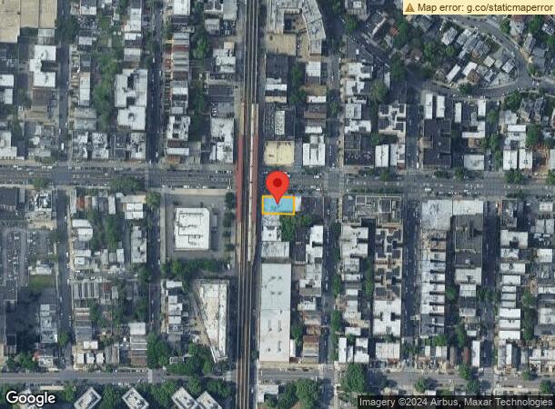
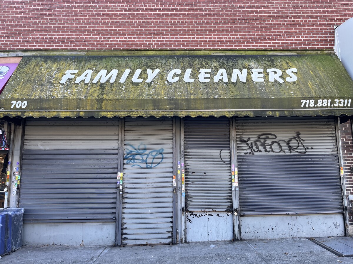
700 Burke Ave, Bronx, NY 10467

NEARBY LISTINGS FOR SALE OR LEASE
Property Detail
700 Burke Ave
04568-0027
Bronx
Storebuilding
New York
X
27
3604970101F
0.12 AC
2024
Bronx
2024
Westchester/So Connecticut
033802
New York-Jersey City-White Plains, NY-NJ
5,000 SF
DEMOGRAPHICS near 700 Burke Ave
1 Mile
3 Mile
5 Mile
2024 Total Population
121,960
892,535
1,750,107
2029 Population
112,001
824,005
1,629,073
Pop Growth 2024-2029
(8.17%)
(7.68%)
(6.92%)
Average Age
38
39
39
2024 Total Households
44,038
320,610
631,864
HH Growth 2024-2029
(8.78%)
(8.32%)
(7.46%)
Median Household Inc
$44,957
$48,784
$47,492
Avg Household Size
2.60
2.60
2.60
2024 Avg HH Vehicles
1.00
1.00
1.00
Median Home Value
$532,027
$482,456
$501,713
Median Year Built
1949
1949
1951
Nearby Places
- Restaurants
- Banks
- Shops
- Fitness
- Groceries
SALE & LEASE HISTORY
LISTING DATE
SALE/LEASE

Jun 06, 2018
For Lease
Jan 30, 2018
For Lease
Jan 11, 2024
For Lease
Feb 22, 2018
For Lease
Nearby Properties
Address
Land Use
TOTAL SIZE
Lot Size
Zoning
Address
Land Use
TOTAL SIZE
Lot Size
Zoning
1,299,700 SF
29.82 AC
R6
Address
Land Use
TOTAL SIZE
Lot Size
Zoning
550,000 SF
8.75 AC
M1-1
Address
Land Use
TOTAL SIZE
Lot Size
Zoning
1,743,584 SF
77.87 AC
R6
Address
Land Use
TOTAL SIZE
Lot Size
Zoning
1,453,318 SF
39.94 AC
R4
Address
Land Use
TOTAL SIZE
Lot Size
Zoning
481,172 SF
205.58 AC
PARK
Address
Land Use
TOTAL SIZE
Lot Size
Zoning
485,484 SF
39.63 AC
R5
Address
Land Use
TOTAL SIZE
Lot Size
Zoning
1,132,500 SF
62.44 AC
R6
Address
Land Use
TOTAL SIZE
Lot Size
Zoning
895,256 SF
8.32 AC
R7-1
Address
Land Use
TOTAL SIZE
Lot Size
Zoning
5,000 SF
363.58 AC
PARK
Address
Land Use
TOTAL SIZE
Lot Size
Zoning
1,237,424 SF
21.25 AC
R6
Address
Land Use
TOTAL SIZE
Lot Size
Zoning
204,200 SF
1.68 AC
R7-1
Address
Land Use
TOTAL SIZE
Lot Size
Zoning
959,880 SF
5.51 AC
R6
Address
Land Use
TOTAL SIZE
Lot Size
Zoning
726,051 SF
33.66 AC
R5
Address
Land Use
TOTAL SIZE
Lot Size
Zoning
269,168 SF
0.19 AC
BUS
Address
Land Use
TOTAL SIZE
Lot Size
Zoning
390,750 SF
265 AC
PARK
Address
Land Use
TOTAL SIZE
Lot Size
Zoning
617,567 SF
3.19 AC
R7-1
Address
Land Use
TOTAL SIZE
Lot Size
Zoning
545,388 SF
29.07 AC
C4-3
Address
Land Use
TOTAL SIZE
Lot Size
Zoning
537,208 SF
4.73 AC
C4-3
Address
Land Use
TOTAL SIZE
Lot Size
Zoning
631,237 SF
30.93 AC
R5
Address
Land Use
TOTAL SIZE
Lot Size
Zoning
707,353 SF
29.34 AC
R6
Address
Land Use
TOTAL SIZE
Lot Size
Zoning
259.87 AC
PARK
Address
Land Use
TOTAL SIZE
Lot Size
Zoning
851,821 SF
7.95 AC
R4
Address
Land Use
TOTAL SIZE
Lot Size
Zoning
393,924 SF
4.50 AC
R7-2
Address
Land Use
TOTAL SIZE
Lot Size
Zoning
18,445 SF
510.83 AC
PARK
Address
Land Use
TOTAL SIZE
Lot Size
Zoning
87,000 SF
455.70 AC
PARK
Address
Land Use
TOTAL SIZE
Lot Size
Zoning
269,100 SF
1.63 AC
R4
Address
Land Use
TOTAL SIZE
Lot Size
Zoning
251,884 SF
21.53 AC
R6
Address
Land Use
TOTAL SIZE
Lot Size
Zoning
607,855 SF
C4-2
Address
Land Use
TOTAL SIZE
Lot Size
Zoning
480,600 SF
2.80 AC
M1-1
Address
Land Use
TOTAL SIZE
Lot Size
Zoning
601,260 SF
3.27 AC
R4
The World's #1 Commercial Real Estate Marketplace
Connect with us
© 2025 CoStar Group
The information above has been obtained from sources believed reliable. While we do not doubt its accuracy we have not verified it and make no guarantee, warranty or representation about it. It is your responsibility to independently confirm its accuracy and completeness. Any projections, opinions, assumptions, or estimates used are for example only and do not represent the current or future performance of the property. The value of this transaction to you depends on tax and other factors which should be evaluated by your tax, financial, and legal advisors. You and your advisors should conduct a careful, independent investigation of the property to determine to your satisfaction the suitability of the property for your needs.