Property Record
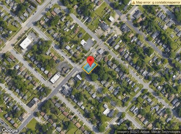
700 Kecoughtan Rd, Hampton, VA 23661
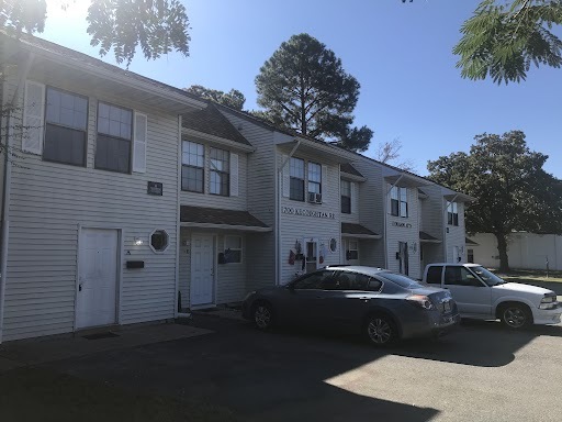
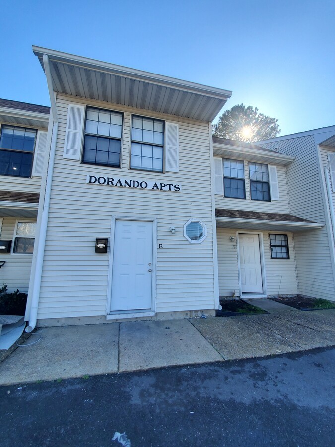
This Property Is For Sale
NEARBY LISTINGS FOR SALE OR LEASE
Property Detail
700 Kecoughtan Rd
Virginia Beach-Norfolk-Newport News, VA-NC
Newpt Nws
1004679
NEWPT NWS CO.L18.19.20.PT17.PC2.PC3. B27
Apartment
Hampton City
X
Virginia
5155270029H
18-20
2023
0.30 AC
2024
Wythe
011500
Hampton Roads
5,112 SF
DEMOGRAPHICS near 700 Kecoughtan Rd
1 Mile
3 Mile
5 Mile
2024 Total Population
10,665
63,638
131,122
2029 Population
10,911
64,528
133,035
Pop Growth 2024-2029
+ 2.31%
+ 1.40%
+ 1.46%
Average Age
39
39
39
2024 Total Households
4,328
27,049
56,327
HH Growth 2024-2029
+ 2.31%
+ 1.35%
+ 1.46%
Median Household Inc
$45,589
$44,692
$50,440
Avg Household Size
2.40
2.30
2.20
2024 Avg HH Vehicles
2.00
2.00
2.00
Median Home Value
$164,995
$171,817
$189,018
Median Year Built
1954
1964
1969
Nearby Places
- Restaurants
- Banks
- Shops
- Fitness
- Groceries
PUBLIC TRANSPORTATION
COMMUTER RAIL
Newport News (Northeast Regional - Amtrak)
DRIVE
WALK
Distance
Newport News (Northeast Regional - Amtrak)
12 min
6.4 mi
AIRPORT
Newport News/Williamsburg International
DRIVE
WALK
Distance
Newport News/Williamsburg International
23 min
14.9 mi
Norfolk International
DRIVE
WALK
Distance
Norfolk International
32 min
20.9 mi
Freight Ports
Virginia Port Authority - Newport News
DRIVE
WALK
Distance
Virginia Port Authority - Newport News
7 min
2.6 mi
Nearby Properties
Address
Land Use
TOTAL SIZE
Lot Size
Zoning
Address
Land Use
TOTAL SIZE
Lot Size
Zoning
1 SF
444.26 AC
M2
Address
Land Use
TOTAL SIZE
Lot Size
Zoning
2,993 SF
169.83 AC
M2
Address
Land Use
TOTAL SIZE
Lot Size
Zoning
110,881 SF
2.30 AC
C3
Address
Land Use
TOTAL SIZE
Lot Size
Zoning
199,364 SF
22.12 AC
6 R-11 ONE
Address
Land Use
TOTAL SIZE
Lot Size
Zoning
116,905 SF
7.42 AC
C3
Address
Land Use
TOTAL SIZE
Lot Size
Zoning
135,333 SF
8.22 AC
C3
Address
Land Use
TOTAL SIZE
Lot Size
Zoning
230,974 SF
42.68 AC
5 R-13 ONE
Address
Land Use
TOTAL SIZE
Lot Size
Zoning
260,228 SF
37.04 AC
M1
Address
Land Use
TOTAL SIZE
Lot Size
Zoning
100 SF
35.50 AC
R7
Address
Land Use
TOTAL SIZE
Lot Size
Zoning
100 SF
26.21 AC
R7
Address
Land Use
TOTAL SIZE
Lot Size
Zoning
60,350 SF
27.53 AC
M1
Address
Land Use
TOTAL SIZE
Lot Size
Zoning
88,941 SF
29.32 AC
11 MD-4 MU
Address
Land Use
TOTAL SIZE
Lot Size
Zoning
255,906 SF
36.57 AC
P1
Address
Land Use
TOTAL SIZE
Lot Size
Zoning
195,709 SF
1.52 AC
C3
Address
Land Use
TOTAL SIZE
Lot Size
Zoning
1 SF
101 AC
M2
Address
Land Use
TOTAL SIZE
Lot Size
Zoning
94,032 SF
1.64 AC
C3
Address
Land Use
TOTAL SIZE
Lot Size
Zoning
31,855 SF
4.37 AC
C3
Address
Land Use
TOTAL SIZE
Lot Size
Zoning
11,941 SF
61.74 AC
M2
Address
Land Use
TOTAL SIZE
Lot Size
Zoning
458,744 SF
28.01 AC
17 M-3 HEA
Address
Land Use
TOTAL SIZE
Lot Size
Zoning
53,551 SF
9.87 AC
P1
Address
Land Use
TOTAL SIZE
Lot Size
Zoning
1 SF
16.10 AC
M2
Address
Land Use
TOTAL SIZE
Lot Size
Zoning
124,050 SF
26.31 AC
19 PO-1 GE
Address
Land Use
TOTAL SIZE
Lot Size
Zoning
133,633 SF
5.39 AC
C3
Address
Land Use
TOTAL SIZE
Lot Size
Zoning
100 SF
22.45 AC
R8 R4
Address
Land Use
TOTAL SIZE
Lot Size
Zoning
1 SF
19.69 AC
M2
Address
Land Use
TOTAL SIZE
Lot Size
Zoning
1.05 AC
C3
Address
Land Use
TOTAL SIZE
Lot Size
Zoning
10.89 AC
R8
Address
Land Use
TOTAL SIZE
Lot Size
Zoning
4.61 AC
C3
Address
Land Use
TOTAL SIZE
Lot Size
Zoning
100 SF
1.65 AC
C3
Address
Land Use
TOTAL SIZE
Lot Size
Zoning
239,876 SF
15.52 AC
9 R-M MULT
The World's #1 Commercial Real Estate Marketplace
Connect with us
© 2025 CoStar Group
The information above has been obtained from sources believed reliable. While we do not doubt its accuracy we have not verified it and make no guarantee, warranty or representation about it. It is your responsibility to independently confirm its accuracy and completeness. Any projections, opinions, assumptions, or estimates used are for example only and do not represent the current or future performance of the property. The value of this transaction to you depends on tax and other factors which should be evaluated by your tax, financial, and legal advisors. You and your advisors should conduct a careful, independent investigation of the property to determine to your satisfaction the suitability of the property for your needs.