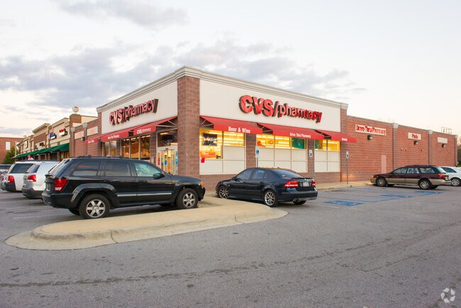
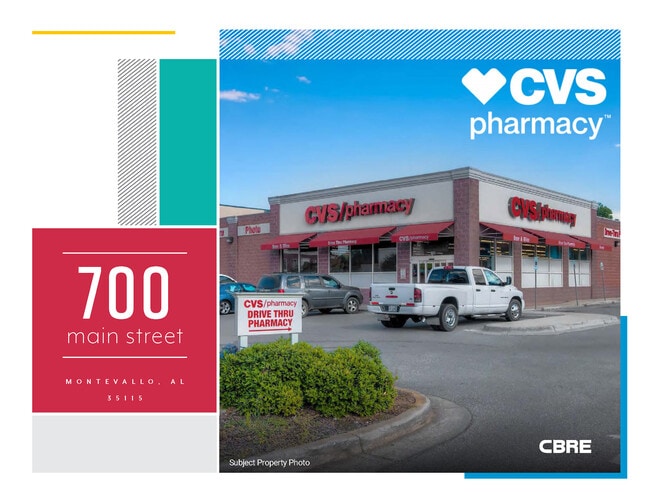
Property Record
700 Main St, Montevallo, AL 35115


Property Detail
700 Main St
Birmingham, AL
SEC/TWNSHP/RAN 21 22S 03W NBRHD: 07 MONTEVALLO COMMERCIAL R-2
27-5-21-3-305-026-001
Shelby
Storebuilding
Alabama
B and X Area of moderate flood hazard, usually the area between the limits of the 100-year and 500-year floods.
1
2025
0.97 AC
2025
I-65 Corr/S Shelby County
030406
Birmingham
10,200 SF
NEARBY LISTINGS FOR SALE OR LEASE
-
-
View all Montevallo listings for sale on LoopNet.com
DEMOGRAPHICS near 700 Main St
1 mile
3 mile
5 mile
2025 Total Population
4,549
8,903
14,549
2030 Population
4,772
9,393
15,338
Pop Growth 2025-2030
+ 4.90%
+ 5.50%
+ 5.42%
Average Age
35
37
38
2025 Total Households
1,475
3,242
5,398
HH Growth 2025-2030
+ 6.03%
+ 6.11%
+ 5.82%
Median Household Inc
$47,211
$47,323
$51,610
Avg Household Size
2.30
2.40
2.40
2025 Avg HH Vehicles
2.00
2.00
2.00
Median Home Value
$220,513
$199,772
$195,047
Median Year Built
1989
1989
1990
Nearby Places
Map Layers
Map Styles
 Street
 Aerial
Layers
 Traffic
 Biking
Places
Listings with unknown addresses are not visible on the map
- Restaurants
- Banks
- Shops
- Fitness
- Groceries
SALE & LEASE HISTORY
LISTING DATE
SALE/LEASE

Apr 08, 2025
For Sale
Nearby Properties
Address
Land Use
TOTAL SIZE
Lot Size
Zoning
Address
Land Use
TOTAL SIZE
Lot Size
Zoning
112,824 SF
33 AC
Address
Land Use
TOTAL SIZE
Lot Size
Zoning
32,192 SF
12 AC
Address
Land Use
TOTAL SIZE
Lot Size
Zoning
79,503 SF
8.80 AC
Address
Land Use
TOTAL SIZE
Lot Size
Zoning
82,714 SF
14.90 AC
Address
Land Use
TOTAL SIZE
Lot Size
Zoning
7,404 SF
9.41 AC
Address
Land Use
TOTAL SIZE
Lot Size
Zoning
2,708 SF
297.42 AC
Address
Land Use
TOTAL SIZE
Lot Size
Zoning
16,530 SF
3.76 AC
Address
Land Use
TOTAL SIZE
Lot Size
Zoning
78,043 SF
4.59 AC
Address
Land Use
TOTAL SIZE
Lot Size
Zoning
15,620 SF
5.61 AC
Address
Land Use
TOTAL SIZE
Lot Size
Zoning
11,250 SF
111 AC
Address
Land Use
TOTAL SIZE
Lot Size
Zoning
41,325 SF
3.74 AC
Address
Land Use
TOTAL SIZE
Lot Size
Zoning
2,475 SF
14.20 AC
Address
Land Use
TOTAL SIZE
Lot Size
Zoning
6,660 SF
7.70 AC
Address
Land Use
TOTAL SIZE
Lot Size
Zoning
57,281 SF
15 AC
Address
Land Use
TOTAL SIZE
Lot Size
Zoning
159,010 SF
8.60 AC
Address
Land Use
TOTAL SIZE
Lot Size
Zoning
0.68 AC
Address
Land Use
TOTAL SIZE
Lot Size
Zoning
2,569 SF
8 AC
Address
Land Use
TOTAL SIZE
Lot Size
Zoning
22,506 SF
1.69 AC
Address
Land Use
TOTAL SIZE
Lot Size
Zoning
12,048 SF
10 AC
Address
Land Use
TOTAL SIZE
Lot Size
Zoning
4,128 SF
4.20 AC
Address
Land Use
TOTAL SIZE
Lot Size
Zoning
47,934 SF
3.45 AC
Address
Land Use
TOTAL SIZE
Lot Size
Zoning
72,232 SF
44 AC
Address
Land Use
TOTAL SIZE
Lot Size
Zoning
31,470 SF
1.49 AC
Address
Land Use
TOTAL SIZE
Lot Size
Zoning
3,380 SF
3.50 AC
Address
Land Use
TOTAL SIZE
Lot Size
Zoning
14,628 SF
2.73 AC
Address
Land Use
TOTAL SIZE
Lot Size
Zoning
19,000 SF
3.10 AC
Address
Land Use
TOTAL SIZE
Lot Size
Zoning
7,481 SF
6.20 AC
Address
Land Use
TOTAL SIZE
Lot Size
Zoning
16,410 SF
1.03 AC
Address
Land Use
TOTAL SIZE
Lot Size
Zoning
17,689 SF
0.96 AC
Address
Land Use
TOTAL SIZE
Lot Size
Zoning
5,800 SF
0.99 AC
The World's #1 Commercial Real Estate Marketplace
Connect with us
© 2026 CoStar Group
The information above has been obtained from sources believed reliable. While we do not doubt its accuracy we have not verified it and make no guarantee, warranty or representation about it. It is your responsibility to independently confirm its accuracy and completeness. Any projections, opinions, assumptions, or estimates used are for example only and do not represent the current or future performance of the property. The value of this transaction to you depends on tax and other factors which should be evaluated by your tax, financial, and legal advisors. You and your advisors should conduct a careful, independent investigation of the property to determine to your satisfaction the suitability of the property for your needs.