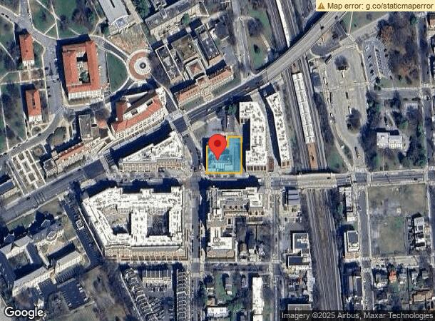
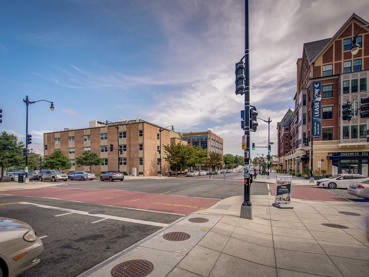
Property Record
700 Monroe St Ne, Washington, DC 20017


NEARBY LISTINGS FOR SALE OR LEASE
Property Detail
700 Monroe St Ne
Washington-Arlington-Alexandria, DC-VA-MD-WV
Brookland
3657-0827
SQUARE 3657 LOT 0827 NBHD: BROOKLAND
Miscellaneous
District of Columbia
X
District of Columbia
1100010036C
827
2024
0.43 AC
2024
Northeast
009201
Washington, DC
19,279 SF
DEMOGRAPHICS near 700 Monroe St Ne
1 Mile
3 Mile
5 Mile
2024 Total Population
25,739
361,765
775,561
2029 Population
23,677
332,813
723,975
Pop Growth 2024-2029
(8.01%)
(8.00%)
(6.65%)
Average Age
38
37
37
2024 Total Households
10,911
164,999
341,270
HH Growth 2024-2029
(8.84%)
(8.87%)
(7.60%)
Median Household Inc
$84,093
$97,002
$93,753
Avg Household Size
2.20
2.10
2.10
2024 Avg HH Vehicles
1.00
1.00
1.00
Median Home Value
$698,846
$680,120
$650,157
Median Year Built
1953
1953
1958
Nearby Places
- Restaurants
- Banks
- Shops
- Fitness
- Groceries
PUBLIC TRANSPORTATION
TRANSIT/SUBWAY
Brookland-Cua (Red Line - Washington Metropolitan Area Transit Authority Metrorail (Metrorail))
DRIVE
WALK
Distance
Brookland-Cua (Red Line - Washington Metropolitan Area Transit Authority Metrorail (Metrorail))
0 min
3 min
0.2 mi
Rhode Island Ave-Brentwood (Red Line - Washington Metropolitan Area Transit Authority Metrorail (Metrorail))
DRIVE
WALK
Distance
Rhode Island Ave-Brentwood (Red Line - Washington Metropolitan Area Transit Authority Metrorail (Metrorail))
4 min
18 min
1.0 mi
COMMUTER RAIL
Union Station (Brunswick Line - Maryland Area Regional Commuter Trains (The MARC), Camden Line - Maryland Area Regional Commuter Trains (The MARC), Fredericksburg Line - Maryland Area Regional Commuter Trains (The MARC), Manassas Line - Maryland Area Regional Commuter Trains (The MARC), Penn Line - Maryland Area Regional Commuter Trains (The MARC), Red Line - Maryland Area Regional Commuter Trains (The MARC))
DRIVE
WALK
Distance
Union Station (Brunswick Line - Maryland Area Regional Commuter Trains (The MARC), Camden Line - Maryland Area Regional Commuter Trains (The MARC), Fredericksburg Line - Maryland Area Regional Commuter Trains (The MARC), Manassas Line - Maryland Area Regional Commuter Trains (The MARC), Penn Line - Maryland Area Regional Commuter Trains (The MARC), Red Line - Maryland Area Regional Commuter Trains (The MARC))
7 min
3.2 mi
L'enfant (Fredericksburg Line - Virginia Railway Express, Manassas Line - Virginia Railway Express)
DRIVE
WALK
Distance
L'enfant (Fredericksburg Line - Virginia Railway Express, Manassas Line - Virginia Railway Express)
8 min
4.3 mi
AIRPORT
Ronald Reagan Washington Ntl
DRIVE
WALK
Distance
Ronald Reagan Washington Ntl
15 min
8.4 mi
Baltimore/Washington International Thurgood Marshall
DRIVE
WALK
Distance
Baltimore/Washington International Thurgood Marshall
45 min
29.0 mi
Washington Dulles International
DRIVE
WALK
Distance
Washington Dulles International
50 min
31.2 mi
Freight Ports
Port of Baltimore
DRIVE
WALK
Distance
Port of Baltimore
52 min
36.4 mi
SALE & LEASE HISTORY
LISTING DATE
SALE/LEASE

Nov 03, 2021
For Sale
Jul 06, 2022
For Sale
Jan 04, 2024
For Sale
Nearby Properties
Address
Land Use
TOTAL SIZE
Lot Size
Zoning
Address
Land Use
TOTAL SIZE
Lot Size
Zoning
2,300,000 SF
1.60 AC
D-5-R
Address
Land Use
TOTAL SIZE
Lot Size
Zoning
187,127 SF
90.60 AC
UNZONED
Address
Land Use
TOTAL SIZE
Lot Size
Zoning
418.97 AC
MU-4,UNZON
Address
Land Use
TOTAL SIZE
Lot Size
Zoning
120 SF
276.66 AC
UNZONED
Address
Land Use
TOTAL SIZE
Lot Size
Zoning
1,100,000 SF
2.13 AC
D-6
Address
Land Use
TOTAL SIZE
Lot Size
Zoning
1,545,768 SF
2.11 AC
D-7
Address
Land Use
TOTAL SIZE
Lot Size
Zoning
1,043,058 SF
4.03 AC
UNZONED
Address
Land Use
TOTAL SIZE
Lot Size
Zoning
607,735 SF
8.94 AC
PDR-3,UNZO
Address
Land Use
TOTAL SIZE
Lot Size
Zoning
758,000 SF
2.22 AC
D-4-R,MU-7
Address
Land Use
TOTAL SIZE
Lot Size
Zoning
2,247,684 SF
6.38 AC
D-4-R
Address
Land Use
TOTAL SIZE
Lot Size
Zoning
479,505 SF
5 AC
D-6-R
Address
Land Use
TOTAL SIZE
Lot Size
Zoning
1,642,951 SF
95.12 AC
RF-1
Address
Land Use
TOTAL SIZE
Lot Size
Zoning
1,083,392 SF
15.33 AC
PDR-3,RA-2
Address
Land Use
TOTAL SIZE
Lot Size
Zoning
561,068 SF
1.39 AC
D-3
Address
Land Use
TOTAL SIZE
Lot Size
Zoning
4.87 AC
D-6
Address
Land Use
TOTAL SIZE
Lot Size
Zoning
512,068 SF
1.36 AC
D-5-R
Address
Land Use
TOTAL SIZE
Lot Size
Zoning
95.32 AC
RA-1
Address
Land Use
TOTAL SIZE
Lot Size
Zoning
730,233 SF
4.78 AC
UNZONED
Address
Land Use
TOTAL SIZE
Lot Size
Zoning
1,600,300 SF
10.35 AC
D-3
Address
Land Use
TOTAL SIZE
Lot Size
Zoning
314,995 SF
5.82 AC
D-5
Address
Land Use
TOTAL SIZE
Lot Size
Zoning
7.41 AC
UNZONED
Address
Land Use
TOTAL SIZE
Lot Size
Zoning
247,900 SF
170.58 AC
UNZONED
Address
Land Use
TOTAL SIZE
Lot Size
Zoning
526,768 SF
1.03 AC
D-5-R
Address
Land Use
TOTAL SIZE
Lot Size
Zoning
1,051,918 SF
5.85 AC
D-4
Address
Land Use
TOTAL SIZE
Lot Size
Zoning
814,320 SF
0.99 AC
D-7
Address
Land Use
TOTAL SIZE
Lot Size
Zoning
558,645 SF
1.22 AC
D-5-R
Address
Land Use
TOTAL SIZE
Lot Size
Zoning
1,323,000 SF
3.36 AC
RA-2
Address
Land Use
TOTAL SIZE
Lot Size
Zoning
1,262,010 SF
1.39 AC
D-4-R,D-5-
Address
Land Use
TOTAL SIZE
Lot Size
Zoning
511,506 SF
1.18 AC
D-7
Address
Land Use
TOTAL SIZE
Lot Size
Zoning
131,465 SF
0.91 AC
D-6
The World's #1 Commercial Real Estate Marketplace
Connect with us
© 2025 CoStar Group
The information above has been obtained from sources believed reliable. While we do not doubt its accuracy we have not verified it and make no guarantee, warranty or representation about it. It is your responsibility to independently confirm its accuracy and completeness. Any projections, opinions, assumptions, or estimates used are for example only and do not represent the current or future performance of the property. The value of this transaction to you depends on tax and other factors which should be evaluated by your tax, financial, and legal advisors. You and your advisors should conduct a careful, independent investigation of the property to determine to your satisfaction the suitability of the property for your needs.