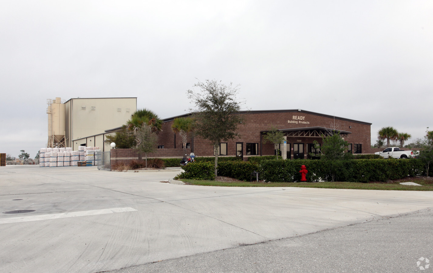
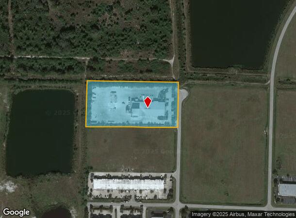
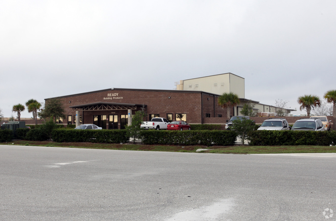
Property Record
7000 Progress Dr, Punta Gorda, FL 33982

NEARBY LISTINGS FOR SALE OR LEASE
Property Detail
7000 Progress Dr
Punta Gorda, FL
Charlotte Comml Center
412310200012
CHARLOTTE COUNTY PARK OF COMMERCE LOT 50 4.965 AC 3043/258 3043/259 3559/665
Lightindustrial
Charlotte
X
Florida
12015C0261G
50
2023
4.96 AC
2023
Charlotte County
010503
Southwest Florida
25,447 SF
DEMOGRAPHICS near 7000 Progress Dr
1 Mile
3 Mile
5 Mile
2024 Total Population
263
10,197
39,446
2029 Population
311
12,292
47,511
Pop Growth 2024-2029
+ 18.25%
+ 20.55%
+ 20.45%
Average Age
50
48
55
2024 Total Households
110
4,498
18,807
HH Growth 2024-2029
+ 19.09%
+ 20.83%
+ 20.69%
Median Household Inc
$55,000
$39,573
$54,843
Avg Household Size
2.40
2.20
2.00
2024 Avg HH Vehicles
2.00
2.00
2.00
Median Home Value
$217,647
$199,453
$272,970
Median Year Built
1992
1994
1993
Nearby Places
- Restaurants
- Banks
- Shops
- Fitness
- Groceries
PUBLIC TRANSPORTATION
AIRPORT
Punta Gorda
DRIVE
WALK
Distance
Punta Gorda
8 min
2.3 mi
Freight Ports
Port Manatee
DRIVE
WALK
Distance
Port Manatee
90 min
73.8 mi
Nearby Properties
Address
Land Use
TOTAL SIZE
Lot Size
Zoning
Address
Land Use
TOTAL SIZE
Lot Size
Zoning
349,844 SF
78.47 AC
P
Address
Land Use
TOTAL SIZE
Lot Size
Zoning
163,527 SF
44.20 AC
ECAP
Address
Land Use
TOTAL SIZE
Lot Size
Zoning
161,439 SF
171 AC
RE1
Address
Land Use
TOTAL SIZE
Lot Size
Zoning
30.47 AC
ECAP
Address
Land Use
TOTAL SIZE
Lot Size
Zoning
345,043 SF
33.12 AC
ECAP
Address
Land Use
TOTAL SIZE
Lot Size
Zoning
62,415 SF
281.65 AC
ECAP
Address
Land Use
TOTAL SIZE
Lot Size
Zoning
134,308 SF
16 AC
RSF3.5
Address
Land Use
TOTAL SIZE
Lot Size
Zoning
208,560 SF
36.69 AC
PD-GM
Address
Land Use
TOTAL SIZE
Lot Size
Zoning
279,650 SF
374.81 AC
ECAP
Address
Land Use
TOTAL SIZE
Lot Size
Zoning
24,580 SF
84.50 AC
PKR
Address
Land Use
TOTAL SIZE
Lot Size
Zoning
8,406 SF
31.48 AC
ECAP
Address
Land Use
TOTAL SIZE
Lot Size
Zoning
13,260 SF
2.26 AC
CG
Address
Land Use
TOTAL SIZE
Lot Size
Zoning
17.06 AC
CG
Address
Land Use
TOTAL SIZE
Lot Size
Zoning
60,000 SF
1.44 AC
ECAP
Address
Land Use
TOTAL SIZE
Lot Size
Zoning
40,000 SF
20 AC
ECAP
Address
Land Use
TOTAL SIZE
Lot Size
Zoning
31,194 SF
7.93 AC
CG
Address
Land Use
TOTAL SIZE
Lot Size
Zoning
54.25 AC
RMF10
Address
Land Use
TOTAL SIZE
Lot Size
Zoning
15,134 SF
2.02 AC
CG
Address
Land Use
TOTAL SIZE
Lot Size
Zoning
66,461 SF
10.86 AC
CG
Address
Land Use
TOTAL SIZE
Lot Size
Zoning
29.24 AC
ECAP
Address
Land Use
TOTAL SIZE
Lot Size
Zoning
68,773 SF
8.05 AC
ECAP
Address
Land Use
TOTAL SIZE
Lot Size
Zoning
14,980 SF
2.57 AC
OMI
Address
Land Use
TOTAL SIZE
Lot Size
Zoning
30,719 SF
107.17 AC
RE1
Address
Land Use
TOTAL SIZE
Lot Size
Zoning
52,934 SF
9.30 AC
P
Address
Land Use
TOTAL SIZE
Lot Size
Zoning
22,597 SF
3.43 AC
HC
Address
Land Use
TOTAL SIZE
Lot Size
Zoning
7,128 SF
0.76 AC
ECAP
Address
Land Use
TOTAL SIZE
Lot Size
Zoning
4,000 SF
40 AC
ECAP
Address
Land Use
TOTAL SIZE
Lot Size
Zoning
34,854 SF
655 AC
ES
Address
Land Use
TOTAL SIZE
Lot Size
Zoning
12,408 SF
1.92 AC
CG
Address
Land Use
TOTAL SIZE
Lot Size
Zoning
22,058 SF
19.13 AC
RMF5
The World's #1 Commercial Real Estate Marketplace
Connect with us
© 2025 CoStar Group
The information above has been obtained from sources believed reliable. While we do not doubt its accuracy we have not verified it and make no guarantee, warranty or representation about it. It is your responsibility to independently confirm its accuracy and completeness. Any projections, opinions, assumptions, or estimates used are for example only and do not represent the current or future performance of the property. The value of this transaction to you depends on tax and other factors which should be evaluated by your tax, financial, and legal advisors. You and your advisors should conduct a careful, independent investigation of the property to determine to your satisfaction the suitability of the property for your needs.